Rogers, Arkansas
Looking for the best hiking in Rogers? We've got you covered with the top trails, trips, hiking, backpacking, camping and more around Rogers. The detailed guides, photos, and reviews are all submitted by the Outbound community.
Top Hiking Spots in and near Rogers
-
Kingston, Arkansas
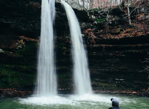
Neil Compton's Double Falls
4.02.15 mi / 404 ft gainThe parking area for Neil Compton’s Double Falls is approximately 1.1 miles past the trailhead for Hawksbill Crag on Cave Mountain Road. Cave Mountain Road is steep and can get pretty muddy after a good rain. A vehicle with 4WD is recommended although plenty of people make it up in small cars. ...Read more -
Kingston, Arkansas
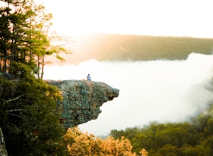
Hawksbill Crag via Whitaker Point Trail
4.52.68 mi / 594 ft gainHawksbill Crag aka Whitaker Point is one of the most popular hiking spots in all of Arkansas and only ~60 miles from Fayetteville. However, doing the hike early in the morning provides one of the best places of all time to watch a sunrise. You begin at the trail marker which is straight across ...Read more -
Kingston, Arkansas
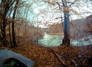
Backpack Along Whitaker Creek
5 miAfter arriving at the Whitaker Point/Hawksbill Crag trailhead, start going down the path for about 1/8th of a mile. You’ll cross a small stream, and here is where you’ll turn off the trail. Using Whitaker Creek as your guide, follow it like a handrail as it descends down into the confluence with ...Read more -
Jasper, Arkansas
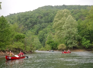
Paddle the Buffalo National River: Ponca to Kyle's Landing
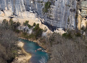
5.010.3 miPut in at the Ponca Bridge, or Steel Creek if the water is too low, for the most scenic float in Arkansas. Paddle surrounded by 3-400 foot bluffs, and through slightly challenging water here and there. Great float for kids as there are plenty of swimming holes.I've done this with my own elementar...Read more -
Jasper, Arkansas
Buffalo River Trail: Ponca to Steel Creek
4.35 mi / 1079 ft gainStart this adventure by crossing the Ponca Low Water Bridge over the beautiful Buffalo National River and proceed up the path till you reach the trail sign on the other side. You have the option of going either right or left at this point, follow the sign to the left and you will see a gate (sim...Read more -
Jasper, Arkansas
Hike to Steel Creek Overlook
2.8 miThis hike begins at the popular Steel Creek Campground area along the Buffalo National River just outside of Ponca, Arkansas. You can park anywhere in the grass just to the left where the pavement turns into gravel at the bottom of the hillside. To reach the trailhead simply walk back up the ro...Read more -
Jasper, Arkansas
Camp along the Buffalo National River
5.02 miThis is a night of camping that is one for the books. Head to the Steele Creek area on the Buffalo River. Once you are in the Steel Creek area simply follow the gravel road to the right and park anywhere in the grass along the river. Camping is permitted anywhere along the Buffalo River as lon...Read more -
Mulberry, Arkansas
Backpack along Hurricane Creek
6 miAfter arriving at the trailhead near the Shores Lake Campground (there is a $3 parking fee, so bring cash), head along the path and go west at the T-junction. Continue going west/northwest and you’ll cross over a forest road. Stay on the trail as it gradually descends, then veer off-trail to the ...Read more -
Compton, Arkansas
Hemmed In Hollow Falls via Hemmed In Hollow Trail
5.05.78 mi / 1572 ft gainAfter parking at the Hemmed In Hollow Falls Trailhead, follow the path down as it descends into the valley. As you approach one of the vistas, you’ll be able to spot the emerald green waters of the Buffalo River, as well as the bluffs to your east where the waterfall hides. After reaching the va...Read more -
Kingston, Arkansas
Hike Big Spring Trail
5.5 mi / 500 ft gainBig Spring Trail is located in Smith Creek Preserve just south of Boxley, Arkansas. There is a small parking area at the entrance. Detailed maps of the area provided by The Nature Conservancy can be found just past gate. Walk through the gate and begin your hike with a steady decline down the s...Read more -
Harrison, Arkansas
Hike to Paige Falls and Broadwater Hollow Falls
5.00.5 mi / 100 ft gainAlthough there is no official trailhead, Paige and Broadwater Hollow Falls can be accessed off of NC 2660 in Compton, Arkansas. Once on NC 2660, head straight down this rugged gravel road for approximately 2 miles. Soon you’ll reach a sharp bend to the left with a small parking area just before...Read more

