Dardanelle Township, Arkansas
Looking for the best photography in Dardanelle Township? We've got you covered with the top trails, trips, hiking, backpacking, camping and more around Dardanelle Township. The detailed guides, photos, and reviews are all submitted by the Outbound community.
Top Photography Spots in and near Dardanelle Township
-
Dardanelle, Arkansas
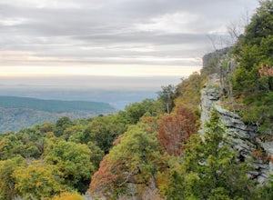
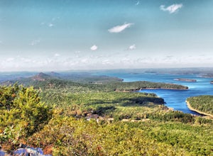
Hike the Rim Trail at Mount Nebo SP
3.03.57 mi / 226 ft gainThe official trailhead for the Rim Trail can be found on the north side of Country Rd 92, but it seems to be much easier to start the hike right behind the visitors center. There is more parking spaces and you can purchase any last minute items you may have forgotten before you start. To find the...Read more -
Dardanelle Township, Arkansas
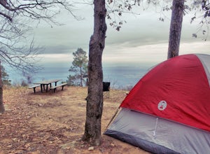
Camp at Mount Nebo SP
4.0Mount Nebo State Park is just 12 miles southwest of Russellville, AR, home of Arkansas Tech University. With its proximity to the university and other large cities, it makes visiting Mount Nebo an easy trip. The last few miles on Country Road 155 takes you through switch backs up the mountain, an...Read more -
Morrilton, Arkansas
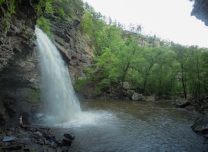
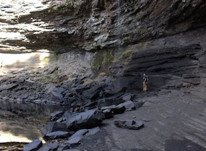
Cedar Falls
4.82.01 mi / 305 ft gainWhen I did this hike it was unbelievable. This entire valley looks like something out of a painting. If at all possible, I recommend that you plan your trip around the rain, because after a heavy rain the valley is full of waterfalls.Getting there: Cedar Falls is located in Petit Jean State Park ...Read more -
Morrilton, Arkansas
Camp at Petit Jean SP
Located between Ft. Smith and Little Rock, just south of Interstate 40, you will find the state treasure that is Petit Jean State Park. Its central location makes it very easy for any one to visit. The main hub of the State Park is the beautiful Mather Lodge, which has a rooms to rent, a restaura...Read more -
Hagarville, Arkansas
Pam's Grotto Trail
4.00.92 mi / 384 ft gainGetting to this trailhead is the most difficult part. The small parking area/campground is located about a half mile east of the Haw Creek Falls Campground. You will see a pull off on the east side of the road where you can park your car. Once you are ready to hit the trail you will cross the ro...Read more -
Witts Springs, Arkansas
Hike Pedestal Rocks Loop
4.52.2 mi / 200 ft gainShortly after the trailhead, you’ll come to a three-way intersection. Head straight on Pedestal Rocks Trail to make a counterclockwise loop. Follow through the woods until you reach the bluff line. Check out the ledges along the way and you’ll begin to see the pedestal rock formations. There ar...Read more -
Sand Gap, Arkansas
Relax at Falling Water Falls
5.0This is definitely a hidden gem located in the middle of nowhere. This waterfall is literally on the side of the road, which makes for a great place to stop and have lunch. During the summer it doubles as a swimming hole and great place to chill. Getting there: Take Hwy. 16 east from Pelsor (loc...Read more -
Mountain Pine, Arkansas
Hike the Caddo Bend Trail
5.04 miLocated within the Lake Ouachita State Park, the Caddo Bend Trail is an wonderful 2-3 hour hike. Although promenently covered by shade the entire 4 miles, the Ouachita Lake area can be very hot in the summer and the trail should be done in the morning or late afternoon. Either way, I nice dip in ...Read more -
Witts Springs, Arkansas
Camp at Richland Creek Campground
5.0This is one of my favorite places to camp in Arkansas. Once you get there you can hike to Twin Falls or Sandstone Castle, or explore the numerous cascades along Richland Creek. It's a relatively small campground with 11 campsites, but has a lot of places to hang hammocks and also offers a picnic ...Read more -
Witts Springs, Arkansas
Hike to Twin Falls in the Richland Creek Wilderness Area
4.05 mi / 200 ft gainThis hike begins at Richland Creek Campground. There's a trace trail that begins from the lowest walk-in campsites and continues along Richland Creek as you head back towards the waterfall. Parking and trailhead coordinates are 35.79839, -92.95774. It's not quite a bushwhack, but it's still a pre...Read more -
Witts Springs, Arkansas
Richland Falls and Twin Falls of Richland Creek
4.04.8 mi / 472 ft gainThe hike to Richland Falls and Twin Falls of Richland creek begins at the Richland Creek Campground. From the entrance of the campground take the road to the right heading to the day use area. The trailhead is found at the end of the day use area. The trail immediately begins with a crossing of...Read more -
Jefferson Township, Arkansas
Hike the Glory Hole Falls Trail
4.42 mi / 345 ft gainThis trail and waterfall is located 13.8 miles south of Boxley, AR or 5.7 miles east of Fallsville, AR. The easiest way to get to the trailhead is to locate the Cassville Baptist Church on your GPS system. If you are headed east, the church is 0.7 miles east of the trail. If you are headed west, ...Read more -
Roland, Arkansas
Hike the Pinnacle Mountain West Summit Trail
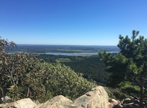
3.01.24 mi / 738 ft gainThis rocky trail begins at the park picnic grounds and winds its way to the top of Pinnacle Mountain. From the top is a spectacular view of Lake Maumelle, the Arkansas River Valley, the Ouachita Mountains and west Little Rock. This is truly a breathtaking view. To return, you must retrace your st...Read more -
Roland, Arkansas
Hike the Pinnacle Mountain East Summit Trail
4.51.4 mi / 719 ft gainThe East Summit trail is a 1.5 out and back that reaches a final elevation of 1,011ft. The trailhead is in the southeast corner of the East Summit Parking Lot on Pinnacle Valley Road. Walk about 10 yards down the trail to the junction, take the right fork and follow the RED and WHITE blazes. This...Read more -
Mount Judea, Arkansas
Hike Sam's Throne
5.00.5 miThis hike starts at the Sam's Throne Campground parking area. Once you walk to the end of the campground there is a fence with three different entrances that all lead to different trails. Take the middle trial for the shortest and easiest hike to the bluffs. This hike is very easy and only tak...Read more -
Hot Springs, Arkansas
Hike Hot Springs Mountain then Soak at Buckstaff Bathhouse
3.85 miStart your day at the Buckstaff Bathhouse. I would recommend doing the hike first and the traditional bath experience after, but depending on the day and time of year, the bathhouse may be closed in the afternoon. You can check their hours here. After you buy a ticket and store your belongings, ...Read more

