Casa Grande, Arizona
Looking for the best hiking in Casa Grande? We've got you covered with the top trails, trips, hiking, backpacking, camping and more around Casa Grande. The detailed guides, photos, and reviews are all submitted by the Outbound community.
Top Hiking Spots in and near Casa Grande
-
Coolidge, Arizona
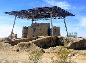
Explore Casa Grande Ruins National Monument
4.00.25 mi / 10 ft gainNo one really knows why the people from the Sonoran Desert built this mud skyscraper. Some scientists believe it was built as a astronomical observatory. What ever the reason, the Casa Grande Ruins National Monument is a engineering marvel that was built in the 1300's. People have been so puzzled...Read more -
Queen Creek, Arizona
Hike the Dynamite and Goldmine Loop
5.04.7 mi / 773 ft gainThis trail is a moderately-rated hike. It is used for a variety of activities including hiking, mountain biking, running, and walking. To access the trail, it is important to note that there is a $7 cash parking fee, so be prepared! The beginning of the trail is the most challenging part as it ...Read more -
Campground Loop B, Arizona
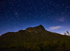
Camp at Picacho Peak State Park
3.1 mi / 800 ft gainDrive about 30 minutes west on I-10 from Tucson, AZ to the Picacho Peak Rd. Exit and follow the signs south to the park entrance. The campgrounds are about a half mile inside the main gate to the right.You can either make a reservation at Pichacho Peak State Park or arrive the day of and pay. Eve...Read more -
Picacho, Arizona
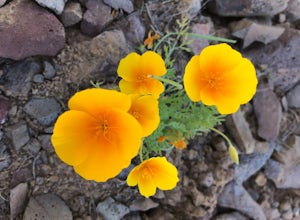
Photograph the Wildflowers at Picacho Peak State Park
4.0If Arizona is lucky enough to have a rainy winter, we will most certainly have a beautiful bloom come spring. One of the best places to see the beautiful golden blooms is on a hike in Picacho Peak State Park. Blooming season typically begins in mid/late February. Length depends on temperature –...Read more -
Picacho, Arizona
Hike Picacho Peak's Hunter Trail
5.04 mi / 1400 ft gainIf you've ever done the drive on highway10 from Phoenix to Tucson, you've definitely noticed an intriguing looking mountain peak about an hour into the drive. It broadly rises from the earth and tapers off into a point at the top, appearing like an illustration straight out of a Dr. Seuss book. ...Read more -
Phoenix, Arizona
Lost Ranch Ruins Trail to Lost Ranch Mines Trail Loop
5.04.97 mi / 1184 ft gainLost Ranch Ruins Trail to Lost Ranch Mines Trail Loop is a loop trail where you may see wildflowers located near Phoenix, Arizona.Read more -
Phoenix, Arizona
Hike Marcos de Niza Ridgeline / National Loop
5.02.8 mi / 640 ft gainThis is somewhat of a hidden gem in South Mountain Park, the largest municipal park in the United States, even though it's right there for all to see. The best way to take advantage of this trail is to attack the ridgeline with an intense hiking pace or trail run, connecting it to the National Tr...Read more -
Phoenix, Arizona
Acer Summit Via Mormon Trail
2.46 mi / 758 ft gainAcer Summit Via Mormon Trail is an out-and-back trail where you may see wildflowers located near Phoenix, Arizona.Read more -
Phoenix, Arizona
Hidden Valley Trail Via Mormon Trail
3.63 mi / 863 ft gainHidden Valley Trail Via Mormon Trail is a loop trail that takes you by a river located near Phoenix, Arizona.Read more -
Phoenix, Arizona
Hidden Valley via the Mormon Loop Trail
4.03.63 mi / 873 ft gainThis is a great spot for an afternoon hike near Phoenix. There are some beautiful rock formations, nice trails, and pretty stunning views of the city and desert beyond. It's open year round and is dog friendly so if you've got a pup, definitely bring it along. It gets super hot in the summer and ...Read more -
Phoenix, Arizona
Hike Holbert Trail to Dobbins Lookout
4.04.1 mi / 1135 ft gainDobbins lookout is a popular high point in South Mountain Park that offers views of the entire Phoenix area. It's accessible by road or by trail with no entry fee. Consider going in the evening for the best views.If you plan to hike to the top, the shortest route is the Holbert trail. Take a l...Read more -
Apache Junction, Arizona
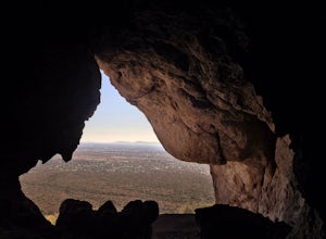
Monument Canyon and Broadway Cave
3.63.69 mi / 866 ft gain...Who doesn't enjoy a short adventure to an scenic location?! If I were to guess, I'd say a good majority of us. This four mile, low trafficked hike to the Broadway Cave will lead you to one of the best spots to hang out or watch the sunset. The Broadway trailhead is located by taking Highway 60...Read more -
Gold Canyon, Arizona
Peak 5057 via Hieroglyphic Trail
5.07.45 mi / 3045 ft gainTo get to the trailhead from US60, turn north onto Kings Ranch Road where you will begin the winding path through the neighborhoods. From Kings Ranch Road, turn east on Baseline Ave, north on Mohican Road, west on Valley View Drive, north on Whitetail Road, and east on Cloudview Ave until it com...Read more -
Gold Canyon, Arizona
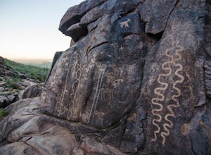
Hieroglyphic Trail
5.02.9 mi / 614 ft gainThis hike is a great beginner hike for those who want to experience the beauty of the Superstitions. I suggest going early in the morning because this trail gets very crowded later in the day (especially on weekends). To get to the trailhead from US60, turn north onto Kings Ranch Road where you ...Read more -
Phoenix, Arizona
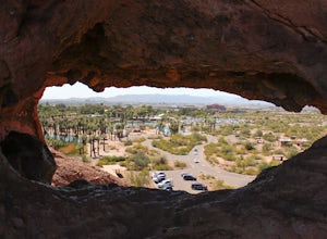
Hole in the Rock
3.60.27 mi / 200 ft gainPapago Park is located right next to the Phoenix Zoo. The park is known for its rock formations and short hiking / running trails. The main attraction, the Hole in the Rock, at the top of the short trail, is a great place to take pictures as it is one of the highest points in the area and it off...Read more -
Phoenix, Arizona
Hike the West Park Loop Trail in Papago Park
4.44 miThis trail begins from the parking lot on the west side of Galvin Parkway. To the east of the parking lot is a single track, dirt trail that heads north towards the big buttes. It continues counterclockwise around the big butte and heads south around the smaller butte. It continues west around th...Read more

