Estillfork, Alabama
Looking for the best camping in Estillfork? We've got you covered with the top trails, trips, hiking, backpacking, camping and more around Estillfork. The detailed guides, photos, and reviews are all submitted by the Outbound community.
Top Camping Spots in and near Estillfork
-
Estillfork, Alabama
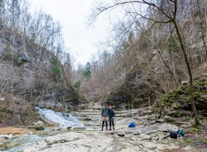
Walls of Jericho via Alabama Trailhead
4.55.8 mi / 1417 ft gainAround 5pm, we hiked down the only clearly marked trail that departs from the parking lot. The path begins with gentle switchbacks and great views of the forest, occasionally passing by small waterfalls, sinkholes, and caves; and arriving at the Hurricane Creek crossing (log with handrail) after ...Read more -
Tracy City, Tennessee
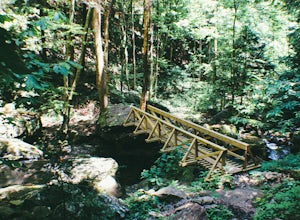
Hike the Fiery Gizzard Trail
5.013.5 miStart this journey from the Grundy Forest Trailhead, where you will quickly begin a decent along the Little Fiery Gizzard Creek. At the 0.7-mile split, be sure to turn left and cross the bridge to stay on the Fiery Gizzard Trail. For the next 0.8-mile journey, you'll encounter the gorgeous Black ...Read more -
Sequatchie, Tennessee
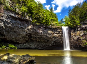
Foster Falls Loop
4.62.19 mi / 574 ft gainFoster Falls State Park is part of the South Cumberland State Park system. A short 45 minute drive from Chattanooga, Foster Falls boasts a stunning 60 foot waterfall that is worth visiting during any season of the year. The trailhead for this 2 mile hike starts from the Foster Falls parking lot a...Read more -
661-799 Stone Fort Drive, Tennessee
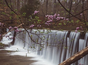
Hike Old Stone Fort Trail
5.02.9 mi / 265 ft gainThe main hiking trail at this small state park follows the wall of Old Stone Fort which was used by the Native Americans as a ceremonial gathering place. The trail threads through dramatic scenery where you can see the original entrance of the fort which was designed to face the exact spot on the...Read more -
Rising Fawn, Georgia
Camp at Cloudland Canyon State Park
4.8If you're looking to camp somewhere with exceptional hiking and beautiful waterfalls, Southeastern Tennessee locals know not to look further than Lookout Mountain. Located on the western edge, Cloudland Canyon State Park straddles Sitton Gulch Creek and is perfect for a weekend exploration.If sta...Read more -
Rising Fawn, Georgia
Hike the West Rim Trail to Cherokee Falls
4.54.77 mi / 814 ft gainGood luck finding something you dislike about Cloudland Canyon State Park - one of Georgia's largest and most scenic parks. Sitting on the western edge of Lookout Mountain, it is home to a plethora of luscious trails, easily-accessible campgrounds or yurts, and flowing waterfalls. The West Rim L...Read more -
Rising Fawn, Georgia
Cloudland Rim Loop via East Rim Campground
4.66 mi / 873 ft gainCloudland Rim Loop via East Rim Campground is a loop trail in Cloudland Canyon State park, which offers up stunning vistas and several waterfalls. This trail is located near Rising Fawn, Georgia.Read more -
Guntersville, Alabama
Kayaking at Lake Guntersville State Park
Lake Guntersville State Park is a publicly owned recreation area located on the far north side of the city of Guntersville in Marshall County, Alabama. The state park occupies 5,909 acres on the eastern shore of Guntersville Lake, a 69,000-acre impoundment of the Tennessee River. Lake Guntersvill...Read more -
Beersheba Springs, Tennessee
Hike to Stone Door and Alum Gap Campground
6.8 mi / 825 ft gainThis is a fun and easy overnight trip that is good for all ages. Start at the Stone Door Ranger Station which has plenty of parking and public restrooms as well. Follow the signs to the Stone Door Trailhead and in a short 0.8 miles you'll arrive at the edge of the gulf (canyon) and the first sign...Read more -
Gruetli-Laager, Tennessee
Hike to Suter and Horsepound Falls
4.06 mi / 1794 ft gainLocated in South Cumberland State Park in the Savage Gulf section, this is a somewhat difficult 5 mile out-and-back viewing two waterfalls, cascades, creeks, rock shelters, and high bluffs. 2 miles past Suter Falls you'll come to Horsepound Falls, a unique waterfall formation with overlooks and l...Read more -
Palmer, Tennessee
Hike the North Plateau-North Rim Loop at Savage Gulf
4.014.7 mi / 2483 ft gainFrom the Savage Ranger Station, take the Savage Day Loop for roughly 2.2 miles until you reach the junction. From there take the North Plateau trail and return on the North Rim trail. The elevation gain on this trail is rather gradual and and subtle, but it is a long trek that requires endurance ...Read more

