Estillfork, Alabama
Looking for the best chillin in Estillfork? We've got you covered with the top trails, trips, hiking, backpacking, camping and more around Estillfork. The detailed guides, photos, and reviews are all submitted by the Outbound community.
Top Chillin Spots in and near Estillfork
-
Estillfork, Alabama
Walls of Jericho via Alabama Trailhead
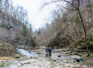
4.55.8 mi / 1417 ft gainAround 5pm, we hiked down the only clearly marked trail that departs from the parking lot. The path begins with gentle switchbacks and great views of the forest, occasionally passing by small waterfalls, sinkholes, and caves; and arriving at the Hurricane Creek crossing (log with handrail) after ...Read more -
Sewanee, Tennessee
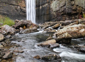
Hike to Bridal Veil Falls in Sewanee, TN
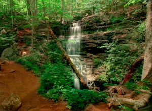
4.01.5 mi / 387 ft gainGreat short hike. Hard to find trail head, it is not marked at the parking area or where you leave the road. Put in your gps the coordinate spot tagged above off Clara Point Rd. To get to the trailhead, you have to cross the road from small parking area and go back 20 - 30 yards, where you will ...Read more -
Woodville, Alabama
Visit the Cathedral Caverns
2.9 mi / 50 ft gainCathedral Caverns - The Pride of Alabama -- Located in northeastern Alabama, Cathedral Caverns offers an easy look inside an underground system of caverns. The primary trail is well-developed and wheel-chair accessible for most of its 2.9 mile length. The Caverns features many impressive sights. ...Read more -
Tullahoma, Tennessee
Hike to Lower and Upper Busby Falls
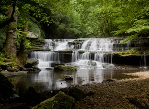
4.82 mi / 275 ft gainShort Springs Natural Area is where these falls are located. There is a decent amount of hiking trails that are a nice getaway for a day to hang out at for waterfalls. Put into your gps "machine falls parking." The gps will take you to the exact parking area. The directions go as follows from Nas...Read more -
661-799 Stone Fort Drive, Tennessee
Hike Old Stone Fort Trail
5.02.9 mi / 265 ft gainThe main hiking trail at this small state park follows the wall of Old Stone Fort which was used by the Native Americans as a ceremonial gathering place. The trail threads through dramatic scenery where you can see the original entrance of the fort which was designed to face the exact spot on the...Read more -
Rising Fawn, Georgia
Camp at Cloudland Canyon State Park
4.8If you're looking to camp somewhere with exceptional hiking and beautiful waterfalls, Southeastern Tennessee locals know not to look further than Lookout Mountain. Located on the western edge, Cloudland Canyon State Park straddles Sitton Gulch Creek and is perfect for a weekend exploration.If sta...Read more -
Rising Fawn, Georgia
Hike the West Rim Trail to Cherokee Falls
4.54.77 mi / 814 ft gainGood luck finding something you dislike about Cloudland Canyon State Park - one of Georgia's largest and most scenic parks. Sitting on the western edge of Lookout Mountain, it is home to a plethora of luscious trails, easily-accessible campgrounds or yurts, and flowing waterfalls. The West Rim L...Read more -
Chattanooga, Tennessee
Mountain Bike Raccoon Mountain
5.0Raccoon Mountain is an extensive, yet newer system of singletrack that circle the TVA Raccoon Mountain pumped storage facility, just 15 minutes east of downtown. The 30 miles of trails primarily span from intermediate to advanced levels, but a few beginner friendly routes can be found as well.Gra...Read more -
Altamont, Tennessee
Hike the Falls Loop Trail in South Cumberland State Park
4.53.2 mi / 500 ft gainNestled in the Savage Gulf State Natural Area, the popular Falls Loop Trail begins across from the Greeter Falls parking lot. At 0.4 miles into the hike you'll reach a fork in the trail, take the left route towards Boardtree Falls. Right before reaching the waterfall you'll come upon a suspension...Read more -
Grove Oak, Alabama
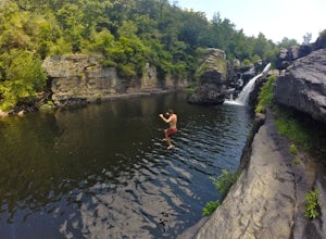
Cliff Jump at High Falls Park
4.9This park is fairly small and definitely off the beaten path on Alabama's back roads, so be sure to pay attention to which streets you're on.From Birmingham or Chattanooga, take Interstate 59 to Exit 218 in Fort Payne. Take Highway 35 West to Rainsville, then turn left onto Highway 75. Follow Hig...Read more -
Lookout Mountain, Georgia
Explore Lula Lake Land Trust
3.93.4 mi / 459 ft gainLula Lake Land Trust may only be accessible on the first and last Saturday of every month, but a visit to this North Georgia park is well worth planning for. It offers a small, but beautiful lake, a large waterfall, and over 6 miles of trails for hiking or biking. The 1-mile level gravel road fro...Read more -
Guntersville, Alabama
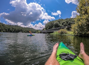
Kayaking at Lake Guntersville State Park
Lake Guntersville State Park is a publicly owned recreation area located on the far north side of the city of Guntersville in Marshall County, Alabama. The state park occupies 5,909 acres on the eastern shore of Guntersville Lake, a 69,000-acre impoundment of the Tennessee River. Lake Guntersvill...Read more -
Mentone, Alabama
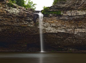
Hike to the Base of DeSoto Falls
4.80.7 mi / 285 ft gainThe main visitor entrance to DeSoto Falls in Mentone, AL provides easy, paved trails along the upper rim of the falls. For a more private an intimate view, there is a pull off on the side of the road and trail access. Heading south on AL Hwy 89, take a left turn on Dekalb Country Road 613. Afte...Read more -
Gruetli-Laager, Tennessee
Hike to Suter and Horsepound Falls
4.06 mi / 1794 ft gainLocated in South Cumberland State Park in the Savage Gulf section, this is a somewhat difficult 5 mile out-and-back viewing two waterfalls, cascades, creeks, rock shelters, and high bluffs. 2 miles past Suter Falls you'll come to Horsepound Falls, a unique waterfall formation with overlooks and l...Read more -
Chattanooga, Tennessee
Relax at Sunset Rock
4.3Sunset Rock provides spectacular access to the Bluff and Gum Spring Trails for hiking, is home to some of the top trad climbing routes in the area, and is perfect for residents and visitors alike who are seeking a great view of the Chattanooga area. Parking is allowed in a tiny lot provided on We...Read more -
Chattanooga, Tennessee
Hike and Swim at the Middle Creek Slide
3.04 mi / 200 ft gainYou park just west of the map waypoint on the wide shoulder (remember to lock your car, thefts have been reported in this area). The trailhead is really just an opening on the side of the road. Follow this to the creek and start making your way along the rocks upstream. The difficulty of the cl...Read more

