New ZealandAshburton Lakes
Ashburton Lakes, New Zealand
Top Spots in and near Ashburton Lakes
-
Westland National Park, New Zealand
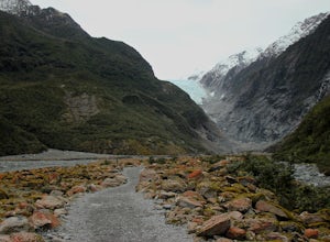
From the carpark take a quick walk through a green, forested area before making your way into the valley. Here you will get your first view of the glacier. At this point the trail gets a bit rocky but is still very doable. The trail continues mostly flat for the next 35 minutes. You will pass ...
Read more
-
Westland National Park, New Zealand
5.0
7.6 mi
/ 1640.4 ft gain
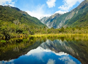
This trail is one of my favorite in New Zeanand. It wasn't so much 'built' as it was 'discovered'. The trail follows natural erosion and clean exposed flows of glacier carved granite walkways.You will enjoy thick, green rainforest, the reflective water of Pete's Pond, and a few long swinging brid...
Read more
-
Westland National Park, New Zealand
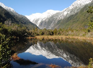
From the carpark for Franz Josef Glacier, Peter's Pool is signposted to the left near the toilets. The walk takes you through a fern and beech forest, eventually dropping you in front of the gorgeous and reflective Peter's Pool. Snap a few photos and then return the way you came or continue along...
Read more
-
Westland National Park, New Zealand
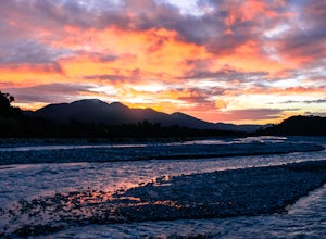
The Waiho River is a glacial fed river from the spectacular Franz Josef Glacier. The main road to get there is Highway 6, which becomes a long single-lane bridge when it crosses the river. If you find yourself staying in the small town of Franz Josef over night then you should make the short walk...
Read more
-
Craigieburn Forest Park, New Zealand
Being a cloudy and gray day in Christchurch, we decided to pack the bikes up and drive the 100kms on SH73 up to the Craigieburn Forest Park. There are several entrances to the tracks. You can either park up in the Castle Hill Village and enter the Hogs Back Track from there, or park in the Broken...
Read more
-
Tasman River, New Zealand
4.0
3 mi
/ 4593.2 ft gain
The route begins on Tasman Valley Road right after it crosses over the Hooker River heading towards the Tasman Valley. Right after the bridge at Hooker corner there will be a small cutoff on the left side (as you head towards the Tasman). This gravel cutoff is where the trail starts up Mt. Wakefi...
Read more
-
Craigieburn Forest Park, New Zealand
Park at the Craggyburn Valley Trailhead for a longer, more scenic hike, or continue driving to the Ski Field Parking at the road's end.The trail follows the true right bank of Craggieburn Valley as it climbs through a thick and scenic beech forest. After an hour it reaches the bush edge just shor...
Read more
-
Mount Cook National Park, New Zealand
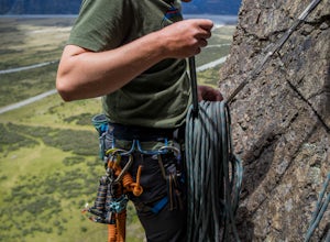
Getting to the Unwin Crag can be more of an adventure than the rock climb itself. You can park at the Unwin Lodge or at the car park at the bottom of the crag. From the lodge you walk towards the Mount Cook Village and you can easily see the 2 small rock faces just above the bush on the left hand...
Read more
-
Mount Cook National Park, New Zealand
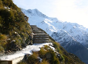
One of the most spectacular hikes in New Zealand next to New Zealand's highest mountain - Mount Cook (aka Aoraki).5.2km one way, it is a tough ascent. The first part of the track ascends to Sealy tarns. This involves climbing zig zag stairs where you will be rewarded with a spectacular view over ...
Read more
-
Mount Cook National Park, New Zealand
5.0
6.4 mi
/ 3000 ft gain
This trek begins in the gateway town of Mount Cook Village, which is a must-visit destination in its own right, and serves as the jumping off point for most Aoraki/Mount Cook National Park ventures. Drive to the White Horse Hill Campground (follow the signs for the Hooker Valley) and park in the ...
Read more
-
Mount Cook National Park, New Zealand
Once in Mount Cook Village follow the signs to the White Horse Hill Campground where you'll find the start of the Hooker Valley Track. Alternatively, you can camp in the campground and begin the hike before sunrise for the best experience. The sign says that the one-way hiking time is 1 hour and ...
Read more
-
Mount Cook National Park, New Zealand
From the car park follow the trail as it begins fairly flat on a gravel trail. After five minutes or so you will see a sign that points you, left, towards the Sealy Tarns track. After following this trail for around 10 more minutes, as it goes slowly uphill, you will come to the base of the steps...
Read more
-
Mount Cook National Park, New Zealand
Start on the track from the White Horse Hill campground. Follow the track up almost 2,000 steps until you reach Sealy Tarns. From here the track continues steeply up the mountain until you reach the ridge. Continue over the ridge until reaching the hut. From here continue up the ridge to the summ...
Read more
-
Mount Cook National Park, New Zealand
Wake before the sun rises and make the short half hour hike from the White Horse Hill Campground to Kea Point. This easy to follow trail leads to a beautiful overlook with views of Mt. Cook and the surrounding Southern Alps. You won't be disappointed as you watch the sun rise behind Mt. Cook and ...
Read more
-
Arthur's Pass, New Zealand
5.0
29.8 mi
/ 3018.4 ft gain
Begin at Klondyke Corner if the Waimakariri is low or at the O'Malley's Track if the river is too high to ford safely. After walking through the Waimakariri River to the Carrington Hut and on up the White River Valley you’ll reach this tiny red hut that stands out in its precarious position as a ...
Read more
-
Arthur's Pass, New Zealand
With peaks rising thousands of meters on every side of you and a wide-open valley to tramp in, the hike to Carrington Hut does feel quite like you're walking in a movie set. After walking a day up the Waimakariri Valley you'll reach this 36-bunk DOC hut, which requires a DOC hut pass to stay the ...
Read more

