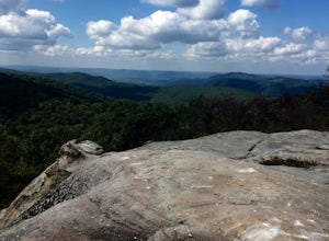
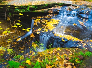
Littcarr Campground
Book this listing through our partner Recreation Gov
About Littcarr Campground
Overview
Littcarr Campground is located on the shores of Carr Creek Lake in southeastern Kentucky's mountainous region. The area provides an excellent atmosphere for camping, fishing, boating and enjoying the natural setting.Recreation
The lake offers boating, water skiing and swimming. Anglers can fish for crappie, bass, bluegill and walleye.A short nature trail for hiking is located in the Dam/Tailwater area. For a bit more adventure, the six-mile Sugar Branch Trail begins at the dam and ends at Sugar Lake Road.
Facilities
The campground offers 45 sites with electric and water hookups. Amenities include flush toilets, showers, drinking water, laundry facilities and a dump station.For family-friendly entertainment, two playgrounds, a picnic shelter, horseshoe pits, and basketball and shuffleboard courts are also on-site.
Natural Features
Carr Creek Lake is situated in a scenic sloping landscape heavily forested with a wide variety of hardwood and pine trees. An array of songbirds and waterfowl inhabit the area's marshlands.Nearby Attractions
Nearby attractions include Daniel Boone National Forest, Lilley Cornett Woods, Bad Branch Falls Nature Preserve, Red River Gorge Natural Scenic Area, Natural Bridge State Park and Buckhorn Lake.Littcarr Campground Reviews
Have you stayed here? Be the first to leave a review!
Top Spots in or near Mallie
Hike the Devil's Bathtub
Duffield, Virginia
5.0
3.96 mi
/ 250 ft gain
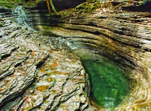
The Devil’s Bathtub is a deep pool of blue-green water known for being a great swimming hole and a beautiful natural feature. This hike is a 3.2 mile out and back hike with 250 feet elevation gain. There are at least 15 stream crossings, so extreme caution should be taken during periods of medium-to-high flow as the stream crossings may be slippery and submerged.
This hike has gotten very cro...
Explore Breaks Interstate Park
Haysi, Virginia
5.0
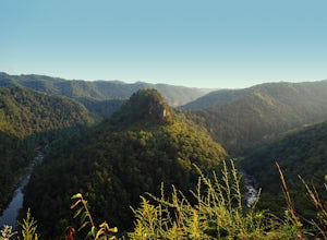
Breaks Interstate Park lies on the border of western Virginia and eastern Kentucky, and is known as the “Grand Canyon of the South”. This park surrounds a 5-mile long gorge created by the Russell Fork River, which lies 1650 feet below the park.Once you enter the park, stop at the first overlook on the left called the “Towers Overlook”. There is a short 0.15 mile path to a beautiful overlook of ...
Backpack to White Rocks in Cumberland Gap National Historic Park
Ewing, Virginia
6.4 mi
/ 2000 ft gain
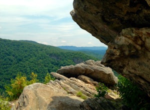
Cumberland Gap National Historic Park encompasses more than 20,000 acres of mountainous terrain spread out across Virginia, Tennessee, and Kentucky. The park offers miles of trails and many historic curiosities, including the actual saddle where pioneers first found their way over the Cumberland Mountains on their way to Western frontiers.
The Ridge Trail offers multiple backpacking sites, and...
Hike to the Sand Caves
Ewing, Virginia
4.7
8 mi
/ 2000 ft gain
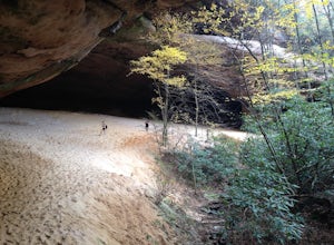
After a 2.5 mi hike up the Ewing Trail, you will reach the Ridge Trail. Go left for approximately 1 mi until you reach a landing for horses. Another 0.25 mi down the trail, you will encounter some steep wooden steps as well as several slippery boulders. Depending on recent weather and season, you will reach the bottom where you may or may not find the Sand Cave Waterfall and stream. Check it ou...
Hike to White Rocks
Ewing, Virginia
5.0
6 mi
/ 1500 ft gain
Starting at the Ewing Trailhead, in Ewing, VA, you will meander up the ridge for about 2.5 mi before meeting up with Ridge Trail. The ascent is approximately 1500 ft up the side of the majestic White Rock Ridge. Mud, loose rocks, and some very steep climbs are included.Once at the top, left takes you to the magnificent Sand Caves after approx. a 1 mi hike with a steep descent. Right will get yo...
Hike the Creation Falls and Rock Bridge Loop
Gillmore, Kentucky
4.8
1.38 mi
/ 285 ft gain
From the Slade, KY exit take KY15 toward Campton to KY715 to Rock Bridge Rd. Park at the Rock Bridge picnic area and take the trailhead closest to the entrance.
The trailhead will quickly descend surrounding you with lush vegetation. A rockshelter can be found on the right hand side of the trail a quarter mile into the hike. Continue down by the creek until you reach Creation Falls. For a ...
Camping and Lodging in Mallie
Sassafras, Kentucky
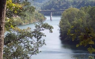
Carr Creek Lake Shelters
Overview
Carr Creek Lake Shelters are located on Carr Creek Lake on the same side of Kentucky Highway 160 as Littcarr Campground. The U.S...
Pound, Virginia
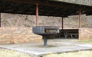
Phillip's Creek Group Picnic Area
Overview
Phillips's Creek Group Picnic area is a secluded site surrounded by forest. It is a great facility for family reunions, organiza...

Hyden, Kentucky
Trace Branch Campground
Overview
The Trace Branch Campground, located on Buckhorn Lake, is a great launchpad for outdoor activities in Kentucky's lush Cumberland...
Clintwood, Virginia
Pound River Campground (Va)
Overview
The John W. Flannagan Dam & Reservoir Area boasts an expansive lake nestled in the rolling green Cumberland Mountains of sou...
Clintwood, Virginia
Cranesnest Campground (Va)
Overview
The John W. Flannagan Dam & Reservoir Area boasts an expansive lake nestled in the rolling green Cumberland Mountains of sou...
Clintwood, Virginia
Lower Twin Campground (Va)
Overview
The John W. Flannagan Dam & Reservoir Area boasts an expansive lake nestled in the rolling green Cumberland Mountains of sou...
Unfortunately, we don't have up-to date pricing data for this listing, but you can check pricing through Recreation Gov.
Book NowAdd your business today to reach The Outbound's audience of adventurous travelers.
Community
© 2024 The Outbound Collective - Terms of Use - Privacy Policy


