Carr Creek Lake Shelters
Book this listing through our partner Recreation Gov
About Carr Creek Lake Shelters
Overview
Carr Creek Lake Shelters are located on Carr Creek Lake on the same side of Kentucky Highway 160 as Littcarr Campground. The U.S. Army Corps of Engineers, in cooperation with the Commonwealth of Kentucky, manages the land and water at Carr Creek Lake for wildlife, fisheries and recreation.Recreation
The 710-acre lake and surrounding area offer a wide variety of outdoor recreation opportunities. Boating and water skiing are popular activities on the lake.For the sportsman, fishing is an ever-present activity. Crappie, bass, bluegill and walleye are plentiful in the lake and provide hours of fishing enjoyment. Also, the Kentucky Department of Fish and Wildlife release trout in the tailwater throughout the summer months.
Hikers can find a short nature trail, less than a mile long, in the Dam/Tailwater area. For a bit more adventure, the 6-mile Sugar Branch Trail begins at the dam and ends at Sugar Lake Road.
Facilities
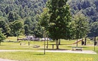
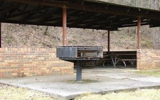
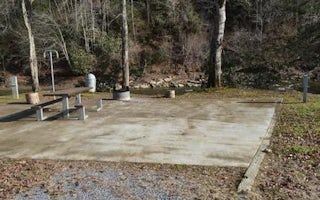
A total of eight picnic shelters are open for use from April through September. The shelters are known as Dogwood, Holly, Laurel, Pin Oak, Poplar, Sycamore, White Pine and Willow. Each is accessible and equipped with electricity, grills, picnic tables and lighting. Each shelter can accommodate up to 200 people.Willow, Pin Oak, White Pine and Dogwood are located at the Littcarr Recreation Area, offering access to a boat ramp, playground, horseshoe pit and shoreline fishing. Sycamore and Poplar are in the Dam/Tailwater Area, with a horseshoe pit, large playground and volleyball courts nearby. Laurel and Holly are at the marina, where guests have access to a boat ramp, playground, horseshoe pits and accessible fishing pier. Restrooms are located near all shelters.
Natural Features
Carr Creek Lake is located in the mountainous region of southeastern Kentucky, about 16 miles from Hazard and 18 miles from Whitesburg. The dam is located 8.8 miles above the mouth of Carr Fork, a tributary of the North Fork of the Kentucky River.Carr Creek Lake Shelters Reviews
Have you stayed here? Be the first to leave a review!
Top Spots in or near Sassafras
Hike the Devil's Bathtub
Duffield, Virginia
5.0
3.96 mi
/ 250 ft gain
The Devil’s Bathtub is a deep pool of blue-green water known for being a great swimming hole and a beautiful natural feature. This hike is a 3.2 mile out and back hike with 250 feet elevation gain. There are at least 15 stream crossings, so extreme caution should be taken during periods of medium-to-high flow as the stream crossings may be slippery and submerged.
This hike has gotten very cro...
Explore Breaks Interstate Park
Haysi, Virginia
5.0
Breaks Interstate Park lies on the border of western Virginia and eastern Kentucky, and is known as the “Grand Canyon of the South”. This park surrounds a 5-mile long gorge created by the Russell Fork River, which lies 1650 feet below the park.Once you enter the park, stop at the first overlook on the left called the “Towers Overlook”. There is a short 0.15 mile path to a beautiful overlook of ...
Backpack to White Rocks in Cumberland Gap National Historic Park
Ewing, Virginia
6.4 mi
/ 2000 ft gain
Cumberland Gap National Historic Park encompasses more than 20,000 acres of mountainous terrain spread out across Virginia, Tennessee, and Kentucky. The park offers miles of trails and many historic curiosities, including the actual saddle where pioneers first found their way over the Cumberland Mountains on their way to Western frontiers.
The Ridge Trail offers multiple backpacking sites, and...
Hike to the Sand Caves
Ewing, Virginia
4.7
8 mi
/ 2000 ft gain
After a 2.5 mi hike up the Ewing Trail, you will reach the Ridge Trail. Go left for approximately 1 mi until you reach a landing for horses. Another 0.25 mi down the trail, you will encounter some steep wooden steps as well as several slippery boulders. Depending on recent weather and season, you will reach the bottom where you may or may not find the Sand Cave Waterfall and stream. Check it ou...
Hike to White Rocks
Ewing, Virginia
5.0
6 mi
/ 1500 ft gain
Starting at the Ewing Trailhead, in Ewing, VA, you will meander up the ridge for about 2.5 mi before meeting up with Ridge Trail. The ascent is approximately 1500 ft up the side of the majestic White Rock Ridge. Mud, loose rocks, and some very steep climbs are included.Once at the top, left takes you to the magnificent Sand Caves after approx. a 1 mi hike with a steep descent. Right will get yo...
Climb at the Motherlode in Red River Gorge
Beattyville, Kentucky
1.2 mi
These directions are similar to those marked in the Red River Gorge Climbing Guide. Be sure to pick one up at Miguel's Pizza or elsewhere to get a good idea of where all of the crags and climbing routes are. This adventure is to the Volunteer Wall and The Gallery crags.
The parking lot is marked on Google Maps as "Motherlode Parking Lot" which is at the base of a very unmaintained gravel rode....
Camping and Lodging in Sassafras

Mallie, Kentucky
Littcarr Campground
Overview
Littcarr Campground is located on the shores of Carr Creek Lake in southeastern Kentucky's mountainous region. The area provides...

Hyden, Kentucky
Trace Branch Campground
Overview
The Trace Branch Campground, located on Buckhorn Lake, is a great launchpad for outdoor activities in Kentucky's lush Cumberland...

Pound, Virginia
Phillip's Creek Group Picnic Area
Overview
Phillips's Creek Group Picnic area is a secluded site surrounded by forest. It is a great facility for family reunions, organiza...

Buckhorn, Kentucky
Buckhorn Campground
Overview
Buckhorn Campground on Buckhorn Lake, provides the perfect outdoor escape in eastern Kentucky's lush Cumberland Plateau.The camp...

Clintwood, Virginia
Pound River Campground (Va)
Overview
The John W. Flannagan Dam & Reservoir Area boasts an expansive lake nestled in the rolling green Cumberland Mountains of sou...

Clintwood, Virginia
Lower Twin Campground (Va)
Overview
The John W. Flannagan Dam & Reservoir Area boasts an expansive lake nestled in the rolling green Cumberland Mountains of sou...
Unfortunately, we don't have up-to date pricing data for this listing, but you can check pricing through Recreation Gov.
Book NowAdd your business today to reach The Outbound's audience of adventurous travelers.
Community
© 2024 The Outbound Collective - Terms of Use - Privacy Policy


