Clintwood, Virginia
Top Spots in and near Clintwood
-
Haysi, Virginia
Explore Breaks Interstate Park
5.0Breaks Interstate Park lies on the border of western Virginia and eastern Kentucky, and is known as the “Grand Canyon of the South”. This park surrounds a 5-mile long gorge created by the Russell Fork River, which lies 1650 feet below the park.Once you enter the park, stop at the first overlook o...Read more -
Duffield, Virginia
Hike the Devil's Bathtub
5.03.96 mi / 250 ft gainThe Devil’s Bathtub is a deep pool of blue-green water known for being a great swimming hole and a beautiful natural feature. This hike is a 3.2 mile out and back hike with 250 feet elevation gain. There are at least 15 stream crossings, so extreme caution should be taken during periods of mediu...Read more -
Saltville, Virginia
Hike the Great Channels
4.86 mi / 1200 ft gainPark at the parking lot at the crest of Clinch Mountain at Hayters Gap on Rt. 80, and walk along the road (Raven Ridge Road) behind the gate. The trail is fairly easy with minimum elevation gain and follows an old road bed almost the whole way. Be sure to keep to the left when the road splits and...Read more -
Bristol, Tennessee
Powerline Trail and Lakeside Trail Loop
4.03.77 mi / 797 ft gainPowerline Trail and Lakeside Trail Loop is a loop trail that takes you through a nice forest located near Bristol, Tennessee.Read more -
Kingsport, Tennessee
Kingsport Greenbelt
5.09.1 mi / 308 ft gainKingsport Greenbelt is a point-to-point trail that takes you by a river located near Kingsport, Tennessee.Read more -
Bristol, Tennessee
Lake Ridge Trail to Cross Ridge Trail Loop
5.04.68 mi / 1368 ft gainLake Ridge Trail to Cross Ridge Trail Loop is a loop trail that takes you through a nice forest located near Bristol, Tennessee.Read more -
Bristol, Tennessee
Lake Ridge Trail and Lakeside Trail
5.04.56 mi / 669 ft gainLake Ridge Trail and Lakeside Trail is a loop trail that takes you through a nice forest located near Bristol, Tennessee.Read more -
Kingsport, Tennessee
Bay's Mountain Firetower
4.83.67 mi / 768 ft gainBay's Mountain Firetower overlooks the city of Kingsport, the South Fork Holston River, and the surrounding Tennessee mountains. Part of Bay's Mountain State Park, this is the most popular hike of the 25 miles of trails. The hike to the fire tower passes the Kingsport Reservoir which is essential...Read more -
Kingsport, Tennessee
Bays Mountain Trail Loop
5.06.01 mi / 728 ft gainBays Mountain Trail Loop is a loop trail that takes you by a lake located near Kingsport, Tennessee.Read more -
Kingsport, Tennessee
Bays Mountain Fire Tower Loop
5.04.79 mi / 879 ft gainBays Mountain Fire Tower Loop is a loop trail that takes you by a lake located near Kingsport, Tennessee.Read more -
Kingsport, Tennessee
Bays Mountain Reservoir Trail
5.02.8 mi / 469 ft gainBays Mountain Reservoir Trail is a loop trail that takes you by a lake located near Kingsport, Tennessee.Read more -
Colonial Heights, Tennessee
Kayak Patrick Henry Reservoir
5.0Patrick Henry Reservoir in Warriors Path State Park is a great location for kayaking, canoeing and stand up paddling. The reservoir is not always very clean, but it can still be very beautiful when you're on the water. In the Summer and Fall, the trees are beautiful to view. There is also a small...Read more -
Church Hill, Tennessee
Laurel Run Trail
5.03.96 mi / 712 ft gainLaurel Run Trail is an out-and-back trail that takes you by a waterfall located near Church Hill, Tennessee.Read more -
Bristol, Tennessee
Tailwater Trail
5.00.95 mi / 30 ft gainThe TVA Tailwater Trail is a 0.5 mile trail along the east side of South Fork Holston River. The trail is dirt and ends in an incline. Along the edge of the river, there are views of the distant Holston Mountain. This trail provides access to the river for fishing. It is located near the Emmett T...Read more -
Bristol, Tennessee
Osceola Island Loop
5.01.52 mi / 95 ft gainThe Osceola Island Loop is a 1.50 mile gravel loop on an island in the South Holston River. There are multiple benches along the loop to stop and observe the wildlife. Fishing is a common activity along the edge of the trail. There is a large parking area and bathrooms at the start of the trail.Read more -
Bristol, Tennessee
Emmett Trail
5.02.16 mi / 194 ft gainThe Emmett Trail is one of the TVA South Holston Tailwater Trails. This trail began as a footpath created by anglers. The trail now has gravel, which makes for easier access for families and pets. The trailhead begins on Piney Hill Road where it the traverses down to the waters edge and leads to ...Read more
Top Activities
Camping and Lodging in Clintwood
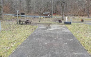
Clintwood, Virginia
Cranesnest Campground (Va)
Overview
The John W. Flannagan Dam & Reservoir Area boasts an expansive lake nestled in the rolling green Cumberland Mountains of sou...
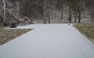
Clintwood, Virginia
Lower Twin Campground (Va)
Overview
The John W. Flannagan Dam & Reservoir Area boasts an expansive lake nestled in the rolling green Cumberland Mountains of sou...
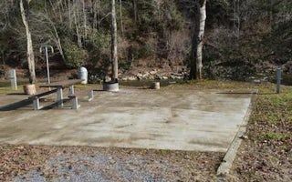
Clintwood, Virginia
Pound River Campground (Va)
Overview
The John W. Flannagan Dam & Reservoir Area boasts an expansive lake nestled in the rolling green Cumberland Mountains of sou...
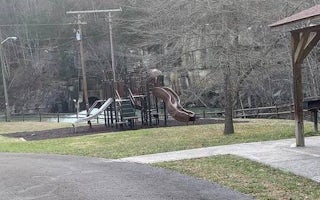
Haysi, Virginia
John W. Flannagan Day Use
Overview
The John W. Flannagan Day Use Area boasts an expansive lake nestled in the rolling green Cumberland Mountains of southwest Virgi...
Pound, Virginia
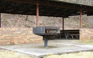
Phillip's Creek Group Picnic Area
Overview
Phillips's Creek Group Picnic area is a secluded site surrounded by forest. It is a great facility for family reunions, organiza...
Coeburn, Virginia
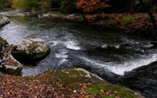
Flatwoods Group Picnic Area
Overview
Flatwoods Group Picnic area is a secluded site surrounded by forest. It is a great facility for family reunions, organization ac...


