Dillon Lake Group Picnic Shelter
Book this listing through our partner Recreation Gov
About Dillon Lake Group Picnic Shelter
Overview
Dillon Lake is approximately six miles northwest of Zanesville, Ohio, and twenty miles east of Newark, Ohio. Access to the lake is provided by State Route 146 via State Routes 16 and 586 from the north and US 40 and Interstate 70 from the south. The office is open from 7:30 a.m. until 4:00 p.m., Monday through Friday, but the area is open 24 hours.Recreation
Plenty of recreation is available throughout this area including water sports on the lake, great fishing and hunting, biking, and extraordinary wildlife viewing. We offer an accessible fishing pier below the dam and a trail with exercise facilities.Facilities
The picnic shelter offers 10 accessible picnic tables. The facility also offers several barbeque grills and a large fenced-in playground. Other facilities include a gazebo and fitness trail surrounded by park benches, picnic tables and beautiful landscaping.Natural Features
The picnic shelter/playground area is located above Dillon Lake, next to a large parking area. Visitors get a beautiful view of the lake, grass covered hills and wooded areas.Nearby Attractions
Other facilities around the area are provided by the Ohio State Parks and Division of Wildlife. These include several boat launches, plenty of hiking, biking, and horse trails, hunting areas, and a swim beach.Dillon Lake Group Picnic Shelter Reviews
Have you stayed here? Be the first to leave a review!
Top Spots in or near Zanesville
Quarry Rim-Chestnut Trail
Heath, Ohio
5.0
6 mi
/ 400 ft gain
Starting at the eastern trailhead off of Gratiot Rd, follow the paved Blackhand Trail for 0.2 mile till you arrive at the sign of the Quarry Rim Trail, a 0.9 mile trail that roughly parallels the bike trail, but takes you along the rim of the old sandstone quarry that was in operation in the late 1800's, as a source for sand for nearby glass factories.
After the Quarry Rim Trail, a short 0.1 ...
Blackhand Trail
Heath, Ohio
8.6 mi
Both the eastern and western trailhead have ample parking and access to the Blackhand Trail, which winds its way along the banks of the Licking River for a 4.3 mile one way trip.
While the trail isn't terribly long, it makes up for it in its scenery, staying within eyesight of the Licking River for almost its entire length, and passing through sections of sandstone walls towering dozens of fe...
Photograph Honey Run Waterfall
Howard, Ohio
4.0
Getting to Honey Run Falls is incredibly easy! There are two parking lots for the park, one on the west side of the road for the Honey Run Highlands, and one on the east side of the road in the forest for the falls. From the forest parking lot, follow the trail south for roughly 500 ft until you reach the base of the waterfall. On most days, you'll hear the falls from the parking lot, its that ...
Corkscrew Falls
Logan, Ohio
3.8
1 mi
/ 35 ft gain
I like to describe this waterfall as the "elusive" Corkscrew Falls (aka Robinson Falls). A couple of years ago, only one or two people had blogged on the internet about these falls. They were not super, descriptive details, so most of the time I wandered around till I found the trail. There is no big official park sign that says the trail starts here.
Here are the best directions on how to hik...
Hike to Ramona Lake
Rockbridge, Ohio
11 mi
/ 1600 ft gain
Starting at the Creekside Meadows Parking Lot, follow the Creekside Meadows Trail for 0.3 of a mile until it forks into two trails. Follow the left fork towards the road, and as soon as you cross the road, the Cemetery Ridge Trail begins. Once across Clear Creek Road, the trail gains elevation fast, with the first 1/4 mile gaining almost 400 ft. From there, the trail follows the ridge line, pas...
Hike the Cantwell Cliffs Loop
Rockbridge, Ohio
5.0
1 mi
/ 100 ft gain
Cantwell Cliffs is one of the more northern units of the overall Hocking Hills State Park Region. Located off of OH SR 374, a short 0.1 spur trail takes you from the parking lot to the rim of the gorge and the area's namesake cliffs. From there, you have two choices: Turn left and descend through "Fat Woman's Squeeze," a narrow staircase of rock cut into the cliffs to the valley floor below, or...
Camping and Lodging in Zanesville

Buckeye Lake, Ohio
Buckeye Lake / Columbus East KOA Holiday
Imagine having the center of Ohio at your doorstep: the Ohio Statehouse, Ohio State University, German Village, Longaberger Homestead, Am...
Coshocton, Ohio
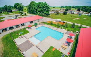
Coshocton KOA Holiday
Immerse yourself in the idyllic countryside at Coshocton KOA. Your family will enjoy the brand-new swimming pool, themed weekends and gre...
Butler, Ohio
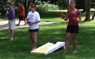
Butler / Mohican KOA Journey
Time stands still here in Amish Country, a lush landscape of rolling hills and quiet country roads where farms are still worked with hors...

Logan, Ohio
Hocking Hills KOA Holiday
Nestled in the spectacular Hocking Hills, this KOA is ideal for a peaceful getaway that's full of adventure. Gem mining and gold panning ...
Sunbury, Ohio
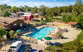
Sunbury / Columbus North KOA Holiday
OUR CAMPGROUND Our beautiful KOA shines with Appalachian mountain charm! We are a seasonal park, open April 12TH - October 20TH, 2019. T...
Galena, Ohio
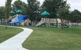
Alum Creek Below Dam Area
Overview
Alum Creek Lake is located in Delaware County, Ohio, just 30 minutes north of Columbus. The lake provides an ideal location for ...
Unfortunately, we don't have up-to date pricing data for this listing, but you can check pricing through Recreation Gov.
Book NowAdd your business today to reach The Outbound's audience of adventurous travelers.
Community
© 2024 The Outbound Collective - Terms of Use - Privacy Policy


