Stykkishólmur, Iceland
Looking for the best photography in Stykkishólmur? We've got you covered with the top trails, trips, hiking, backpacking, camping and more around Stykkishólmur. The detailed guides, photos, and reviews are all submitted by the Outbound community.
Top Photography Spots in and near Stykkishólmur
-
Stykkishólmur, Iceland
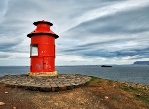
Visit the Stykkishólmur Lighthouse
3.0From the parking area which is adjacent to where the Ferry Baldur loading area is, walk up the hill and shortly after you'll see the brightly-colored lighthouse. It gets very windy here and there are birds everywhere. From the lighthouse you can look out over some islands between the Snæfellsne...Read more -
Snæfellsnesvegur, Iceland
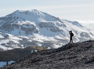
Hike Mount Drápuhlíðarfjall
3.7 mi / 1640.4 ft gainYou can park your car on the south side of Snæfellsnesvegur (road 51) and basically make a straight shot to the base of the mountain from there. You'll cross some boggy/marshy land, but should be able to find enough dry spots to hop across. The trail isn't always well defined as you walk up scree...Read more -
Snæfellsnesvegur, Iceland
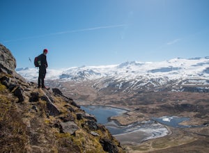
Scramble Kirkjufell Mountain
5.01.2 mi / 1542 ft gainYou can park at the Kirkjufellsfoss parking lot and head north across the road. Just a bit northwest there's a farm and some guest houses - head towards that. The trail up Kirkjufell starts ascending before you enter the fences of the guest houses. If you end up going too far, the nice woman who ...Read more -
Snæfellsnesvegur, Iceland
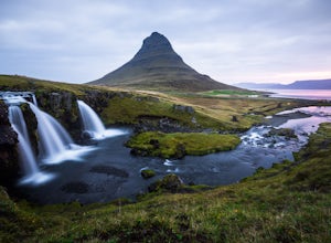
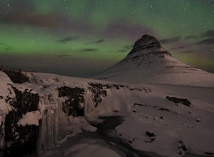
Photograph Kirkjufell and Kirkjufellsfoss
4.5Only 2.5 hours from Reykjavík in good weather, Kirkjufell is a popular spot for Iceland photography. Situated on the northern half of Snæfellsnes peninsula, the falls and mountain work as a sunrise, sunset, or northern lights location. Due to its popularity a large gravel parking area has been de...Read more -
Snæfellsnesvegur, Iceland
Photograph the Northern Lights at Kirkjufell and Kirkjufellsfoss
5.0Kirkjufell is a freestanding symmetric mountain, and is the most photographed mountain in Iceland. It is located in West Iceland on the north coast of Iceland's Snæfellsnes peninsula. It is 463m high, and attracts tourists at all time of the year.During the winter evenings, photographers and tour...Read more -
Útnesvegur, Iceland
Canyoning at Raufeldsgja
4.0Copule clarifications. The first, I say Intermediate and advanced. The reason I say this is because getting into the canyon is pretty simple. Few rock hops and you will be in a little clearing. The further you go into the canyon the harder it gets. Very shortly into the canyon there are two water...Read more -
Arnarstapi, Iceland
Explore Arnarstapi
4.71.6 mi / 0 ft gainArnarstapi is a small village located on the southern side of Snæfellsnes peninsula. It is not as touristy as other places in Iceland, and really allows you to get a feel for what most of Iceland is like. Today the small town is a fishing village. Although summer months are a much busier than the...Read more -
Arnarstapi, Iceland
Explore the Sea Cliffs on Iceland's Western Peninsula at Arnarstapi
5.0To get to Arnarstapi, you'll most likely be heading north and then west from Reykjavik along Route 1 and then Route 54. You won't need an intense vehicle for this as it's highway the entire way. Take Route 1 and head towards Borgarnes. Here, you'll transfer onto Route 54 for the next 99km. As you...Read more -
Útnesvegur, Iceland
Explore Snæfellsjökull National Park
4.82 miWhen I planned my road trip through Iceland, I found plenty of information and advice online for the southwestern part of the island, as well as up north in the area around Akureyri and Lake Myvatn, but there isn't a whole lot to be found about the northwestern region. Snæfellsjökull National Par...Read more -
Útnesvegur, Iceland
Explore Saxhóll Crater
Just off of Road 574 in Snæfellsjökull National Park, Saxhóll Crater is a short leg-stretcher. Saxhóll Crater is estimated to have erupted 3,000 years ago, and much of the surrounding landscape is the result of that eruption. The collapsed core of the crater is fairly deep, and the rim around t...Read more -
Skarðsvík Beach, Iceland
Explore Skarðsvík Beach
4.00.3 mi / 40 ft gainFrom the parking area you are free to roam the area. We started by walking down the stairs from the left of the parking lot. We walked down to the beach and went to the right towards the cliffs, hiked up under the base of the cliffs and around to the left to get on top of the cliffs. The area is ...Read more -
Skarðsvík Beach, Iceland
Explore Skarðsvík Beach
Follow the directions to the parking area and from the parking area you are free to roam. There are little paths everywhere down to the beach where you can walk down the shoreline into the different coves. Please be careful during high tide and make sure you are always in an area that is easy to ...Read more -
Malarrif Lighthouse, Iceland
Photograph the Malarrif Lighthouse in Snæfellsjökull National Park
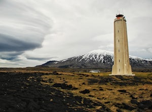
4.0From the visitor's center parking lot, take the path towards the lighthouse. This unique 24m (~80 ft) tall lighthouse was built in 1917, then rebuilt in 1946. The grounds surrounding the lighthouse consist of lava formations. Depending on where you stand, you have views out to the Atlantic Oce...Read more -
Unnamed Road, Iceland
Explore Djúpalónssandur Beach
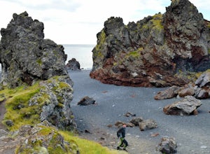
Djupalonssandur Beach is located within Snæfellsnes National Park. The beach is covered in black pebbles (lava) with enormous monoliths sticking out all over the beach. Behind the beach is Snæfellsjökull, a 700,000-year-old stratovolcano with a glacier covering its summit and it's active! To expl...Read more -
Þjóðvegur, Iceland
Explore Grábrók Volcano
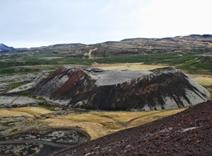
5.00.8 mi / 400 ft gainFrom the parking area just off the Ring Road (Highway 1) near the town of Bifröst, the trail starts to the left. It is a very short, steep hike up to the top of the crater, but there are stairs and boardwalks to aid the ascent. At the top, there are wonderful views of the surrounding area and y...Read more -
Glanni-Paradis Road, Iceland
Explore Glanni Waterfall
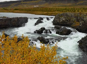
3.00.3 mi / 0 ft gainGlanni Waterfall is in the western region of Iceland right off the main Ring Road. It's the perfect place to get out and stretch your legs for a quick 15 minutes.Starting at the parking area, walk towards the signs with hiking trail directions (to the right). From here you'll see a maintained gra...Read more

