Bayrischzell, Germany
Looking for the best hiking in Bayrischzell? We've got you covered with the top trails, trips, hiking, backpacking, camping and more around Bayrischzell. The detailed guides, photos, and reviews are all submitted by the Outbound community.
Top Hiking Spots in and near Bayrischzell
-
Schönau am Königssee, Germany
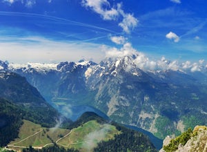
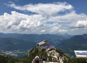
Mount Jenner Summit
0.5 mi / 500 ft gainThe Jennerbahn (an enclosed lift) will take you almost to the top of Mount Jenner. Buy a ticket at the booth at the entrance. It costs 32 euro, which is steep, however the views are incredible and it's very enjoyable to have lunch up there (there's a cafe). The alternative is to climb it from the...Read more -
Schwaz, Austria
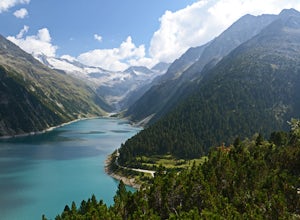
Hike to Olpererhütte in the Austrian Alps
4.04 mi / 1969 ft gainAustria’s Zillertal Valley is a spectacular region of the Alps offering a plethora of hiking options. Locals as well as tourism hosts overwhelmingly recommended Olpererhütte! From Mayrhofen, a public transit bus delivers hikers directly to the trailhead. Mayrhofen is a great village to use as hom...Read more -
Axamer Lizum, Austria
Hike up Hoadl at Axamer Lizum
5 mi / 2739.5 ft gainIf you are looking for somewhere to watch one of the best sunsets in Tirol, then Axamer Lizum might just be that place. Whilst this area is perhaps better known as being a ski resort in winter, it has some of the most picturesque hiking close to the city of Innsbruck, being at the foot of the Kal...Read more -
8 Florengasse, Austria
Hike To The Kemater Alm
7 mi / 2040.7 ft gainTake the bus from Innsbruck to Grinzens or if you have a car, park in the village of Grinzens at the Sportplatz. From here already you can see signs to the Kemater Alm. The route is really simple. Just follow the dirt road straight through the forest and deeper in to the valley. For the first ha...Read more -
Grinzens, Austria
Hike to Salfeins
5.04.4 mi / 3211.9 ft gainThe trail begins next to the Sportplatz in the village of Grinzens, just outside of Innsbruck. The trail begins as a gravel road, but within a few meters it splits. You can either take route 51 which follows the gravel road or route 52 which cuts through the forest. We chose to follow route 52 on...Read more -
Grainau, Germany
Hike Höllentalanger to Höllentalangerhütte
8.2 mi / 2400 ft gainStarting from the parking lot, walk 500m to the trail head. The hike begins with a gravel path that winds up an initial climb and spills out onto a gravel road. The marked trail leads to a hut that serves as the entrance to the gorge. The hut serves light food, drinks, and has free bathrooms avai...Read more -
Grainau, Germany
Hike Höllental Gorge to Lake Eibsee via Riffelscharte Peaks
9.1 mi / 4757.2 ft gainThis trail starts out right where one of the paths lead up to Zugspitze (Germany's highest mountain) but we take the route via Riffelscharte down to Eibsee. The tour starts from Hammersbach (parking available) through the spectacular Höllentalklamm gorge. At the end of the gorge, you can rest, ea...Read more -
Fulpmes, Austria
Hike To The Schlicker See In The Stubai Valley
9.9 mi / 2821.5 ft gainIn this circular hike starts at the Kreuzjoch top station of the Schlick 2000 gondola and finishes back at the bottom station, meaning that the elevation gain you're hiking is about half of the amount that you'll descend if you follow this particular route. As you exit the lift station, you'll ta...Read more -
Berchtesgaden, Germany
Kehlsteinhaus - Eagles Nest
0.9 mi / 334.6 ft gainYou arrive at the parkinglot just outside of the city Berchtesgaden. From there you can either buy a bus ticket to take a ~20 min drive up or you can choose to hike, which will take you approximately ~4 hours. Once arrived you can choose again. Take the elevator or once again choose to hike to th...Read more -
Salzburg, Austria
Hike Kapuzinerberg
4.02.8 mi / 492.1 ft gainStarting at the Platzl (at the State Bridge) walk up Linzergasse, through the Franciscan Gate to Stefan Zweig Weg. The steep climb up the Kapuzinerberg is lined by stations of the cross chapels.Walk through the Felix Gate (1632) past the Paschinger Schlössl (where Stefan Zweig lived from 1919-193...Read more -
Neustift im Stubaital, Austria
Hike & Overnight Stay at the Innsbrucker Hütte
13.7 mi / 4511.2 ft gainBecause the Innsbrucker Hütte sits on a ridge between two valleys, it can be reached from two sides; from the Gschnitz Valley or from the Stubai Valley. We chose to take the slightly longer (but less steep) route from the Stubai side. We parked the car in the village of Neder at the gravel parkin...Read more

