Ucluelet, British Columbia
Top Spots in and near Ucluelet
-
Alberni-Clayoquot C, British Columbia
Hot Springs Cove is a splendid hot spring located in Maquinna Provincial Park on Vancouver Island, in the remote northern end of Clayoquot Sound. The undeveloped natural hot mineral spring pools are still enjoyable in their natural state, reached via a pleasant two-kilometer boardwalk through old...
Read more
-
Comox-Strathcona D, British Columbia
Very few people know about this hidden gem which makes it less crowded and all the more special. The views and serenity that this place possess are what will really draw you in.
The hike starts at the Westmin Mine parking lot, located 2 hours north of Courtenay. To find the start of the trailhea...
Read more
-
Comox-Strathcona C, British Columbia
4.0
3.62 mi
/ 1342 ft gain
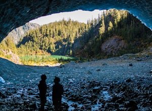
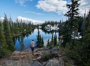
The next time you have the opportunity, I recommend you pay Century Sam Lake a visit. This short day hike complete with a spectacular emerald green lake, towering rock cliffs and summer snow caves make this a 'must do' for mid Island adventurers.
This day hike is a well kept secret – and often...
Read more
-
Comox-Strathcona D, British Columbia
5.0
40.4 mi
/ 5987.5 ft gain
As Vancouver Island's highest peak, the Golden Hinde is an obvious draw for coastal climbers. Its gravitational pull, however, requires a commitment, given this crown jewel of the Island Alpine is also one of its most remote, and gains more elevation than from Base Camp to Everest's summit.Winter...
Read more
-
Comox-Strathcona D, British Columbia
The hike starts at the Westmin mine parking lot, located 2 hours north of Courtenay. To find the start of the trail you need to walk 50 metres down a dirt road from the parking area. You will see a sign for Phillips ridge, which marks the start of your journey.The trail starts in a relatively fl...
Read more
-
Comox-Strathcona D, British Columbia
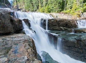
These beautiful falls are just a short and easy 500 metre stroll from the parking lot, making this one of the more family-friendly hikes in the area. Located at the end of the trail are the 75 metre cascading falls and spectacular views of Buttle Lake.Located approximately 1 1/2 hours north of th...
Read more
-
Comox-Strathcona D, British Columbia
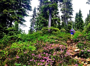
With a name like Flower Ridge, who wouldn't want to add this hike to their bucket list?The Flower Ridge trailhead is located approximately 26kms down the Buttle Lake Parkway, towards Westmin Mine, in Strathcona Provincial Park. A classic Island alpine approach, you will be more than warmed up af...
Read more
-
Errington, British Columbia
Mount Arrowsmith resides in the heart of Vancouver Island between Nanaimo and Tofino within the Alberni Valley region. At the height of 1817m this peak boasts being the tallest point on the southern half of the island. With it's easy access it is surely the most visited and summited mountain on t...
Read more
-
Nanaimo F, British Columbia
This park is a great stop right on the side of highway 4 heading to or from the Tofino area. If you are heading to Tofino on Vancouver Island, this park is hard to miss. There are signs for it and easy parking on the side of the highway. There are two loop trails on either side of the highway, an...
Read more
-
Errington, British Columbia
Mt. Arrowmsith's claim to fame is the tallest mountain on "southern" Vancouver Island. Standing at 1,819 m (6,000 ft), it barely squeezes into the top 50 of the Island, as it stands no chance against the peaks of Strathcona, which you can see gazing north from the summit!The advantage of Arrowsmi...
Read more
-
Honeymoon Bay, British Columbia
The opportunity to travel deep into a region where ancient forests still stand, telling their story of centuries past, can't be overlooked. One of the last remaining areas of such beauty and rarity still exists deep in the heart of the southern interior on Vancouver Island. This spot is known as ...
Read more
-
Errington, British Columbia
The starting point depends a lot on the time of year and snow level. On a bad snow year you can get all the way to the old ski area base. Depending on the road conditions, however, be prepared to snowshoe/skin in anywhere from an extra 3 to 5 km (2-3 mi). The Rousseau Chute route is an alternativ...
Read more
-
Nanaimo F, British Columbia
5.0
12.4 mi
/ 1000 ft gain
The trail from Cameron Lake to the top of Mount Cokely (5302') provides the most ready access to the alpine on Southern Vancouver Island. The route is straightforward and non-technical, albeit physically challenging. Expect to spend 6-8+ hours if hiking the entire route described below (which we ...
Read more
-
Youbou, British Columbia
Heather Mountain is a moderate well marked out and back hike through managed forest land.
The hike brings a wonderful feeling of solitude as there are no towns or buildings visible even with distant views in all directions. It is also quite lightly tracked: we saw no other hikers on the entire r...
Read more
-
Fanny Bay, British Columbia
4.3
3.84 mi
/ 515 ft gain
Starting at the Rosewall Creek Provincial Park parking lot you take the trail upstream of the creek passing under the inland island highway bridge. This trail eventually leads out of the provincial park boundary, but don't worry you haven't gone too far.
It is about a 7 km roundtrip hike and the...
Read more

