Shirley, British Columbia
Top Spots in and near Shirley
-
Duncan, British Columbia
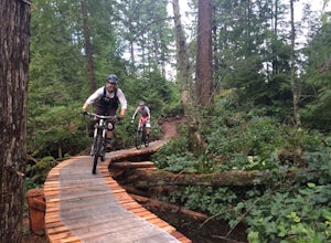
The Maple Mountain trail network has been enjoyed for countless years by hikers, but not until recently did the mountain receive the attention it deserved for mountain biking. Over the last few years the Cowichan Trail Stewardship Society in conjunction with the approval of the local municipality...
Read more
-
Salt Spring Island, British Columbia
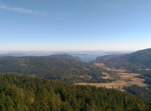
From Ganges head south on Fulford-ganes road toward Fulfrod harbour. Turn right on Dukes road then a right on Seymour Heights. Seymour Heights turns into a dirt road, with a number of pot holes but nothing a non 4x4 car can't handle. At the trail head there is a small turn around and not a ton of...
Read more
-
Port Angeles, Washington
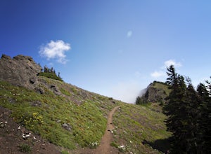
Hiking to Klahhane Ridge is a rewarding experience that provides you with sweeping views of the Olympic Mountains. Further access to overnight opportunities is possible if you venture beyond the summit trail. Here’s the scoop:
Get an early start. There is a decent amount of parking available at ...
Read more
-
Port Angeles, Washington
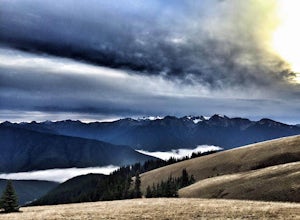
The winding roads and drop-off cliffs provide an outstanding journey to the trailheads on a clear day. If you have to bear through the fog, your reward at the top is worth every second of what you missed. The first image above is your view from the Hurricane Ridge Visitor Center, so even if you a...
Read more
-
Neah Bay, Washington
Cape Flattery, the most northwesterly point of the lower contiguous 48 states is accessed via an easy trail which includes many board walks and sets of stairs. Maintained by the Makah Tribe of Indains, the trail provides spectacular views of the Pacific Ocean, Tatoosh Island, nearby rocky cliffs...
Read more
-
Neah Bay, Washington
Shi Shi offers an incredible reward for those who feel like venturing out a bit further and reaching a less accessible beach on the Olympic Coast, just be sure to time your hike with the low tide! The trail starts off near the fish hatchery on the Makah Indian Reservation.
To get there from Port ...
Read more
-
Neah Bay, Washington
Introduction:My friends and I decided to head out to the Pacific Northwest (PNW) from Philadelphia to do some backpacking and beach camping. We choose Shi Shi Beach for it's terrific beach camping and extraordinary photography potential. Here is a rundown of the out and back, 2-night backpackin...
Read more
-
Honeymoon Bay, British Columbia
The opportunity to travel deep into a region where ancient forests still stand, telling their story of centuries past, can't be overlooked. One of the last remaining areas of such beauty and rarity still exists deep in the heart of the southern interior on Vancouver Island. This spot is known as ...
Read more
-
Forks, Washington
5.0
35.69 mi
/ 5948 ft gain
Grab a permit on your way in at the Wilderness Information Center (WIC) in Port Angeles or at the Quinault USFS/NFS Recreation Information center before parking at the Hoh Rain Forest Visitor Center and use the wash station and rest room before you head out on the trail.
The first five miles of...
Read more
-
Forks, Washington
Olympic National Park was established to preserve “the finest example of primeval forest” and so the Hoh Valley remains much like it has for thousands of years. This is the best trail to experience the magic of Hoh Valley, the grandeur of its old growth trees, lush understory and iridescent glaci...
Read more
-
Forks, Washington
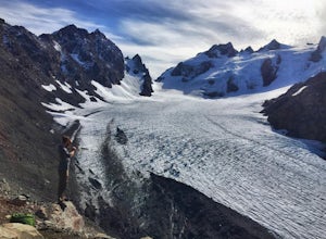
Getting to the summit is no easy task. The approach is long, you must cross a glacier, and once you are to the summit block the easiest way up is on loose 4th class rock, however a short pitch of 5.4 rock is recommended instead.
Getting there
On your way to the trail-head you will need to stop a...
Read more
-
Forks, Washington
5.0
35.68 mi
/ 5948 ft gain
The well trodden and well marked trail begins in the rainforest, and is flat and follows the river for the first few miles. There are many marked camp sites along the way, as well as dispersed camping on the sand bars in the river bed. Follow the trail until the first major intersection, at the O...
Read more
-
Forks, Washington
Olympic National Park plays host to some incredible things, including the Hoh Rainforest. Known for its long hanging moss and crystal clear waters, it's easy to see why this is a popular destination. Spring is the perfect time of the year to visit, the weather is mild and the park is almost empty...
Read more
-
18113 Upper Hoh Road, Washington
4.5
1.04 mi
/ 203 ft gain
Starting at the Hoh Rainforest Visitor Center, take the only trail out into the forest itself. After a few hundred yards there will be a sign pointing you in the direction of the Hall Of Mosses. Follow signs and a very well-maintained trail over crystal clear creeks and fallen trees until you r...
Read more
-
-
Sequim, Washington
Park at a the north side of the Dungeness Spit Recreation Area, in the Refuge parking lot. There is a kiosk at the Refuge where you can pay an entrance fee ($3) and check the Tide Table. Only attempt the hike at low tide or the sand spit becomes narrow and you have to climb over logs.Follow the R...
Read more

