Nanaimo, British Columbia
Top Spots in and near Nanaimo
-
Port Renfrew, British Columbia
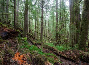
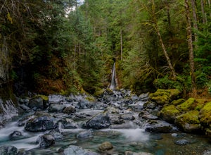
To get to the Avatar Grove, drive to Port Renfrew along West Coast highway 14. Turn right onto Deering Rd and cross the long bridge over the San Juan River. Stay right at the next Y intersection, and then left at the T intersection. At the next Y keep left and cross a tall bridge over the crys...
Read more
-
North Vancouver, British Columbia
The Lynn Canyon Loop is a 5km trail that takes you up through the dense forest before looping back along the rushing water of the river.There are several trail systems throughout Lynn Headwaters Regional Park, that cater to every ability. Depending on what you're looking for, Lynn Canyon can prov...
Read more
-
North Vancouver, British Columbia
The trail starts in Lynn Headwaters Regional Park.
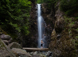
This is a fantastic day hike that give you just enough of a challenge but isn't too long. It's about 14km to the norvan waterfalls and back ( 7km each way) and it totally work the walk. There is very minimal gain on this hike.
The first bit of th...
Read more
-
North Vancouver, British Columbia
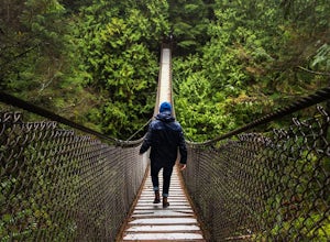
Lynn Canyon Suspension Bridge spans Lynn Canyon and is located near the popular Lynn Headwaters Park. To get there, exit the Trans Canada Highway onto Lynn Valley Road. Shortly after passing through the centre of the Lynn Valley community, turn right onto Peters Rd. This road will turn into "P...
Read more
-
Fanny Bay, British Columbia
4.3
3.84 mi
/ 515 ft gain
Starting at the Rosewall Creek Provincial Park parking lot you take the trail upstream of the creek passing under the inland island highway bridge. This trail eventually leads out of the provincial park boundary, but don't worry you haven't gone too far.
It is about a 7 km roundtrip hike and the...
Read more
-
North Vancouver, British Columbia
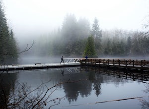
Walk down Rice Lake Road, cross the bridge, and follow the pathway towards the park ranger buildings. Past the buildings you will find a gravel path going into the trees, which will take you towards a fence beside the trail. Continue on the path towards the lake, while the trees and moss along th...
Read more
-
North Vancouver, British Columbia
Head over to the Lower Seymour Conservation Reserve and hop on your two-wheeler to enjoy this stunning 20k ride.
Your ride will begin at the trailhead, where hikers walk off to rice lake. Stay off to the right, where there is an obvious bike path (2 paved lanes). This trail will take you ~11kms ...
Read more
-
Port Renfrew, British Columbia
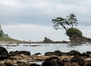
The trail requires a permit from May 1 - September 16. All other dates have restrictions. Check Parks Canada website for more details.You can start from the north or south end of the trail. There are buses provided by the Pacific Rim National Park that will shuttle you back to your car or to the ...
Read more
-
Port Renfrew, British Columbia
In the summer of 2016, myself and three others decided to hike the West Coast Trail (WCT) on a bit of a whim! We naively, and courageously, choose the WCT as our first major backpacking hiking trip - we thought it would be best to throw ourselves into a hike that has earned a reputation for being...
Read more
-
Delta, British Columbia
As you begin your journey into Burns Bog Delta Nature Reserve from the parking lot and small trail coming off of Westview Drive, notice the gravel trail ahead of you and across the train tracks that will take you into the bog itself and take a left. After spending a few minutes on the straight tr...
Read more
-
Honeymoon Bay, British Columbia
The opportunity to travel deep into a region where ancient forests still stand, telling their story of centuries past, can't be overlooked. One of the last remaining areas of such beauty and rarity still exists deep in the heart of the southern interior on Vancouver Island. This spot is known as ...
Read more
-
Victoria, British Columbia
4.0
5.75 mi
/ 1499 ft gain
Gowlland Tod is a beautiful park, running along the Finlayson Arm fjord. Jocelyn hill is in the middle of the park, and can be accessed from the Caleb Pike access at the South end (along the Ridge trail) or from the McKenzie Bight access at the North end (along the Timberman trail). With planning...
Read more
-
Denman Island, British Columbia
Fillongley Park is located on Denman Island. To get there take the Denman Island Ferry from Buckley Bay, off Hwy #19A on central Vancouver Island. Take the Buckley Bay exit #101 from Hwy #19A. Once on the island, follow Denman Road to Swan Road. Turn left on Swan Road, then right on Beadnell Road...
Read more
-
North Vancouver, British Columbia
Only 30 minutes from downtown Vancouver, Deep Cove is a great place to paddle in tranquil ocean waters. You can rent ocean kayaks, canoes and stand-up paddle boards from Deep Cove Kayak.The bay in front of the community is one of the few in Indian Arm that has both a sheltering shape and the shal...
Read more
-
North Vancouver, British Columbia
Setting out from Deep Cove’s pebble shoreline, it only takes a few minutes before you are away from small village and paddling the calm waters of this gorgeous arm. Seals can be frequently spotted as you follow the path of off oceanfront homes, some living off the grid, deeper into the mountains....
Read more
-
North Vancouver, British Columbia
3.8
2.4 mi
/ 328.1 ft gain
Deep Cove is a cozy little town located at the base of Mt. Seymour, lying on the shores of the Indian Arm which is a branch of the Burrard Inlet in North Vancouver. In autumn, the tree-lined streets glow orange in the sunlight and the sailboats, kayakers and paddleboarders fill the harbour with ...
Read more

