Lytton, British Columbia
Looking for the best camping in Lytton? We've got you covered with the top trails, trips, hiking, backpacking, camping and more around Lytton. The detailed guides, photos, and reviews are all submitted by the Outbound community.
Top Camping Spots in and near Lytton
-
Lillooet, British Columbia
Drive the Molybdenite Ridge
5.012.4 miStarting at the Lytton Cable Ferry the gravel road begins. You are immediately greeted with views of the iconic Fraser River and local mountains. After approximately 40 km on the road, you turn onto Texas Creek FSR and follow this for 7 km before turning onto Molybdenite Main. This road takes you...Read more -
Lillooet, British Columbia
Camp at Cottonwood Recreation Site
5.0Located 3+ hours North of Vancouver on Duffey Lake Road (Highway 99), Cottonwood Recreation Site is one of 4 sites managed by the BC Forest Service. Duffey Lake Road is an extension of Highway 99 and connects Pemberton to Lillooet.If you plan on hiking or backcountry camping at Joffre Lakes, you...Read more -
D'Arcy, British Columbia
Hike Vantage Peak
3.04.7 mi / 3618.8 ft gainThis trip can be done as big day trip, or broken up over two days if you bring a tent. It makes for a great weekend trip from Vancouver. So good in fact Arc'teryx made a whole movie about it. Just beyond the ever popular Joffre Lakes turn off by about 20km is a unmarked extended shoulder, with a ...Read more -
D'Arcy, British Columbia
Overnight at Keith's Hut
2.05.6 mi / 1312.3 ft gainStarting from the side of the highway outside of Pemberton, continue towards Duffy Lake past Joffre Lake trail head. Cross the Cayoosh Creek bridge and pass the work sheds on your right with a green roof, 3.3km from this is a shoulder and between no-stopping avalanches areas, you will see a pull ...Read more -
D'Arcy, British Columbia
Hike to Mt Rohr
5.0/ 3200 ft gainThe Duffy Lake Road area is a scrambling paradise. If you love exploring the alpine off trail, this would be the place.Mt Rohr is a prominent peak, located just above Duffy Lake. One of the highlights of this trip is that you get to hike directly beside the incredible glaciers of Joffre Peak, as ...Read more -
Squamish-Lillooet C, British Columbia
Joffre Lakes Trail
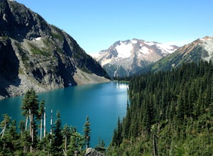
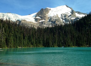
4.65.67 mi / 1266 ft gainJoffre Lakes is a well loved destination, and for good reason: it is absolutely stunning. Not only is it located on one of the most scenic drives you could ever hope to find (Duffy Lake Road) , but it's possible to enjoy this area no matter how much time you have, or how much hiking you want to d...Read more -
Squamish-Lillooet C, British Columbia
Backcountry Camp Upper Joffre Lake
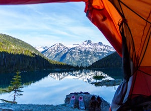
3.03.1 mi / 2952.8 ft gainJoffre Lakes Provincial Park is located roughly three hours from Vancouver north of Whistler and Pemberton on Highway 99 (Sea-to-Sky Highway). The drive itself up to the trailhead is very scenic and worth it in itself. Once you get to the parking lot, park your car anywhere in the lot and consi...Read more -
Squamish-Lillooet C, British Columbia
Snowshoe Joffre Lakes
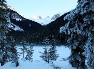
6.2 mi / 1312.3 ft gainThe Canadian west coast mountains around Whistler BC receive over thirty feet of snow each winter. This area is well known for epic skiing and snowboarding, and it's also a really fun place to go snowshoeing. Here's a winter version of the incredible Joffre Lakes adventure (see my profile to read...Read more -
Lytton, British Columbia
Camp at Strawberry Point
2.0If you're coming from Vancouver give yourself about 3 -4 hours of daylight driving time. This place isn't the easiest to find in the dark. From Pemberton, stay on the highway - this drive is beautiful! Follow any directions you see that will take you to the Duffy Lake road. After you drive along ...Read more -
Lytton, British Columbia
Explore Lillooet Lake
Lillooet Lake sits at the bottom of the Duffey Lake Road, just past the village of Mt Currie. In 2010, Mt Meager experienced a landslide totalling 48 million cubic metres, the largest in modern Canadian history. Sitting directly upriver of Lillooet Lake, the Meager slide turned this beautiful tur...Read more -
Harrison Mills, British Columbia
Relaxing at Sloquet Hot Springs
4.3Nestled between Harrison Hot Springs and Pemberton, the Sloquet Hot Springs are a great place to unwind. With multiple natural pools, it is easy to settle in and enjoy a beer, or my winter favourite, Baileys and coffee. If things heat up too fast, take refuge in a lower pool or cool off in the ri...Read more -
Yale, British Columbia
Summit Needle Peak
5.08.1 mi / 2893.7 ft gainMake your way to the Zopkios exit (#217) on the Coquihalla Highway (Hwy 5), which is almost exactly halfway between the Lower Mainland and the Okanagan of BC. The trailhead is off the pipeline service road on the opposite side of the highway as the rest stop. The hike can be done in one day, but ...Read more -
Yale, British Columbia
Hike to Tasty Lake
8.1 mi / 2894 ft gainTo Needle PeakTotal Distance: 13.0 km (return)Estimated Time: 4 - 7 hoursAverage Grade: 13.6%Structure: Linear - ReturnElevation Gain: 882 mStart Elevation: 1210 mMax Elevation: 2092 mTo Small LakeTotal Distance: 13.0 km (return)Estimated Time: 4 - 6 hoursAverage Grade: ...Read more -
Yale, British Columbia
Hike & Swim at Falls Lake, BC
3.0Usually the Coquihalla is a means of a way to get from Point A to Point B, but why drive past all that rugged B.C. beauty? Skip the usual travel rest stops and have a micro adventure while passing through the transition zone between B.C.'s coastal and interior landscapes.The trailhead is 1km (0.6...Read more -
Squamish-Lillooet C, British Columbia
Camp at the Top of Kafir Peak
5.0At the turn off to Birkenhead Lake Provincial Park, take a hard left to the Telus cell phone tower access road (there is a telus branded sign). Drive up the road, which is very steep at times. High clearance and four wheel drive are a must! Drive up to the top, take in the view, and find a place ...Read more

