Hope, British Columbia
Looking for the best camping in Hope? We've got you covered with the top trails, trips, hiking, backpacking, camping and more around Hope. The detailed guides, photos, and reviews are all submitted by the Outbound community.
Top Camping Spots in and near Hope
-
Hope, British Columbia
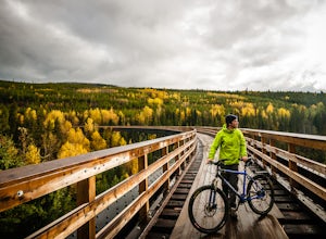
Cycle the Kettle Valley Rail-Trail
4.0Top 10 Areas of Interest - from West to East (1) Coquihalla Canyon Provincial Park(2) Red Ochre cliffs in the Tulameen(3) Trout Creek Trestle & The Kettle Valley Steam Train(4) Penticton's Munson Mountain & the Naramata Bench(5) The Little & Big Tunnel above Naramata(6) Myra-Bellevue ...Read more -
Fraser Valley D, British Columbia
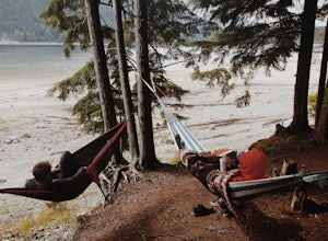
Camp at Jones Lake
3.0Southwest of Hope and just east of Chilliwack, Jones Lake is a recreation site at a reservoir lake in the coastal mountain range, managed by BC Hydro. Set below granite mountain peaks and surrounded by a dense forest (that is unfortunately being logged), this lake isn't pristine, but it sure is p...Read more -
Fraser Valley D, British Columbia
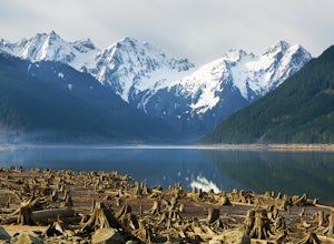
Paddle on Jones Lake, BC
5.0Jones Lake Reservoir is approximately 25 km southwest of the town of Hope, British Columbia. Directly off of BC Highway #1 at the community of Laidlaw. To reach the lake, you will have to drive 9 km (5.6 mi.) on a steep and pretty beat up gravel road. The Jones Lake Forest Service Road is car ac...Read more -
Fraser Valley E, British Columbia
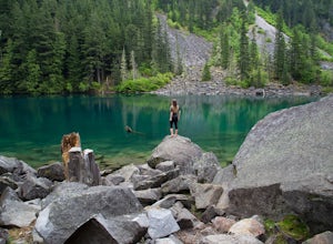
Hike to Lindeman & Greendrop Lakes
4.46.89 mi / 1240 ft gainYou start the trail in a newly created parking lot (outhouses as well). Follow along the trail, and within a short distance from the parking lot you will come to a fork. Take the left trail (right goes to Flora Lake). This part of the trail is fairly flat with some nice scenery. You will follow t...Read more -
Yale, British Columbia
Summit Needle Peak
5.08.1 mi / 2893.7 ft gainMake your way to the Zopkios exit (#217) on the Coquihalla Highway (Hwy 5), which is almost exactly halfway between the Lower Mainland and the Okanagan of BC. The trailhead is off the pipeline service road on the opposite side of the highway as the rest stop. The hike can be done in one day, but ...Read more -
Yale, British Columbia
Hike to Tasty Lake
8.1 mi / 2894 ft gainTo Needle PeakTotal Distance: 13.0 km (return)Estimated Time: 4 - 7 hoursAverage Grade: 13.6%Structure: Linear - ReturnElevation Gain: 882 mStart Elevation: 1210 mMax Elevation: 2092 mTo Small LakeTotal Distance: 13.0 km (return)Estimated Time: 4 - 6 hoursAverage Grade: ...Read more -
Okanagan-Similkameen H, British Columbia
Hike to Illal Meadows & Illal Peak
3.06.2 mi / 1968.5 ft gainTo access Illal Meadows, you have to take a little spur road off of the Tulameen Forest Service Road. This spur road is described as being accessible with high clearance 2WD before turning into a 4WD road.The first part follows an old, overgrown, flat logging road to the south branch of Illal Cr...Read more -
Yale, British Columbia
Hike & Swim at Falls Lake, BC
3.0Usually the Coquihalla is a means of a way to get from Point A to Point B, but why drive past all that rugged B.C. beauty? Skip the usual travel rest stops and have a micro adventure while passing through the transition zone between B.C.'s coastal and interior landscapes.The trailhead is 1km (0.6...Read more -
Whatcom County, Washington
Winter Hike to Winchester Mountain
3.5 mi / 1320 ft gainDespite this trip report being titled "to Winchester Mountain", the fun doesn’t stop there. Even though Winchester Mountain is the most popular summer hike departing from Twin Lakes, this whole area turns into a fun-zone during the winter.Upon reaching higher ground above the lakes, this zone off...Read more -
Whatcom County, Washington
Winchester Mountain Fire Lookout
4.83.28 mi / 1335 ft gainWinchester Mountain is said to have the greatest reward for least amount of effort in all the North Cascades. One of the last fire-lookouts in the region stands on the summit. Views from the summit of Winchester Mountain are beautiful and dramatic to say the least. Being one of the easiest hikes...Read more -
Whatcom County, Washington
Yellow Aster Butte and Tomyhoi Peak
4.713.4 mi / 4902 ft gainThe best way to describe the location is due east of Bellingham. After driving through gorgeous roads to reach Twin Lakes Road (fire service road 3065), you are treated to about a 4-mile drive up to the trailhead for Yellow Aster Butte (8.3 miles RT with 2850' of gain) and Tomyhoi Peak. The drive...Read more -
Whatcom County, Washington
Yellow Aster Butte
9.08 mi / 3258 ft gainYellow Aster Butte has to be one of the most visually rewarding hikes in the Mt. Baker-Snoqualmie National Forest for the effort required to get there. Abundant with lush, rolling mountain meadows, hikers can be treated to an abundance of wildflowers, heather fields, and berry patches with dreamy...Read more -
Manning Park, British Columbia
Hike to Mt. Frosty, EC Manning Provincial Park
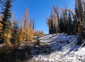
14.2 mi / 5433.1 ft gainThe larch meadows on the approach to Mt. Frosty are known for 2 things: 1. Wild flowers during the summer and 2. Larches during the autumn.The trail climbs up the south end of Lightning Lake; it is well groomed and graded all the way up. The steepest section is the climb out of Lightning Lakes – ...Read more -
Manning Park, British Columbia
Backpack the Heather Trail, BC
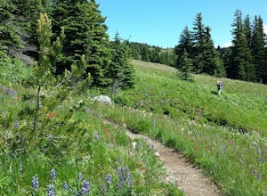
24.9 mi / 1138.5 ft gainThis hike begins in the middle of Manning Park, with a drive up to the trail-head. This means you get all the benefits of alpine views and fields of wildflowers in the summer months, without hiking the elevation gain. Manning Park is on the Crowsnest Highway (BC-3). Across the highway from the ...Read more -
Deming, Washington
Winter Backpack to Artist Point
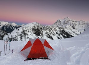
4 mi / 1000 ft gainYou do need a Northwest Forest Pass to park in the lot overnight. You can buy a day use E-pass online here (pick Mount Baker-Snoqualmie National Forest from the drop down menu) and print it out and it's ready to use. Or you can buy the annual pass here.The adventure to Artist Point begins in the ...Read more -
Deming, Washington
Backcountry Skiing Near Mt. Baker
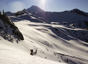
5.0Park at Heather Meadows parking lot at Mount Baker Ski Resort and follow the Blueberry cat-track, which is actually a paved road in the summer, leading south up for 2 miles passing Austin Pass and continuing southwest on to Artist Point, gaining 1200 ft in elevation. From there, dig out your snow...Read more

