Chilliwack, British Columbia
Looking for the best hiking in Chilliwack? We've got you covered with the top trails, trips, hiking, backpacking, camping and more around Chilliwack. The detailed guides, photos, and reviews are all submitted by the Outbound community.
Top Hiking Spots in and near Chilliwack
-
North Vancouver, British Columbia
Snowshoe Dog Mountain
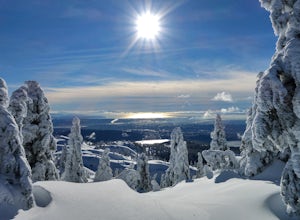
2.7 mi / 328.1 ft gainA perfect way to get outside before or after work. Dog mountain is an easily accessible snowshoe trail that takes you up to the short peak from the Mt. Seymour parking lot. This is a perfect spot for sunrise or sunset photography, and you can catch great 360 views from the top. Start at the BC Pa...Read more -
North Vancouver, British Columbia
Hike Dog Mountain, BC
4.23.1 mi / 150 ft gainThe trail begins in the furthest northwest corner of the parking lot, by a big trail map. The start of the trail is gradual and meanders through the forest. The trail then begins to become more technical and requires scrambling over rocks and up areas with roots. Although this hike has minimal ga...Read more -
North Vancouver, British Columbia
Hike to Mystery Lake
4.03.1 mi / 492.1 ft gainFrom the Mt. Seymour ski area parking lot, head towards the Mystery Peak Express. Once you have passed the base of the Mystery Peak Express, you will continue up the trail to your left (right goes to dog mountain, straight to the 3 peaks of Seymour). Follow the trail all the way up to the lake. T...Read more -
Rockport, Washington
Photograph Ketchum Falls
0.2 mi / 1388 ft gain...After spending my 3 days exploring and capturing the partial lunar eclipse at North Cascades National Park in Washington, I was eager to find another adventure that I haven't done yet or others didn't know much about. As I was driving East leaving Gorge Creek Falls, .9 miles on my left I spott...Read more -
Skagit County, Washington
Sauk Mountain Summit 5,541'
4.34 mi / 1200 ft gainEven from the Trailhead, the views overlooking the Skagit River valley, all the way out toward Mount Vernon, are outstanding. The trail follows 20 tight switchbacks as it makes it's way 600 feet up to the southern crest of the summit ridge. This is a steep slope and it's possible to look straight...Read more -
North Vancouver, British Columbia
Snowshoe Mt. Seymour to Tim Jones Peak
5.6 mi / 1607.6 ft gainYou'll see traction of all sorts in the Mt. Seymour area during Winter months, including: yak tracks, microspikes, crampons, snowshoes, skis (with and without skins), and my personal favourite, the magic carpet.The Mt. Seymour trail parallels the Seymour downhill ski area. It follows up and over...Read more -
Yale, British Columbia
Summit Needle Peak
5.08.1 mi / 2893.7 ft gainMake your way to the Zopkios exit (#217) on the Coquihalla Highway (Hwy 5), which is almost exactly halfway between the Lower Mainland and the Okanagan of BC. The trailhead is off the pipeline service road on the opposite side of the highway as the rest stop. The hike can be done in one day, but ...Read more -
Yale, British Columbia
Hike to Tasty Lake
8.1 mi / 2894 ft gainTo Needle PeakTotal Distance: 13.0 km (return)Estimated Time: 4 - 7 hoursAverage Grade: 13.6%Structure: Linear - ReturnElevation Gain: 882 mStart Elevation: 1210 mMax Elevation: 2092 mTo Small LakeTotal Distance: 13.0 km (return)Estimated Time: 4 - 6 hoursAverage Grade: ...Read more -
Rockport, Washington
Sourdough Mountain Trail
5.09.34 mi / 5046 ft gainGoing east from Newhalem on highway 20, turn off towards the small town of Diablo. There are signs from there on where to park. This hike is very difficult. It is very steep and gains elevation very quickly and right from the start. Once you get above tree line though you are greeted with great ...Read more -
Rockport, Washington
Hike to Pyramid Lake
2.1 mi / 1500 ft gainDay hike with moderate elevation gain, 2.1 miles one way. You will be going up, up, up until you get to the top where you will find the lake. Take your time going up - take breaks and stop to check out the forest around you. There were a few times where we found it difficult to follow the trail (...Read more -
Yale, British Columbia
Hike Yak Peak
5.03.4 mi / 2755.9 ft gainThe granite slab of Yak Peak is easily identified by those passing by on the Coquihalla Highway. What most don't know is there is a hiking trail and climbing opportunities, both offering amazing 360 degree views of the Zopkios range and beyond.This hike starts at the Zopkios rest area (across the...Read more -
Yale, British Columbia
Hike to Guanaco Peak
4.5 mi / 2950 ft gainThe Coquihalla Summit Recreation Area is a zone comprised of several oddly shaped granite peaks. A few of these mountains demand your attention while driving along the Coquihalla Highway, but many remain hidden and require backroad exploration and elevation gain to be seen. Guanaco Peak is rea...Read more -
North Vancouver, British Columbia
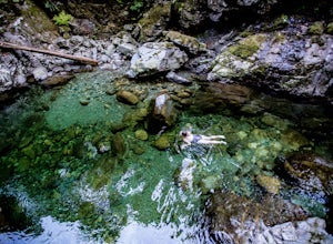
Swim at the Lynn Canyon Swimming Hole
4.50.6 mi / 50 ft gainFrom the last field at inter city park, continue walking down the road to the Lynn Canyon trail. Follow the trail up the wooden boardwalks and to the first open area on the trail. When you can see the creek to your left, head down to the creek. To get to this particular swimming hole, you will ha...Read more -
North Vancouver, British Columbia
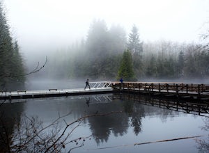
Hike Rice Lake
3.4Walk down Rice Lake Road, cross the bridge, and follow the pathway towards the park ranger buildings. Past the buildings you will find a gravel path going into the trees, which will take you towards a fence beside the trail. Continue on the path towards the lake, while the trees and moss along th...Read more -
North Vancouver, British Columbia
Hike the Lynn Canyon Loop
4.44 miThe Lynn Canyon Loop is a 5km trail that takes you up through the dense forest before looping back along the rushing water of the river.There are several trail systems throughout Lynn Headwaters Regional Park, that cater to every ability. Depending on what you're looking for, Lynn Canyon can prov...Read more

