Chilliwack, British Columbia
Looking for the best hiking in Chilliwack? We've got you covered with the top trails, trips, hiking, backpacking, camping and more around Chilliwack. The detailed guides, photos, and reviews are all submitted by the Outbound community.
Top Hiking Spots in and near Chilliwack
-
Maple Ridge, British Columbia
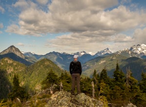
Hike Evans Peak in Golden Ears Provincial Park
4.0Start on the West Canyon Trail and then take a left up the View Point Trail. Along the View Point trail you’ll cross a creek. There’s a beautiful waterfall and natural hammock (a log) which is great for a quick snack spot or photo.A few hundred meters past the creek, 1.5km from the start of the...Read more -
Maple Ridge, British Columbia
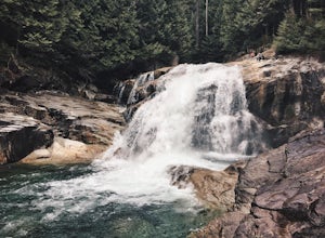
Hike to Lower Falls in Golden Ears Provincial Park
5.03.5 miLower Falls is found within Golden Ears Provincial Park in British Columbia. Easily accessible from the Gold Creek Parking lot, it is a relatively flat trail snaking along Gold Creek itself. It can be done as an out & back trail, or you can make it a loop by using the connector trail located ...Read more -
Maple Ridge, British Columbia
Summit Golden Ears
4.514.9 mi / 5039.4 ft gainDay 1 Starting from the Golden Ears parking lot, your journey begins up a relatively small incline passing two bridges and entering the forest. Continue through the forest passing small cliffs and revealing some views of what you are going to climb the next day. Your estimated time it should take...Read more -
Maple Ridge, British Columbia
Hike to Alder Flats in Golden Ears Provincial Park
4.06.8 mi / 918.6 ft gainIf you're looking for a challenge and hope to get into the mountains this is a great adventure to set out on.Be prepared: Water, a lot of time, and with an understanding of the elevation gain will be important. This hike to the viewpoint of Alder Flats (overlooking the ears) takes around 2 hours ...Read more -
Maple Ridge, British Columbia
Hike the East-West Canyon Loop
8.1 mi / 1640.4 ft gainPark your car in the Gold Creek Parking lot ( at the end of the dirt road), and look for a yellow gate at the far end of the parking lot. This will be the East Canyon trail.The first part of the trail winds through the forest and you emerge on an old logging road. Follow this road along with the ...Read more -
Maple Ridge, British Columbia
Hiking Golden Ears Trail
14.9 mi / 4921.3 ft gainGolden Ears is well known to those in the Lower Mainland. After staring at the jagged 'ears' from all angle, I finally got to see them up close and in-person. The West Canyon Trail is a gentle 5.5 kilometers on a well groomed path, lined with deciduous trees making it a perfect place to watch the...Read more -
Maple Ridge, British Columbia
Camp in Golden Ears Provincial Park
11.2 mi / 3937 ft gainBackcountry permits are required to camp on Panorama Ridge ($5) and can be paid online.The trailhead is located at the West Canyon Parking lot. The trail starts out on a relatively flat old logging road. The trail slowly gains elevation over three kilometers taking you through thick green forest ...Read more -
Hope, British Columbia
Hike to Eaton Lake
5.0From Exit 68, follow Silver Skagit Road 16km until you reach a sign for Eaton Lake Trail and Eaton Lake Forestry Campsite on the left. There is parking for a few cars a short distance past the campsites where you will find the start of the trailhead on your left. From here, the trail climbs steep...Read more -
Maple Ridge, British Columbia
Stroll along the Spirea Nature Trail
3.01.5 mi / 0 ft gainAn hour outside of downtown Vancouver lies the beautiful 150,000 acre Provincial Park of Golden Ears. The park has a myriad of hikes and adventures all with varying degrees of difficulty. The Spirea Nature Trail likely clocks in as one easiest amongst the dozens within the park. However, don’t le...Read more -
Hope, British Columbia
Cycle the Kettle Valley Rail-Trail
4.0Top 10 Areas of Interest - from West to East (1) Coquihalla Canyon Provincial Park(2) Red Ochre cliffs in the Tulameen(3) Trout Creek Trestle & The Kettle Valley Steam Train(4) Penticton's Munson Mountain & the Naramata Bench(5) The Little & Big Tunnel above Naramata(6) Myra-Bellevue ...Read more -
Concrete, Washington
Rainbow Ridge
4.51 mi / 1552 ft gainThe Trail From the parking area proceed back towards the road and hang a right up an abandoned road bed. The trail follows this road bed for a about 0.2 miles before the real trail becomes evident. The first 0.5 - 1.0 miles of this trail can be difficult. Deadfall, wet, steep, and root covere...Read more -
Concrete, Washington
Winter Hike to Rainbow RIdge
4.5 mi / 1200 ft gainTurn left off of the Grandy-Baker Lake Road onto FS RD 1130 just past the Boulder Creek Campground. Stay right at the first fork in the road. At 3.9 miles go right towards Rainbow Falls. The falls are located at a large bend in the road at approximately 4.5 miles. I have never found a good safe...Read more -
Hope, British Columbia
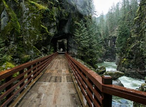
Hike the Kettle Valley Trail through the Othello Tunnels
3.03.4 mi / 300 ft gainThis 5.5km loop family-friendly hike is highly accessible and an easy jaunt into the beautiful Coquihalla Canyon Provincial Park. Just two hours from Vancouver, the loop hike will take you up and down through some lush forest towards the beautiful old railway tunnels which were built in the early...Read more -
Concrete, Washington
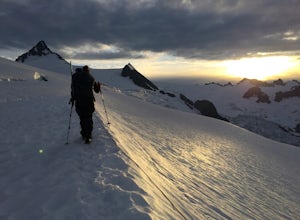
Mt. Shuksan via The Sulphide Glacier Route
13.62 mi / 6230 ft gainNOTE: This is a very challenging mountaineering adventure. Please do not attempt without the proper skill, knowledge, and equipment. The Sulphide Glacier is the easiest and most popular route to the summit of Mt. Shuksan, and is a great beginner’s glacier + rock climb. More experienced climbers...Read more -
Concrete, Washington
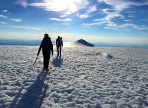
Climb Mt. Baker via the Easton Glacier Route
16 mi / 7600 ft gainThe Easton Glacier route is one of the mountain’s most popular and likewise, most crowded. Check out Mt. Baker’s Squak Glacier route or Coleman Deming Glacier route for an alternative climb with similar difficulty.You’ll start out at Schreibers Meadow Trailhead (3,200 ft.). To get there, exit off...Read more -
Concrete, Washington
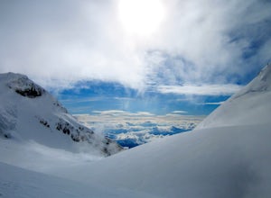
Climb Mt. Baker via Squak Glacier
10 mi / 7500 ft gainNOTE: THIS ROUTE REQUIRES GLACIER TRAVEL SKILLSMt Baker, or Kulshan, is a remarkable mountain in northwest Washington. Whether you're in Anacortes, Bellingham, Vancouver or on the San Juan Islands you can see Mt Baker standing as a citadel over the Northwest. Unlike the more popular routes like t...Read more

