Britannia Beach, British Columbia
Top Spots in and near Britannia Beach
-
North Vancouver, British Columbia
The trail begins in the furthest northwest corner of the parking lot, by a big trail map. The start of the trail is gradual and meanders through the forest. The trail then begins to become more technical and requires scrambling over rocks and up areas with roots. Although this hike has minimal ga...
Read more
-
North Vancouver, British Columbia
4.0
3.1 mi
/ 492.1 ft gain
From the Mt. Seymour ski area parking lot, head towards the Mystery Peak Express. Once you have passed the base of the Mystery Peak Express, you will continue up the trail to your left (right goes to dog mountain, straight to the 3 peaks of Seymour). Follow the trail all the way up to the lake. T...
Read more
-
North Vancouver, British Columbia
The elevation gain to first peak is approximately 451m and is about 9km.There are several ways to get to the top, each trail is marked well. One way is to follow the ski run up to brockton point and then take the turn off to Mount Seymour. Do not follow the Elsay Lake trail as it's signifciantly ...
Read more
-
North Vancouver, British Columbia
From the end of the parking lot next to the BC Parks sign board, walk towards the ski run and follow it uphill to a green sign on the left. The first trail goes to Dog Mountain, another scenic and shorter hike then Mount Seymour. Instead, follow the trail that heads uphill and parallel to the ski...
Read more
-
North Vancouver, British Columbia
4.5
5.5 mi
/ 1476 ft gain
This trip is best done in a 3-5 hour window. The trail meanders up past several peaks until you reach the summit and a panoramic view of Vancouver and the mountains.Start at the Mount Seymour Parking Lot, walk uphill and follow the trail to the left of the ski hill until you get to the the trail ...
Read more
-
North Vancouver, British Columbia
A perfect way to get outside before or after work. Dog mountain is an easily accessible snowshoe trail that takes you up to the short peak from the Mt. Seymour parking lot. This is a perfect spot for sunrise or sunset photography, and you can catch great 360 views from the top. Start at the BC Pa...
Read more
-
North Vancouver, British Columbia
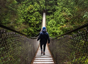
Lynn Canyon Suspension Bridge spans Lynn Canyon and is located near the popular Lynn Headwaters Park. To get there, exit the Trans Canada Highway onto Lynn Valley Road. Shortly after passing through the centre of the Lynn Valley community, turn right onto Peters Rd. This road will turn into "P...
Read more
-
Vancouver, British Columbia
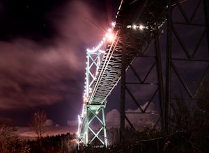
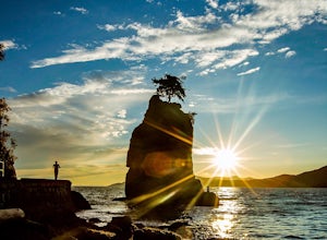
Park at the parking lot at Prospect point in Stanley Park to begin your photography adventure. The first photo opp is from the walkway on the Lions Gate, at about the middle of the bridge and looking to the left towards the Seawall. This is the perfect sunset spot.Once it gets dark, head to the b...
Read more
-
Whistler, British Columbia
5.0
5.3 mi
/ 1719.2 ft gain
This is a great hike with varied terrain. From a flat meandering path to steep, scramble sections with chains and braided ropes. The must-see attraction on this trail is the thunder force of tumbling water heard throughout the day as you hike along a steep walled canyon.You have the option of par...
Read more
-
North Vancouver, British Columbia
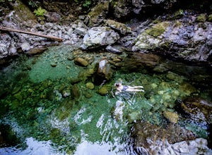
From the last field at inter city park, continue walking down the road to the Lynn Canyon trail. Follow the trail up the wooden boardwalks and to the first open area on the trail. When you can see the creek to your left, head down to the creek. To get to this particular swimming hole, you will ha...
Read more
-
Vancouver, British Columbia
Start at either end of Stanley Park, running directly along the pacific ocean on the seawall path. I prefer to run from Coal Harbour to south towards English Bay - a better view, and you can stop at sunset beach for a post-run drink!
Read more
-
North Vancouver, British Columbia
3.8
2.4 mi
/ 328.1 ft gain
Deep Cove is a cozy little town located at the base of Mt. Seymour, lying on the shores of the Indian Arm which is a branch of the Burrard Inlet in North Vancouver. In autumn, the tree-lined streets glow orange in the sunlight and the sailboats, kayakers and paddleboarders fill the harbour with ...
Read more
-
Whistler, British Columbia
5.0
19 mi
/ 5708.7 ft gain
This is a very challenging trail! If you are going to carry in a backpack for an overnight hike, you should have a good level of fitness. For a day hike, the trail is nearly 30km long, so still a good level of fitness is required. The trail isn’t technically challenging, but it is up in the alpin...
Read more
-
Whistler, British Columbia
5.0
18.6 mi
/ 5700 ft gain
The Black Tusk is a distinctive landmark just south of Whistler (the remnants of an old volcano). There is nothing else like it, and it is visible from all over the Sea to Sky area.Depending on your experience and fitness level, you can either: climb right to the top of the Tusk (expert hiking/sc...
Read more
-
Whistler, British Columbia
4.8
17.17 mi
/ 5289 ft gain
Take the Sea to Sky Highway (HWY 99) north from Vancouver up towards Whistler. Turn off the highway about 30 minutes before Whistler Village onto Daisy Lake Road. There are signs along the highway indicating the Garibaldi Lake turn off. The trailhead is located at the end of Daisy Lake Road. Ther...
Read more
-
Whistler, British Columbia
Garibaldi Lake is a huge basin of beautiful turquoise water measuring almost 10 square kilometers (2460 acres), and located at nearly 5000ft above sea level. The lake is over 800 feet deep, filled with pristine glacial water. You’ll be surrounded by big snowy mountains, which remain bright white ...
Read more

