Britannia Beach, British Columbia
Looking for the best photography in Britannia Beach? We've got you covered with the top trails, trips, hiking, backpacking, camping and more around Britannia Beach. The detailed guides, photos, and reviews are all submitted by the Outbound community.
Top Photography Spots in and near Britannia Beach
-
Whistler, British Columbia
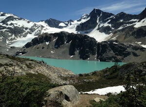
Hiking to Wedgemount Lake
5.08.7 mi / 1160 ft gainJust a little ways past Whistler BC Canada, you'll find a steep mountain trail leading to one of the true gems of Garibaldi Provincial Park and the Sea to Sky area: Wedgemount Lake. This is the stuff dreams are made of.The route ascends 7km through beautiful old growth forest, and as you crest th...Read more -
Whistler, British Columbia
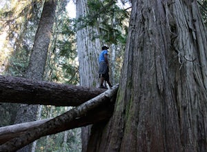
Visit the Ancient Cedars
The Sea to Sky area is covered in old growth forest, but few people would expect to find trees of this size in Whistler. The Ancient Cedars Trail is a beautiful hike through breezy sunny forest to a little hidden grove of giant trees, tucked into the side of Cougar Mountain.If you're looking for ...Read more -
Surrey, British Columbia
Hike the Elgin Heritage Park Nature Trail
4.02 miHead over to this magical little park by the water. The forested area between the 2 entrances to the park has many large trees often used by eagles and hawks to survey the surrounding area for prey. The habitat functions of the marsh significantly contribute to the ecological value of the lower N...Read more -
Surrey, British Columbia
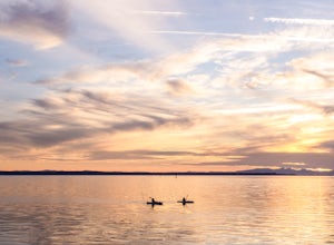
Catch a Sunset at Crescent Beach
5.0Crescent beach is a great place to end your day, by taking some sunset pictures. It often lights up the sky and really pops with colour. It is best to park at the main parking lot near the pier and start from there. The beach walk from the pier to the end is just over a kilometre, so is very shor...Read more -
Delta, British Columbia
Take a Sunset Ride on the Tsawwassen-Swartz Bay Ferry
4.0You can walk on or take your car on the ferry. Either way gets you to the same views. Make sure you sit on the right side of the boat (and it sometimes turns around once leaving the dock). Set up on the upper deck, and prepare yourself for an unbelievable show. Make sure you check out the onboard...Read more -
Nanaimo, British Columbia
Scramble Down to Nanaimo's Hidden Cove
Firstly, use google maps to take you to Stephenson Rd in Nanaimo. About a mile down, the road forks, follow the left road (It says no exit, but the road just ends at a property so you will need to turn around to get back out). Continue down the road another half mile or so and you will see a smal...Read more -
Surrey, British Columbia
Walk the 1001 Steps Trail
2.00.3 miOne of Surrey's hidden gems, head down to this short trail down a set of stairs that will take you to an uninhabited beach.The zig zagged steps take you down to the Birlington Rail Lines and you can walk along a trail to an opening under the tracks. Head to the beach from here where you will like...Read more -
Nanaimo, British Columbia
Catch a Sunset at Sugarloaf Mountain
You can easily put Sugarloaf Mountain Park into your GPS when in Nanaimo, but lets, just say you have an old school map. First make your way from the Island Highway onto Departure Bay Rd. Just before you get to Hammond Bay Rd turn onto Little John Way and take your first left, then take your firs...Read more -
Surrey, British Columbia
Stroll through Redwood Park in Surrey, BC
3.01.2 miRedwood Park is large beautiful forested park in South Surrey. The park is a legacy of one of Surrey's early pioneer's, David Brown, who in 1893 gave the property to his twin sons, David and Peter. The Brown twins spent much of their life traveling the world collecting the seeds and saplings of e...Read more -
Nanaimo, British Columbia
Hike to Ammonite Falls
4.82.69 mi / 558 ft gainThe falls cascades off of a sheet of rock that is filled with Ammonite fossils, thus the name Ammonite Falls! The trailhead is very distinct and has a parking lot close to the start of the trail. From the Nanaimo Parkway (#19) head onto Jingle Pot Road. Follow that for a few kilometres and turn ...Read more -
Pemberton, British Columbia
Hike to Nairn Falls
4.3From the turnoff of Highway 99, there is a parking lot specifically for Nairn Falls Provincial Park. There are maps all over the place, and they will direct you to the trailhead for a short hike to the waterfall. There is a blockaded section at the waterfall for viewing due to the danger that the...Read more

