Bowen Island, British Columbia
Top Spots in and near Bowen Island
-
West Vancouver, British Columbia
The directions to get to this location are a bit scattered as you need to weave through the upper streets of the British Properties.
Driving Instructions If you are coming along Highway #1, take the Taylor Way exit and turn right (coming from the east) or left (coming from the west) onto Taylor W...
Read more
-
Vancouver, British Columbia
Located on UBC Vancouver campus, Wreck Beach is the only nude beach in Canada. It is a popular destination for students and the public, and is home to the best sunsets seen in Vancouver.To get to the beach, there is a descent of approximately 500 stairs, so be cautious - going down means having t...
Read more
-
Vancouver, British Columbia
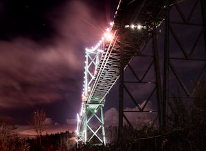
Park at the parking lot at Prospect point in Stanley Park to begin your photography adventure. The first photo opp is from the walkway on the Lions Gate, at about the middle of the bridge and looking to the left towards the Seawall. This is the perfect sunset spot.Once it gets dark, head to the b...
Read more
-
North Vancouver, British Columbia
Once you park in the parking lot near the dam, its fairly easy to tell where it is, and how to get there.
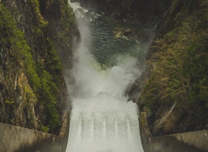
The awesome spillway looks like one of the worlds most dangerous slides, (don't slide down it), and Capilano Lake and the peaks of the Lions make for a great backdrop in North Vancouver.
Ph...
Read more
-
North Vancouver, British Columbia
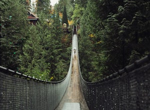
This is a great place to visit to get a feeling for the outdoors of Canada. The bridge is a little scary when a lot of people are walking across, but it is well worth the look.Measuring 140 m (460 ft) long, the bridge crosses over the Capilano River in the District of North Vancouver, British Col...
Read more
-
North Vancouver, British Columbia
5.0
6.1 mi
/ 1263.1 ft gain
You can take the gondola up Grouse Mountain and then hike from there which roughly takes around 5 hrs at a decent pace. The hike is a hard one that is a lot of up and down and a fair bit of climbing.You can start at the top of the Skyride on Grouse Mountain, follow the paved path to the grizzly b...
Read more
-
North Vancouver, British Columbia
A 25 minute drive outside of Vancouver, Grouse Mountain is a great escape from the city for a myriad of winter activities. If you can swallow the pricey ticket for the gondola ride and accompanying activities at the top, you’ll be welcomed by spectacular views with relatively little effort. Whet...
Read more
-
Vancouver, British Columbia
Start at either end of Stanley Park, running directly along the pacific ocean on the seawall path. I prefer to run from Coal Harbour to south towards English Bay - a better view, and you can stop at sunset beach for a post-run drink!
Read more
-
North Vancouver, British Columbia
Goat Mountain is a picturesque hike that starts from the top of the Grouse Mountain Ski Resort. On a sunny, clear day, the top of Goat Mountain can offer views of Vancouver and even as far away as Mount Baker, Vancouver Island, and some of the mountain ranges in Garibaldi Provincial Park near Squ...
Read more
-
Vancouver, British Columbia
This is a great place for families to relax at. You can kayak or paddle the calm water. There is a paved path running along the beach that is great for jogging, biking, and dog walking. Benches line the park and beach, making it easy to take breaks when needed. This is also where a lot of ferr...
Read more
-
Squamish-Lillooet D, British Columbia
3.0
7.5 mi
/ 3280.8 ft gain
Begin the Deeks Lake trail at the Lions Bay parking lot (same entrance as the Howe Sound Crest Trail) just off of Highway 99 North. The pullout is right before Porteau Cove Provincial Park.
Begin by walking past the yellow gate and taking an immediate right into the trail where you will begin y...
Read more
-
Squamish-Lillooet D, British Columbia
Porteau Cove Provincial Park is located 38 km outside of Vancouver just off the Sea-to-Sky highway between Lion’s Bay and Squamish. The park is open year-round for day visits and camping.
Porteau Cove Provincial Park is located in the most southerly fjord in North America. The park overlooks Ho...
Read more
-
North Vancouver, British Columbia
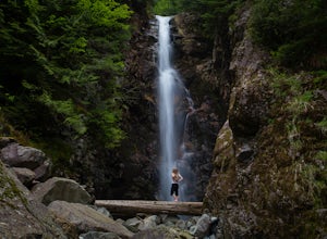
The trail starts in Lynn Headwaters Regional Park.
This is a fantastic day hike that give you just enough of a challenge but isn't too long. It's about 14km to the norvan waterfalls and back ( 7km each way) and it totally work the walk. There is very minimal gain on this hike.
The first bit of th...
Read more
-
North Vancouver, British Columbia
The Lynn Canyon Loop is a 5km trail that takes you up through the dense forest before looping back along the rushing water of the river.There are several trail systems throughout Lynn Headwaters Regional Park, that cater to every ability. Depending on what you're looking for, Lynn Canyon can prov...
Read more
-
North Vancouver, British Columbia
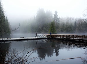
Walk down Rice Lake Road, cross the bridge, and follow the pathway towards the park ranger buildings. Past the buildings you will find a gravel path going into the trees, which will take you towards a fence beside the trail. Continue on the path towards the lake, while the trees and moss along th...
Read more
-
North Vancouver, British Columbia
Head over to the Lower Seymour Conservation Reserve and hop on your two-wheeler to enjoy this stunning 20k ride.
Your ride will begin at the trailhead, where hikers walk off to rice lake. Stay off to the right, where there is an obvious bike path (2 paved lanes). This trail will take you ~11kms ...
Read more

