Anmore, British Columbia
Looking for the best hiking in Anmore? We've got you covered with the top trails, trips, hiking, backpacking, camping and more around Anmore. The detailed guides, photos, and reviews are all submitted by the Outbound community.
Top Hiking Spots in and near Anmore
-
Ferndale, Washington
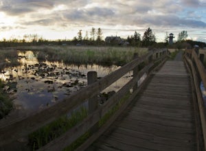
Take a Stroll through Hovander Homestead Park
5.01.4 mi / 0 ft gainDriving up to the park entrance: take a right to drive towards the barnyards, playgrounds, covered picnic areas, historic house and community gardens, and access to the Snoqualmie River. Or, drive straight and park outside of the fragrance gardens and historic house/ museum, and take a walk to a...Read more -
Squamish-Lillooet, British Columbia
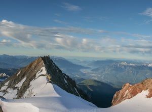
Climb Mt. Garibaldi
12.5 mi / 4350 ft gainDuration: 2 DaysClosed Gate (described below): 49.831834, -123.088424Camp Ground: 49.855926, -123.016797 Driving north from Vancouver along the Sea to Sky Highway (HWY 99) pass through Squamish. Turn right on to Cat Lake Road (Cheekye FSR).49°48’52.6”N 123°07’25.5”W From here the route becomes ...Read more -
Harrison Mills, British Columbia
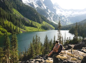
Hike to Statlu Lake
5.6 mi / 984.3 ft gainStatlu Lake is a hidden gem in the Harrison area. Start your journey at the Harrison West Forest Service Road. This road is pretty well maintained, and a piece of cake for any 4x4 vehicle but high clearance is always helpful, especially for the last bit of road up the hill to the trailhead. It wo...Read more -
Deming, Washington
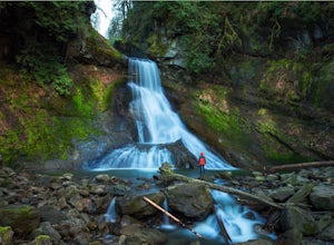
Hike to Racehorse Falls
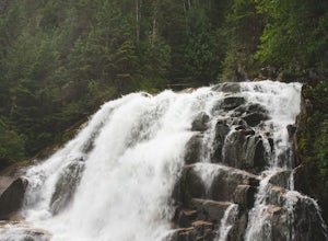
3.7Racehorse Creek is broken up into four distinct waterfalls that drop a total of 140ft through a relatively shallow gorge. The first two waterfalls are punchbowl-type falls that have deep holes at their bases. Immediately below the second waterfall, the creek descends rapidly before it arrives at...Read more -
Olga, Washington
Hike to the Mount Constitution Summit
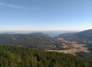
5.07 mi / 1500 ft gainThis 7 mile round-trip hike takes you to the mountain's summit. From here you'll be able to take in an amazing view. During the hike, you'll head around the left side of Mountain Lake, and then continue on to Twin Lakes, before starting your jaunt to the top of Mt. Constitution. The hike around ...Read more -
Moran State Park, Washington
Camp at Moran State Park
Moran State Park is an true gem within the beautiful San Juan Islands. The park takes up a large portion of the East side of Orcas Island, the largest of all the San Juans. There are multiple campgrounds within the park along the shores of Cascade Lake and Mountain Lake. For the most relaxing exp...Read more -
Whistler, British Columbia
Summit Black Tusk in Garabaldi Provincial Park
5.019 mi / 5708.7 ft gainThis is a very challenging trail! If you are going to carry in a backpack for an overnight hike, you should have a good level of fitness. For a day hike, the trail is nearly 30km long, so still a good level of fitness is required. The trail isn’t technically challenging, but it is up in the alpin...Read more -
Whistler, British Columbia
Hike to the Black Tusk Lookout Point
5.018.6 mi / 5700 ft gainThe Black Tusk is a distinctive landmark just south of Whistler (the remnants of an old volcano). There is nothing else like it, and it is visible from all over the Sea to Sky area.Depending on your experience and fitness level, you can either: climb right to the top of the Tusk (expert hiking/sc...Read more -
Whistler, British Columbia
Panorama Ridge
4.817.17 mi / 5289 ft gainTake the Sea to Sky Highway (HWY 99) north from Vancouver up towards Whistler. Turn off the highway about 30 minutes before Whistler Village onto Daisy Lake Road. There are signs along the highway indicating the Garibaldi Lake turn off. The trailhead is located at the end of Daisy Lake Road. Ther...Read more -
Whistler, British Columbia
Hike and Camp at Garibaldi Lake
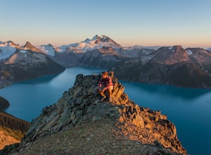
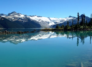
4.6Garibaldi Lake is a huge basin of beautiful turquoise water measuring almost 10 square kilometers (2460 acres), and located at nearly 5000ft above sea level. The lake is over 800 feet deep, filled with pristine glacial water. You’ll be surrounded by big snowy mountains, which remain bright white ...Read more -
Salt Spring Island, British Columbia
Hike Mount Maxwell
From Ganges head south on Fulford-ganes road toward Fulfrod harbour. Turn right on Dukes road then a right on Seymour Heights. Seymour Heights turns into a dirt road, with a number of pot holes but nothing a non 4x4 car can't handle. At the trail head there is a small turn around and not a ton of...Read more -
Squamish-Lillooet D, British Columbia
Hike to Crooked Falls
4.04 mi / 1400 ft gainThe trail to Crooked Falls starts at the Sigurd Creek Trail. The coordinates are: N49.910556, W-123.322817. It is a scenic dive just past the Squamish city center and the Squamish River. Once at the trail head you'll walk across a bridge over Sigurd Creek and follow the logging road for a couple...Read more -
Salt Spring Island, British Columbia
Hike Up Reginald Hill
1.2 mi / 771 ft gainFrom the Fulford ferry terminal, turn left onto Morningside Drive and follow the road to the end, where you’ll find a small area to park your car. From here, head up towards the subdivision and keep an eye out for the trail marker on your left, located 100m past the gate into Reginald Hills Estat...Read more -
Bellingham, Washington
Hike to Pine & Cedar Lakes
5.05 mi / 1400 ft gainThese two quaint lakes in the Chuckanuts are a must-do for people looking for a day hike, short camping trip or steep trail run in the Bellingham area. Starting at the trailhead off of Old Samish Road, one begins the 2 mile ascent to the two lakes. The first 1,400ft climb has its fair share of up...Read more -
Friday Harbor, Washington
Hike to Lovers Leap on Stuart Island
5 mi / 200 ft gainThis hike is only doable if you are already on Stuart Island! There is no public transportation to Stuart Island, so you must already be there or have a plan to be there in order to complete this hike.I frequent this island during the summer months and it is one of my favorites. I always stay in ...Read more -
Whistler, British Columbia
Hike to High Falls Creek, BC
5.05.3 mi / 1719.2 ft gainThis is a great hike with varied terrain. From a flat meandering path to steep, scramble sections with chains and braided ropes. The must-see attraction on this trail is the thunder force of tumbling water heard throughout the day as you hike along a steep walled canyon.You have the option of par...Read more

