Alberni-Clayoquot A, British Columbia
Top Spots in and near Alberni-Clayoquot A
-
Alberni-Clayoquot A, British Columbia
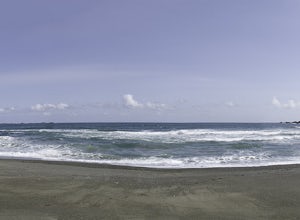
Far on the west coast of Vancouver Island, accessed only by a harrowing dirt road, is a wild and rugged coast begging to be explored. Bamfield is about a 3 hour drive from Nanaimo, half of which is on the gnarliest (and most active) logging road I've ever been on - and I grew up driving on loggin...
Read more
-
Alberni-Clayoquot A, British Columbia
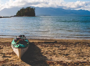
The Broken Group Islands are an internationally acclaimed sea kayaking destination. They can only be done properly on a multi-day trip and it’s not recommended for novice paddlers. The stunning archipelago located on the west coast of Vancouver Island features hundreds of islands, lagoons, caves,...
Read more
-
Bamfield, British Columbia
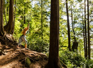
On the island of West Bamfield, accessible only by foot and by taking a ferry from East Bamfield, itself only accessible via a 60 mile brutal dirt road from Port Alberni, is a taste of the free-wheeling, regulations-be-damned old-Vancouver-Island-made-manifest in an epic rope swing that hurls its...
Read more
-
Ucluelet, British Columbia
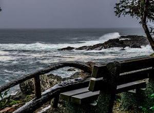
Drive south west on Coast Guard drive to the parking lot for the wild coast trail to your left (where the pin is). Park in the parking lot, and head to the trailhead where the big sign board is. We completed the lower loop in approximately one hour, but you can continue up the coast all the way i...
Read more
-
Cowichan Valley F, British Columbia
Nitinat Lake is located about 70 km from Lake Cowichan on Vancouver Island. It's about a 2 h drive from Lake Cowichan with 1 h on logging roads. When you get close to Lake Cowichan, the highway splits into two possible routes, one on the south side of the lake, the second on the north side. Since...
Read more
-
Alberni-Clayoquot C, British Columbia
4.0
2.5 mi
/ 1640.4 ft gain
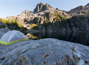
Lower Lake is a gorgeous alpine lake located on the Triple Peak Trail. The route to the lake is very steep and scrambling is involved, but is well worth the effort. When you come to the rise above the final ridge, the stunning Triple Peak and Lower Lake come into view.The hike starts down a very ...
Read more
-
Ucluelet, British Columbia
The Willowbrae trailhead is not marked along the Tofino Ucluelet highway and the turnoff is easy to miss. Driving from Tofino look for Willowbrae Road on the right hand side, 2 kilometers past the Port Alberni junction. From Ucluelet this road is on the left, 5 kilometers from town. Drive up...
Read more
-
Alberni-Clayoquot C, British Columbia
The mountains of the South Central Range of Vancouver Island that skirt Highway 4 leading to Tofino are often overlooked as in that region surfing is the big draw, while the larger peaks of Strathcona Peak call to others. I feel this spot is a true gem of the island, with unparalleled biodiversit...
Read more
-
Honeymoon Bay, British Columbia
The opportunity to travel deep into a region where ancient forests still stand, telling their story of centuries past, can't be overlooked. One of the last remaining areas of such beauty and rarity still exists deep in the heart of the southern interior on Vancouver Island. This spot is known as ...
Read more
-
Ucluelet, British Columbia
The staggering coastal and rain forest beauty of the Pacific Rim National Park Reserve ensures Vancouver Island’s place as one of BC's most deeply rewarding hiking destinations. The Nuu-chah-nulth Trail is just one of many trails that will leave you with a billowing sense of wonder.Starting at th...
Read more
-
Ucluelet, British Columbia
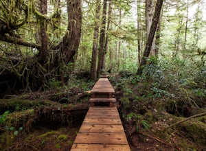
For an amazing jungle experience in Clayoquot Sound, the fantastic Rainforest Trails is the place to go. Located in the Pacific Rim National Park, the forest is deep, wet and massive. The wonderful aroma of nature fills your lungs as an incredibly elaborate boardwalk leads you along massive nurs...
Read more
-
Alberni-Clayoquot D, British Columbia
4.0
5.6 mi
/ 3149.6 ft gain
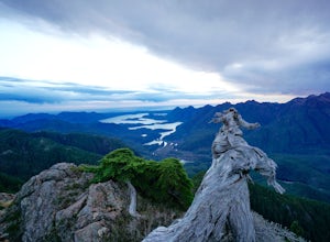
Access to Triple Peak mountain is found via the Marion Creek Main logging road approximately 48km west of Port Alberni on your left hand side along highway #4 headed towards Tofino. The road can present seasonal challenges and is rough so best to have a high clearance and 4x4 capable vehicle if p...
Read more
-
Alberni-Clayoquot F, British Columbia
I have lived on Vancouver Island my entire life yet I had never heard about this world class trail until last summer. A 24km point to point coastal trail that travels the length of the Alberni Inlet from the coast right to the town? Through paradise meadows, along sun drenched bluffs, past water...
Read more
-
Youbou, British Columbia
Heather Mountain is a moderate well marked out and back hike through managed forest land.
The hike brings a wonderful feeling of solitude as there are no towns or buildings visible even with distant views in all directions. It is also quite lightly tracked: we saw no other hikers on the entire r...
Read more
-
Alberni-Clayoquot C, British Columbia
Park at the well marked parking lot off of the Pacific Rim Highway (4) about 16 kilometres south of Tofino. Start off on a relatively easy two kilometre trail. The scenic hike wanders through lush rainforest before arriving at a spectacular beachfront area. You will pass giant cedars, a number ...
Read more
-
Port Renfrew, British Columbia
To get to the Avatar Grove, drive to Port Renfrew along West Coast highway 14. Turn right onto Deering Rd and cross the long bridge over the San Juan River. Stay right at the next Y intersection, and then left at the T intersection. At the next Y keep left and cross a tall bridge over the crys...
Read more

