Mount Norquay, Alberta
Looking for the best hiking in Mount Norquay? We've got you covered with the top trails, trips, hiking, backpacking, camping and more around Mount Norquay. The detailed guides, photos, and reviews are all submitted by the Outbound community.
Top Hiking Spots in and near Mount Norquay
-
Bighorn No. 8, Alberta
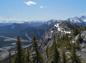
Summit Door Jamb Mountain and Loder Peak
4.0If you're looking for views, vistas, and great scrambles in the Rockies, this is a great place to start. For any geology enthusiast, furthermore, this hike cannot be missed, offering great opportunities to search for some seriously ancient fossils.The trail begins on the west side of the parking ...Read more -
Bighorn No. 8, Alberta
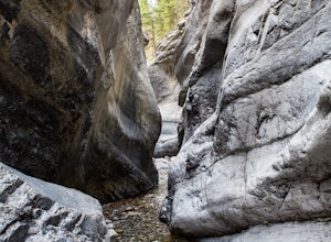
Hiking Jura Creek
5.0From the parking lot find the trail head that leads away from the highway. This is an easy, but very interesting hike that will take you through a winding slot canyon.Take your time and explore all the various options, there are small waterfalls, and if you're feeling really adventurous you can c...Read more -
Bighorn No. 8, Alberta
Hike Mt. Yamnuska
4.35.4 mi / 855 ft gainThis Alberta classic start just a few minutes off the Trans Canada. The trail begins gently through forests of Aspen. In spring and fall these are particularly lovely. Steadily the trail heads upwards bringing you to a three-way junction. Head right, and follow the trail Eastwards, as it zigs int...Read more -
Bighorn No. 8, Alberta
Grillmair Chimneys Climb - Mount Yamnuska
First route put up on Yamnuska by Hans Gmoser, Leo GrillmairSome say this was the start of modern climbing in Canada5.6 Trad Route- 8 PitchesThis climb is very unique once you get to the last pitch- squeezing your way into a cave, once at the cave you climb through a small hole which brings you o...Read more -
Improvement District No. 9, Alberta
Climb the Grand Sentinel
8.6 mi / 3612.2 ft gainThe Grand Sentinel has two routs on it. While it is hard to access it is a modern classic with bolted anchors, and Cardia Arete is a Sport climbing route. While I could offer my take on this classic, Chris Perry' Banff Rock is a far better resource than I. To access the climb park at Moraine Lak...Read more -
Improvement District No. 9, Alberta
Eiffel Lake via Valley of Ten Peaks
5.07.35 mi / 1647 ft gainHike with amazing views of Valley of Ten Peaks, including Mount Fay (10,613 ft), Mount Little (10,131 ft), Deltaform Mountain (11,234 ft), and Wenkchemna Peak (10,401 ft) to two breathtaking glacial lakes in the heart of the Continental Divide. From the lake, the trail is quite easy to follow, a...Read more -
Improvement District No. 9, Alberta
Hike to Consolation Lakes
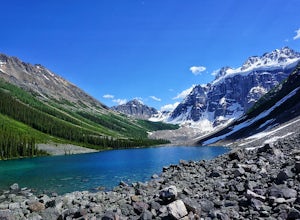
4.03.7 mi / 196.9 ft gainOnce at Moraine Lake, the directions to Consolation Lakes are quite clear. From the parking lot, head northeast past the rockpile, which provides fantastic views of Moraine, then follow the Consolation Lakes Trail for another 2.9 km (1.8 miles) past Taylor Lake until you reach the lake. Depending...Read more -
Improvement District No. 9, Alberta
Larch Valley Trail to Minnestimma Lakes
5.05.61 mi / 1909 ft gainStarting at the Moraine Lake parking lot take, take the main trail the leads down past the cafe and lodges on the lake shore. A short way down the trail splits, to the left is just the lakeside walk. For Larch Valley take a right, it is clearly signed. Depending on the time of the year there are ...Read more -
Improvement District No. 9, Alberta
Eiffel Peak
5.07.14 mi / 3917 ft gainTake in stunning alpine views of the famous Valley of the Ten Peaks as you head to Eiffel Peak. A much more unique photo opportunity of Moraine Lake. Views of several prominent glaciers and the gorgeous Paradise Valley. The Eiffel Tower rock formation viewable from the summit. 11km roundtrip. 130...Read more -
Improvement District No. 9, Alberta
Scramble Mount Temple
4.512.4 mi / 6430.4 ft gainMount Temple is a stunning iconic mountain in Banff National Park located in the Canadian Rockies. It overlooks the Lake Louise area and stands at a massive 3542m (11,624ft) , making it one of the many sought after 11,000ers.To reach the mountain you will be headed down highway #1 and take the tu...Read more -
Improvement District No. 9, Alberta
Scramble the Tower of Babel
4.01.94 mi / 1726 ft gainStarting at the Moraine Lake parking lot follow the trail East along behind the large pile of boulders along the lake shore. Once you reach the foot of the Tower of Babel scramble up the slope to heading towards the valley between the two peaks. The easiest route is along one of the cliff faces w...Read more -
Improvement District No. 9, Alberta
Sentinel Pass: Larch Valley to Paradise Valley
5.010.45 mi / 2618 ft gainThis popular hike starts out by the one the most iconic lakes in Banff National Park, Moraine Lake. Though the trail from Larch Valley attracts herds of tourists, this is a majestic hike you don’t want to miss. Before your hike, contact the park office at Moraine Lake about possible hiking restr...Read more -
Improvement District No. 9, Alberta
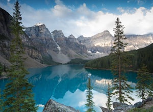
Moraine Lake
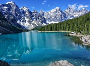
4.8Showing up at Moraine Lake before dawn is a must as to avoid the multitude of tours busses. The morning sun is subtle and magical. The lake, being glacially fed, does not reach its crest until mid to late June. When it is full, it reflects a distinct shade of blue. The color is due to the refract...Read more -
Kananaskis, Alberta
Hiking to Karst Spring in Kananaskis Country
4.5Every year, over 5 million visitors make their way through Banff National Park to soak in the surrounding peaks, bountiful wildlife, and turquoise-colored lakes. With this many visitors, it's hard to find yourself alone, especially during the peak seasons of summer and fall. Right next door to Ba...Read more -
Kananaskis, Alberta
Bryant Creek Lodge via Watridge Lake Trail
16.65 mi / 1401 ft gainThis moderate-graded backcountry hike or ski in the winter can take 5-8 hours (one way). Most people hike or ski in from the Mt. Shark parking lot in Kananaskis Country, a 30 min. drive from Canmore, Alberta. From Mt. Shark Parking Lot (off the Smith-Dorrien Road), take the Watridge Lake Trail t...Read more -
Kananaskis, Alberta
Hike the Prairie View - Jewel Pass Loop
5.09.3 mi / 2050.5 ft gainPark at the Barrier Lake day use area on Hwy. 40. Make your way across the dam heading west. Follow the main trail slightly north west into the trees and begin your ascent. Mostly long switchbacks with some sections getting a bit steeper near the top. As soon as you break through the trees, you'l...Read more

