Canmore, Alberta
Top Spots in and near Canmore
-
Kananaskis, Alberta
Rawson Lake & Sarrail Ridge
4.06.8 mi / 2427.8 ft gainTake Hwy. 40 to Kananaskis Lakes Trail. Continue on this road until you reach a turn off for Upper Kananaskis Lake Day Use Area. This is your trail head. Follow the trail along west side of the lake. After about 1 km you will reach Sarrail Falls. Shortly after crossing the bridge, take the trail ...Read more -
East Kootenay G, British Columbia
Hiking in Marble Canyon
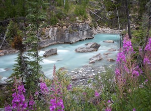
1.2 miMarble Canyon is easily accessible off of the 93S in Kootenay National Park between Banff and Radium.This is a really beautiful area and a nice easy walk for the family with some beautiful scenery to go along with it. Make a visit here in August when the the Fireweed is at its prime, lining the f...Read more -
Kananaskis, Alberta
Rawson Lake
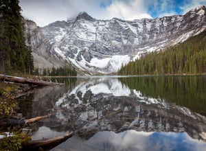
4.55 miGetting There From Highway 1, Take Highway 40 South to Kananaskis Lakes Trail, and turn left at Upper Kananaskis Lakes Drive. The Trail The trail to Rawson Lake starts at the end of the "Day Use Area" at Upper Kananaskis Lake. The lake gently laps the shoreline to the right and moss carpets the...Read more -
Kananaskis, Alberta
Hike the Aster Lake Trail in Kananaskis Provincial Park
7.5 mi / 1969 ft gainA long day hike or perfect backpack trip, this alpine lake surrounded by high peaks, starts out relatively easy from the upper Kananaskis Lake parking lot, at the far end of the south side of the lake, with a short tour around the east side of Hidden Lake, you start, what at some points will seem...Read more -
East Kootenay G, British Columbia
Backpack the Rockwall Trail
68 mi / 8530 ft gainThe Rockwall trail is a famous 3-5 day trek in Kootenay National Park. We started from the North and camped at Helmet Falls our first night, and then continued south and exited out Floe Lake. I would recommend this direction for a backpack, and the opposite direction for a trail run (it's about ...Read more -
Kananaskis, Alberta
Hike to Grizzly Ridge near Highwood Pass
4.2 mi / 1840.6 ft gainThe hike starts at 2206 meters elevation Highwood Pass, and takes you through beautiful Pocaterra Cirque up to the peak of Grizzly ridge at 2767 meters, an impressive altitude to attain with only a 561 meter climb.Park at the parking lot at Highwood Pass, and follow the interpretive trail to a s...Read more -
Kananaskis, Alberta
Hike Ptarmigan Cirque
4.03.1 mi / 754.6 ft gainPtarmigan Cirque is a great beginner hike in Highwood Pass. Take Hwy. 40 approximately 50 km's from Hwy. 1. You will find the trail head at the Highwood Pass Day Use Area. This interpretive trail heads north along the road for about 100 meters and then crosses the highway. The trail is easy to na...Read more -
Kananaskis, Alberta
Scramble Mount Rae
4.0Mount Rae has given me the slip a couple times before, so I opted to take it on solo in the hopes of getting a successful attempt in. Damn, this is a good one.Park at the Highwood Pass parking lot, and start off on the Ptarmigan Cirque Trail. Forested until you get to the cirque, check beforehand...Read more -
Kananaskis, Alberta
Hike Pocaterra Ridge
4.09 mi / 650 ft gainDuring the fall I find the biggest treat is the changing of the larch trees and the beautiful contrast they provide against the landscape with their intense golden yellow colors. One of the best places to experience this is Pocaterra Ridge, located in the Highwood Pass of the Kananaskis region in...Read more -
Kananaskis, Alberta
Explore the Pocaterra Cirque
Start at the Pocaterra/Highwood pass parking lot. The pond is about 1.5km directly west from the parking lot, but the trail head is not always obvious, especially if there is snow. Keep an eye out for the flagging tape that marks the trail. Consider bringing snowshoes in November.This makes for ...Read more -
Kananaskis, Alberta
Snowshoe Mount Tyrwhitt
1.05.6 mi / 2132.5 ft gainDescribing snowshoeing trails is always a bit difficult, but luckily the way up Mount Tyrwhitt gets used heavily by people going to Pocaterra Cirque - first thing to remember is to take the first fork off the main trail to the left after you cross the bridge.Even if the trail is snow covered and ...Read more -
Kananaskis, Alberta
Hike to Little Arethusa
2.8 mi / 2034.1 ft gainUnfortunately, pictures of larches in autumn never actually do them justice. It's worth it to go out and experience them for yourself. This hike is pretty scenic for the short distance it is, but my favourite part is that you get to be up close and personal with the larches as the forest is bathe...Read more -
Improvement District No. 9, Alberta
Climb the Grand Sentinel
8.6 mi / 3612.2 ft gainThe Grand Sentinel has two routs on it. While it is hard to access it is a modern classic with bolted anchors, and Cardia Arete is a Sport climbing route. While I could offer my take on this classic, Chris Perry' Banff Rock is a far better resource than I. To access the climb park at Moraine Lak...Read more -
Improvement District No. 9, Alberta
Eiffel Lake via Valley of Ten Peaks
5.07.35 mi / 1647 ft gainHike with amazing views of Valley of Ten Peaks, including Mount Fay (10,613 ft), Mount Little (10,131 ft), Deltaform Mountain (11,234 ft), and Wenkchemna Peak (10,401 ft) to two breathtaking glacial lakes in the heart of the Continental Divide. From the lake, the trail is quite easy to follow, a...Read more -
Improvement District No. 9, Alberta
Hike to Consolation Lakes
4.03.7 mi / 196.9 ft gainOnce at Moraine Lake, the directions to Consolation Lakes are quite clear. From the parking lot, head northeast past the rockpile, which provides fantastic views of Moraine, then follow the Consolation Lakes Trail for another 2.9 km (1.8 miles) past Taylor Lake until you reach the lake. Depending...Read more -
Improvement District No. 9, Alberta
Larch Valley Trail to Minnestimma Lakes
5.05.61 mi / 1909 ft gainStarting at the Moraine Lake parking lot take, take the main trail the leads down past the cafe and lodges on the lake shore. A short way down the trail splits, to the left is just the lakeside walk. For Larch Valley take a right, it is clearly signed. Depending on the time of the year there are ...Read more

