Canmore, Alberta
Top Spots in and near Canmore
-
Improvement District No. 9, Alberta
Snowshoe to Silverton Falls and Rockbound Lake
10.4 mi / 2493.4 ft gainPark at Rockbound Lake Trailhead, 0.2 km east of Castle Junction on Bow Valley Parkway (Highway 1A).The trail wanders through forest until coming to a fork to the right, leading to SilvertonFalls. This is a worthwhile 1 km side trip to a beautiful small waterfall dropping into a turquoise blue po...Read more -
Kananaskis, Alberta
Snowshoe up Gypsum Ridge
3.7 mi / 1378 ft gainIf you have a topographic map of Kananaskis Lakes, the trailhead is just to the east of Blackshale Creek. If you don't have a topographic map of the area, the Google Maps pin on this adventure will help you get there --- you'll see a pretty large opening on the south side of the road. Luckily, th...Read more -
Bragg Creek, Alberta
Rock Climb at White Buddha
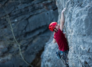
4.01.9 mi / 492.1 ft gainTo reach White Buddha, park at the Powerface Creek parking lot. Between December and May, Route 66 is closed at Elbow Falls, so you may need to park at the gate and walk in, about 0.3 miles (500 m). The trailhead is well marked from the parking lot.The first section of the trail is mellow, though...Read more -
Bragg Creek, Alberta
Hike White Buddha via Powderface Trail
3.02.5 mi / 1148.3 ft gainFollow Hwy. 66 until you come upon the Powderface Staging Area. This is the trailhead. If you are coming between December & May, park at the Elbow Falls Day use area and walk along the road approximately 100 meters. This trail is easy to find and is quite wide. Follow the Powderface Creek Tra...Read more -
Bragg Creek, Alberta
Winter Hike Up Vent's Ridge
Whether it was the unseasonably warm weather; the forested, uneven, foot-wide, root-covered trail; limestone cliffs towering above me; the view of Myosotis Peak from the ridge; or exploring along Powderface Creek on the descent, this trail was an absolute blast.If you do this hike in February lik...Read more -
Bragg Creek, Alberta
Prairie Mountain and Elbow Falls
4.422 km west of Bragg Creek, turn off Highway 66 at the Elbow Falls Parking Lot. Park on the North side of the road on the shoulder at the winter closure gates. The trail is well-defined and heads straight up (North) from the highway.The trail begins with some steep switchbacks, but then levels out...Read more -
Bragg Creek, Alberta
Hike Iyarhe Ipan
3.02.5 mi / 1476.4 ft gainIyarhe Ipan means "mountain point" in Stoney, and while it's far from the highest peak you'll ever climb, it certainly is worth it. Iyarhe Ipan was the fix for the scrambling itch I've had all winter.Before Highway 66 opens in the summer, you'll have to park your car at Elbow Falls parking lot an...Read more -
Bragg Creek, Alberta
Cross-Country Ski and Scramble to Oldforgetmenot for Sunrise
9.9 mi / 2395 ft gainI think it's because I tend to watch football on Sundays that I've started doing more sunrise hikes --- can't say I regret it either! Oldforgetmenot is a perfect objective to take in a sunrise on: elevation gain isn't too intense, distance isn't too trying, and there are quite a few stretches tha...Read more -
Bragg Creek, Alberta
Scramble Mount Glasgow
3.014.3 mi / 4265.1 ft gainAs with most hikes in the Bragg Creek/Little Elbow area, the trail begins at the Little Elbow campground. To make the hike a tiny bit shorter, most people bike for the first 4 km on the Big Elbow trail to South Glasgow Creek. If you're not using a GPS trail, you'll know you're at the creek once y...Read more -
Bragg Creek, Alberta
Hike Nihahi Ridge
4.58.1 mi / 2624.7 ft gainThis year on the summer solstice, I was invited to go up Nihahi Ridge to celebrate. It's in one of my personal most underrated areas of the Rockies just west of Bragg Creek, and it's a popular objective, but less so during the evening. The trail begins once you park your car at the Little Elbow p...Read more -
Bragg Creek, Alberta
Hike to Bragg Creek Ice Cave
4.04.3 mi / 5879.3 ft gainAlso known as Moose Mountain Ice Cave, Canyon Creek Ice Cave and Ing Mine.The cave is located on the west side of Moose Ridge andhas a huge entrance, it is approximately1,600 ft. in depth. Take Highway 22 past Bragg Creek, continue on the 66 towards Moose Mountain. Turn off at Canyon Creek Road...Read more -
East Kootenay G, British Columbia
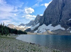
Hike The Floe Lake Trail
13 mi / 2350 ft gainKootenay National Park is one of the lesser visited parks in a chain of spectacular parks in the Canadian Rockies between Banff and Jasper. Straddling the Trans-Canadian Highway, the park offers hot springs, awesome mountain views, and glaciers. As you enter the park, keep an eye out for the griz...Read more -
Improvement District No. 9, Alberta
Hike to Boom Lake
4.06.2 miBoom Lake offers amazing views of Boom Mountain and the ridge separating Alberta and British Columbia. It is not as popular as many other hikes in the area, which means exclusion for anyone willing to explore the lake. The abundant wildlife in the area includes wolves, bears, mountain goats, de...Read more -
Eldon, Alberta
View the Castle Mountain Lookout
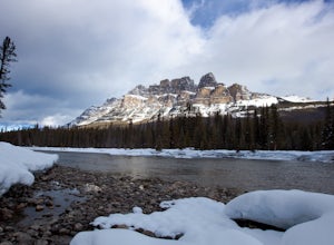
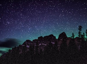
Castle mountain, so named for its fortress-like shape, is a quick hop away from the town of Banff. If you don't have time to hike to Rockbound Lake (at the base of Castle), head to the viewpoint just off of Highway 91 and snap some pictures of this epic mountain. Drive north for about 10 minutes...Read more -
Kananaskis, Alberta
Hike Mount Indefatigable
4.5If you choose to do this hike, you'll find yourself at Kananaskis Lakes, one of my favourite spots in K-Country! Park your car at the Interlakes parking lot, have that one last bathroom break, and make your way north to get to the trailhead. The trailhead is impossible to miss as it's blocked off...Read more -
Kananaskis, Alberta
Backpack the Northover Ridge Loop
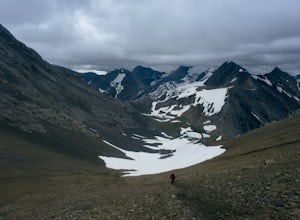
5.025 mi / 4000 ft gainWhile most people opt to hike this route as a 2 or 3 day trip, camping at Aster and Three Isle Lakes, this description is for a 1 day loop. This is NOT an easy hike to do in 1 day, however, and the ridge is no pushover for any length trip. Exercise caution and don't be afraid to backtrack if weat...Read more

