Obernberg am Brenner, Austria
Looking for the best hiking in Obernberg am Brenner? We've got you covered with the top trails, trips, hiking, backpacking, camping and more around Obernberg am Brenner. The detailed guides, photos, and reviews are all submitted by the Outbound community.
Top Hiking Spots in and near Obernberg am Brenner
-
Obernberg am Brenner, Austria
Hike to the Lichtersee Lake
8.6 mi / 2198.2 ft gainPark at the large car park (paid parking) for the main Obernberg lake, but instead of following the trail to the lake, take the road on the right towards Haus Waldbauer. At the end of the paved road, a gravel road bends off to the right. Follow this gravel road as it leads you uphill and back al...Read more -
Gschnitz, Austria
Hike to the Lapones Alm
1.1 mi / 508.5 ft gainThe Laponesalm hike is an easy family-friendly hike in the stunning Gschnitz valley in Tirol, Austria. Park the car at the paid parking at the end of the valley, and follow the asphalt road which is signposted towards the Lapones Alm. After about 15-20 minutes of walking, you'll come to a bridg...Read more -
Gschnitz, Austria
Hike to the Italian Border
9.9 mi / 4327.4 ft gainThe Gschnitz valley is one of my favourite places to hike in Tirol. Not only does it have some absolutely stunning scenery, but I've never experienced crowded trails whenever I've been there. This hike is an extension of another hike I've shared on here, to the Tribulaunhütte. Whilst we did take ...Read more -
Gschnitz, Austria
Hike to the Tribulaunhütte in Gschnitztal
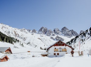
7.5 mi / 2575.5 ft gainThe Tribulaun Hütte mountain hut in the Gschnitztal is one of the easiest mountain huts to reach in the area. Leave your car (or take the Post Bus) to the end of the Gschnitztal valley. Just past the car park, the trail up to the Tribulaun hut begins. The trail starts as a wide gravel road that s...Read more -
Neustift im Stubaital, Austria
Hike & Overnight Stay at the Innsbrucker Hütte
13.7 mi / 4511.2 ft gainBecause the Innsbrucker Hütte sits on a ridge between two valleys, it can be reached from two sides; from the Gschnitz Valley or from the Stubai Valley. We chose to take the slightly longer (but less steep) route from the Stubai side. We parked the car in the village of Neder at the gravel parkin...Read more -
Fulpmes, Austria
Hike To The Schlicker See In The Stubai Valley
9.9 mi / 2821.5 ft gainIn this circular hike starts at the Kreuzjoch top station of the Schlick 2000 gondola and finishes back at the bottom station, meaning that the elevation gain you're hiking is about half of the amount that you'll descend if you follow this particular route. As you exit the lift station, you'll ta...Read more -
Neustift im Stubaital, Austria
Stubai High Trail Section 4 - Hike from the Sulzenau Hut to the Dresdener Hut
2.5 mi / 1640.4 ft gainWe spent the night before this hike at the Sulzenau hut, and woke up early to watch the sunrise over the glacier, which I highly recommend. From the Sulzenau hut, follow the trail as it rises gradually up the valley floor towards the Sulzenau Ferner Glacier. On the route you'll follow a gushing s...Read more -
Neustift im Stubaital, Austria
Hike to the Suzlenau Hut in the Stubai Valley
9.3 mi / 2168.6 ft gainThe Sulzenau Hut is a popular destination for hikers in the Stubai Valley in Tirol. There are a few different routes to approach the hut, but for this adventure, we took the route that follows the WildWater Trail (WilderWasser Weg). We started this route from the Grawa Alm at the foot of the Graw...Read more -
Neustift im Stubaital, Austria
Hike to the Franz Senn Hut
2.2 mi / 1322.2 ft gainThe hike from the Oberiss Alm mountain pastures to the Franz Senn Hut in the Stubai Valley in Tirol is a wonderful hike for the whole family. The hike starts from the Oberissalm, a remote farmhouse surrounded by alpine meadows. Here you'll find a paid parking area and working farmhouse serving f...Read more -
Neustift im Stubaital, Austria
Hike to the Mutterberger See Lake in Stubai
5.3 mi / 2624.7 ft gainThe hike starts from the bottom of the Gamsgarten cable car lift station at the Stubai Glacier, so it's best to park in the highest car park. (Most cars park at the lower Eisgrat cable car so the upper car park should be fairly quiet). If you're arriving by bus, this is the very last bus stop on ...Read more -
Schwaz, Austria
Hike to Olpererhütte in the Austrian Alps
4.04 mi / 1969 ft gainAustria’s Zillertal Valley is a spectacular region of the Alps offering a plethora of hiking options. Locals as well as tourism hosts overwhelmingly recommended Olpererhütte! From Mayrhofen, a public transit bus delivers hikers directly to the trailhead. Mayrhofen is a great village to use as hom...Read more -
Mutterbergalm, Austria
Hike to the Hildersheimer Hut on the Stubai Glacier
2.1 mi / 721.8 ft gainThis short hike is a great mini tour when you want to get up high without a whole lot of effort but enjoy some stunning glacier views. The hike to the Hildersheimer Hut is a high altitude tour on the Stubai glacier, that if done during the summer months from the top station of the Schaufeljochbah...Read more -
Axamer Lizum, Austria
Hike up Hoadl at Axamer Lizum
5 mi / 2739.5 ft gainIf you are looking for somewhere to watch one of the best sunsets in Tirol, then Axamer Lizum might just be that place. Whilst this area is perhaps better known as being a ski resort in winter, it has some of the most picturesque hiking close to the city of Innsbruck, being at the foot of the Kal...Read more -
Innsbruck, Austria
Hike to the Summit of the Patschekofel in Innsbruck
4.5 mi / 951.4 ft gainTake the Patscherkofelbahn cable car up to the top station to start this hike. From the top station of the lift you'll see a trail sign for the "Zirbenweg". For the first part of this hike you're going to follow this almost completely flat trail that hugs the side of the mountain. Stay on this t...Read more -
Grinzens, Austria
Hike to Salfeins
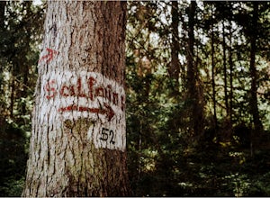
5.04.4 mi / 3211.9 ft gainThe trail begins next to the Sportplatz in the village of Grinzens, just outside of Innsbruck. The trail begins as a gravel road, but within a few meters it splits. You can either take route 51 which follows the gravel road or route 52 which cuts through the forest. We chose to follow route 52 on...Read more -
8 Florengasse, Austria
Hike To The Kemater Alm
7 mi / 2040.7 ft gainTake the bus from Innsbruck to Grinzens or if you have a car, park in the village of Grinzens at the Sportplatz. From here already you can see signs to the Kemater Alm. The route is really simple. Just follow the dirt road straight through the forest and deeper in to the valley. For the first ha...Read more

