Australia
Looking for the best hiking in Australia? We've got you covered with the top trails, trips, hiking, backpacking, camping and more around Australia. The detailed guides, photos, and reviews are all submitted by the Outbound community.
Top Hiking Spots in and near Australia
-
Taggerty, Victoria
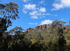
Hike the Cathedral Peak Loop
4.35.3 mi / 1837.3 ft gainFrom Ned's Gully carpark, cross the road where you see a small suspension bridge to the campground, taking a left towards the trail once you're on the other side. Follow the trail until you reach a junction and follow the Cathedral Track (rather than the Little River Walk). The trail will quickly...Read more -
Forrestfield, Western Australia
Hike to Lesmurdie Falls
3.51.2 miThis walk is particularly recommended in winter and spring when the rains swell Lesmurdie Brook which tumbles over the Darling Range Escarpment. Walking down the hill, the trail follows the brook until it reaches a bridge at the top of the falls. A lookout allows you to view the falls and, on a c...Read more -
Mount Eliza Trailhead, Tasmania
Summit Mount Eliza
4.0The hike to the summit of Mount Eliza is one of the most physically tough but rewarding day hikes in the region. From the summit, an amazing view over the wilderness that surrounds you is unlike any that can be found outside of Southwest National Park.The trail begins by leading you along flat ma...Read more -
Ingliston, Victoria
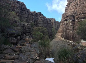
Hike to Falcon's Lookout and the Ingliston Granites
4.03.7 miThis hike is very short, but since it's so close to Melbourne it's great if you want to head out mid-afternoon for a few hours and be back by dinner. The route I've posted is comprised of two out-and-backs and has fantastic views of the gorge from several lookouts. Please note that the second por...Read more -
35 Echo Point Road, New South Wales
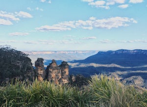
Photograph the Three Sisters
4.00.75 mi / 200 ft gainNo visit to Katoomba and the Blue Mountains would be complete without viewing the Three Sisters. There is a main viewing area at Echo Point, which offers amazing views of the rock formation and the surrounding valley, with the Blue Mountain's signature hazy blue tint. However, this area can get p...Read more -
Halls Gap, Victoria
Backpack to Bugiga Hikers Camp
5.010.7 mi / 2755.9 ft gainStarting in the town of Halls Gap, leave your car in the car park indicated on the map. From here, make your way west, away from the town and towards the forest. You will walk past the botanical gardens and wild kangaroos to the start of the trail. At the start of the trailhead, there is a fork. ...Read more -
Patonga, New South Wales
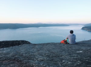
Warrah Lookout
Drink your morning coffee with incredible panoramic views of the Pacific Ocean and Hawkesbury River. Drive to Patonga and from the end of the beach follow the trailhead signs to Pearl Beach. A steep incline for the first 10-15 minutes of the walk will get the legs burning. Once it starts to plate...Read more -
Rottnest Island, Western Australia
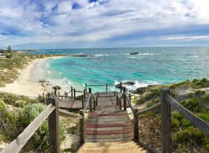
Explore Rottnest Island
5.0Rottnest Island is probably most famous for its adorable Quokka population, but the island also has lots more to explore outside the main settlement. With well-marked walking and biking trails both on the beach, track and road, there of tons of places to see. With trails as long as 40km, you can...Read more -
Yadboro, New South Wales
Hike Pigeonhouse Mountain (Didthul)
5.03.1 mi / 2624.7 ft gainFrom Milton, turn off Princes Highway, following signs marked ‘Pigeon House’ (this will take you along Croobyar Road, Woodstock Road and Yadboro Road). The walk begins in the picnic area off Yadboro Road.Best to walk in dry weather as trail is steep and there are ladders to climb, and the road to...Read more -
Herron, Western Australia
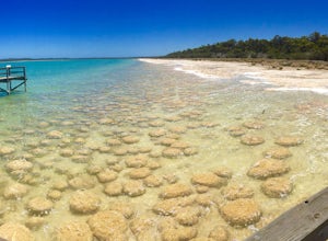
Explore Lake Clifton and the Thrombolites
4.00.4 miThis is one of the lesser known areas that has the conditions to allow thrombolites to thrive - a biofilm on the rocks that shows you what life looked like at the dawn of time billions of years ago.The walk is quite short (600m), but there is another option to take a 5km loop walk along Lake Clif...Read more -
Blue Mountains National Park, New South Wales
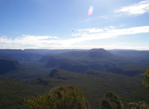
Hike Perry's Lookdown to Govetts Leap Lookout
4.010.8 mi / 3608.9 ft gainStarting at Perry's Lookdown car park, the track takes you to a railed lookout, stop here and take in the magnificent Grose Valley infront of you and the Blue Gum Forest below you. The track descends down and contours around the hill, passing Dockers Lookout, the track is quite steep in places a...Read more -
Mount Field, Tasmania
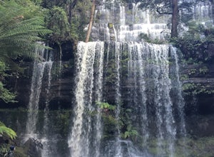
Hike in the Tasmanian Wilderness at Russell Falls
5.00.7 miWithin the Russell Falls area, there are a number of hikes of varying difficulty to choose from, all starting at the main car park of the pristine Mt Field National Park. Please note that there is a fee associated with entry, with a vehicle of up to 8 people costing $24. This is money well spent,...Read more -
Lamb Range, Queensland
Swim at Crystal Cascades Waterfall
5.00.7 mi / 60 ft gainStarting from the Crystal Cascades parking lot at the end of the Redlynch Intake Road follow the paved and well signed path up 1.2 KM to see the beautiful Crystal Cascades Waterfall. Along the path are plenty of spots for lunch and gorgeous opportunities for pictures. If its warm out (which it al...Read more -
Esk, New South Wales
Camp at Black Rocks Campground
3.0This is a great place to explore - the beach is quite large and has some beautiful places to watch the waves or jump in. There are also lots of walks such as the 8km Jerusalem Creek Walk, which you can find instructions for in the link below: http://www.nationalparks.nsw.g... Make sure to book a...Read more -
Tawonga, Victoria
Backpack Mt Bogong
5.017.1 mi / 4219.2 ft gainMt Bogong sits at 1,986m and takes the crown for the highest peak in Victoria and 8th highest in Australia. The views both on the way up and at the top are amazing, especially once you pass the tree line. This hike is not only challenging because of its length and steepness nearing the top, but l...Read more -
Stirling Range National Park, Western Australia
Hike to Mount Talyuberlup
5.01.7 mi / 1312.3 ft gainThe hike starts at the car park on Stirling Range Drive. If you're coming from Chester Pass Road then it's around 15 minutes down the gravel surfaced Sitriling Range Drive. Don't be put off though as the road is in very good condition and any 2 wheel drive will be able to make the trip quite comf...Read more

