Yellowstone, Wyoming
Looking for the best hiking in Yellowstone? We've got you covered with the top trails, trips, hiking, backpacking, camping and more around Yellowstone. The detailed guides, photos, and reviews are all submitted by the Outbound community.
Top Hiking Spots in and near Yellowstone
-
West Yellowstone, Montana
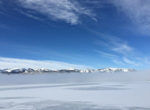
Ice Fishing Hebgen Lake
Hebgen Lake is a beautiful lake, just outside of Yellowstone National Park. With 21 square miles of surface, there's plenty to fish.A favorite place to access the lake for ice fishing is by Kirkwood Resort and Marina. There's easy parking, and you can just walk right out on the lake. The locals t...Read more -
Yellowstone National Park, Wyoming
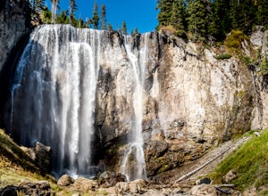
Dunanda Falls via Boundary Creek Trail
4.516.56 mi / 771 ft gainYou'll start at the Bechler Ranger Station and take the Boundry Creek Trail. Depending on which camp site you reserve your hike will be anywhere from 5-9 miles. We camped at site 9A1 5 miles from the ranger station. Hiking to waterfall is 16+ miles round trip Your feet will get wet on this hike,...Read more -
Cody, Wyoming
Camp on the Clarks Fork of the Yellowstone River
4.0Coming out of Cooke City, MT follow the Beartooth Highway (named the most scenic byway in the U.S.) toward Beartooth Pass. Go about 8 miles.Once you drop back down into Wyoming and pass the Fox Creek campground on your left, start looking for the small break in the trees on your left. There is ...Read more -
Cooke City-Silver Gate, Montana
Rock Island Lake Trail
6.86 mi / 771 ft gainRock Island Lake Trail is an out-and-back trail that takes you by a lake located near Cooke City, Montana.Read more -
Park County, Montana
Backpack the Aero Lakes to Granite Peak
26 mi / 6200 ft gainGranite Peak is considered one of the most difficult state high-points, for its remoteness and its climbing challenge. Unfortunately, the access to this route is very remote. Fortunately, this route to the summer is the easiest way up in terms of the technical climbing challenge. This route, k...Read more -
Island Park, Idaho
Hike Mt. Jefferson and Lake Marie
5.011 mi / 2000 ft gainThis out-and-back hike to the highest point in the Centennial mountains of Idaho and Montana skirts the continental divide and provides stunning views of both states. From U.S. Highway 20, Sawtell Peak Road heads west, winding back and forth up the south side of Sawtell Peak. Because there is a...Read more -
Gallatin Gateway, Montana
Backpack the Gallatin Crest Trail
42 mi / 6000 ft gainThere are some different options for starting and ending this hike, but the route I did started at Buffalo Horn Trailhead and ends at the Hyalite Creek Trailhead, and is approximately 42 miles total. I did the trail over the course of three and a half days, spending three nights in the backcountr...Read more -
Ashton, Idaho
Upper and Lower Mesa Falls Loop
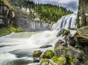
4.82.6 mi / 358 ft gainWhen two waterfalls have their own scenic byway, you know it is worth the additional stop. Lower Mesa Falls and Upper Mesa Falls are spectacular waterfalls along the Henrys Fork River, deep in the Grand Targhee Forest. The winding scenic byway yields some spectacular views of the Grand Targhee Fo...Read more -
Ashton, Idaho
Mesa Nature Trail
5.02.44 mi / 236 ft gainThe Mesa Nature Trail begins on the dirt road to the Upper Mesa Falls overflow parking lot. The first mile of the trail is wide and smooth. Pause a half mile in to admire the Henry's Fork from the top of a lava field. The trail terminates at a flat bluff overlooking the top of Upper Mesa Falls. ...Read more -
Livingston, Montana
Summit Arrow Peak
2.4 mi / 3600 ft gainStarting in Livingston, MT, take Hwy 89 for 16 miles and take a left on Mill Creek Road. A junction with Road 540 will be reached. At this junction, continue on Mill Creek Road for another 8 miles until a large rock gully on the left is present and a wooden fence is on the right. The route is not...Read more -
Island Park, Idaho
Hike the River Trail and Ranch Loop at Harriman State Park
3 mi / 20 ft gainLocated at 6,100 feet above sea level, Harriman State Park (also called "the Ranch") is renown for it's fly fishing along the Henry's Fork. Whether you bring a fly rod or not, this scenic loop through the park is a delight for hikers of all abilities.Make a stop at park headquarters to pay the en...Read more -
Moran, Wyoming
Colter Bay Lakeshore Trail
4.02.55 mi / 148 ft gainWithin the first 100 feet on the trail, you are greeted with the stunning view of the peaks of Grand Teton reflecting off of Jackson Lake. Here you can enjoy lunch or a small snack at one of the picnic tables before or after the short hike. Continue following the Colter Bay Lakeshore Trail along...Read more
Top Activities
Let Adventure be your Destination in Wyoming
Wyoming’s wide-open spaces make it easy to get off the grid and on a trail, through a park, into a forest, up a mountain or down a river. During your journey through Wyoming’s Black to Yellow Region, discover geologic marvels, dense evergreen forests and sprawling prairielands.
Learn More

