Verlot, Washington
Looking for the best photography in Verlot? We've got you covered with the top trails, trips, hiking, backpacking, camping and more around Verlot. The detailed guides, photos, and reviews are all submitted by the Outbound community.
Top Photography Spots in and near Verlot
-
Seattle, Washington
Night Photography at Gasworks Park
4.8Everyone knows Gasworks Park for its awesome views of downtown Seattle. A great spot during anytime of the year, the park is even beautiful at night, when you can see reflections of the city lights in Lake Union. Make sure you bring a tripod to capture some awesome long exposure images!During the...Read more -
Snoqualmie, Washington
Rattlesnake Mountain Trail
4.010.54 mi / 2664 ft gainThe Rattlesnake Mountain Trail is often associated with Rattlesnake Ledge, one of the busiest hiking destinations around. But most people don't know that you can continue on from Rattlesnake Ledge another 10 miles to Snoqualmie Point Park. Using the Snoqualmie Point Trailhead, this hike is a wo...Read more -
Skykomish, Washington
Hike Mount Sawyer
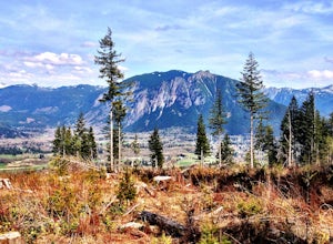
8 mi / 1200 ft gainThis trail starts off going through the forest of fir and hemlock for the first mile. Once you reach the top of the first hill, you will get a glimpse of all the views you will have the opportunity to enjoy later on. As you descend, the trees will start to thin out. The trail follows the ridge l...Read more -
Marblemount, Washington
Hike Lazy Bear Falls
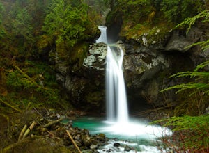
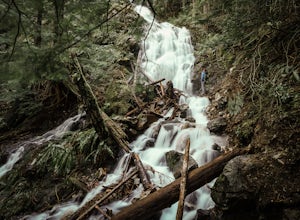
3.0To get to Lazy Bear Falls, take Bacon Creek Road off the North Cascade Highway for 5 miles. At the 3-way fork, take the left road, which will lead you down and over a bridge crossing Bacon Creek. From here, the road will require 4x4 and high clearance.From here, continue up the road for about 0.5...Read more -
Marblemount, Washington
Climb Eldorado Peak via the East Ridge
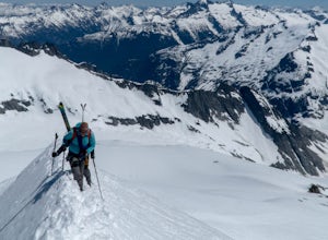
8 mi / 6800 ft gainStanding on the knife edge summit, the terrain around you plummets steeply into glacier-filled basins that trickle into turquoise alpine lakes. Serrated snowy peaks give way to forest covered valleys below that craft a rugged landscape. Eldorado Peak delivers you atop this wild and mountainous wo...Read more -
Concrete, Washington
Anderson and Watson Lake
5.68 mi / 1165 ft gainThe drive up to the starting point of the trail to Anderson and Watson Lake was easy, but at the end it gets a little tricky - the service road is sharp gravel and runs for about 10 miles to the trailhead. Some spots are steep and there are large potholes, but slow and steady wins the race. There...Read more -
Seattle, Washington
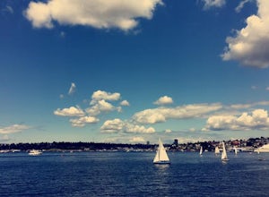
Ice Cream Cruise on Lake Union
My family and I were in Seattle for a wedding and I believe my mom across this gem being advertised in either a newspaper or a magazine. We had a great time and it was an affordable way to get onto the water and something everyone of all ages could do. I love checking out houseboats, being on the...Read more -
Seattle, Washington
Discovery Park Beach
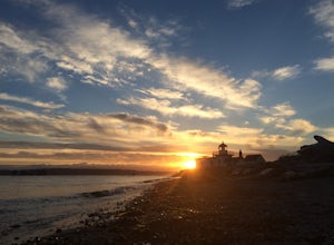
4.32.39 mi / 535 ft gainDiscovery Park and its beach area great for walking, running, photography, and taking in a sunset. If you want to put your feet in the sand, head down to the western most part of the park. This beach is a sand beach with an iconic lighthouse at the end. Dirftwood also washes up on the beach provi...Read more -
Seattle, Washington
Take in the View at Kerry Park
4.8Located at the top of Queen Anne Hill, Kerry Park is a favorite destination for photography. On any given day you'll find tourists and locals relaxing in the park and enjoying the beautiful view.The park is located in the Queen Anne neighborhood so there is free parking along the streets. If yo...Read more -
King County, Washington
Teneriffe Falls (Kamikaze Falls)
4.55.64 mi / 1732 ft gainThe lesser known Mt Si Rd trail starts off as a relatively flat road. This continues for two miles until you reach the Teneriffe Falls sign. Upon turning right at this junction, the terrain takes a shift and the incline steepens. This is where most of the elevation is gained. The rest of the way...Read more -
Marblemount, Washington
Sahale Glacier Camp via Cascade Trailhead
5.011.09 mi / 4183 ft gainAs an initial note, to spend an overnight at Sahale Glacier Camp, you need to obtain a permit at the North Cascades Ranger Station in Marblemount, Washington. Permits are limited, so get there early or call in advance. To start, go to Marblemount, WA and then drive ~23 miles east on Cascade Rive...Read more -
Skagit County, Washington
Sahale Arm via Cascade Pass
4.312.34 mi / 5230 ft gainTo get to this hike, go to Marblemount, WA. Then, drive ~23 miles east on Cascade River Road until the end, the Cascade Pass Trailhead. Even before you hit the trail, you'll get an amazing view of Johannesburg Mountain. Once you're ready to get going, the initial 3.7 miles of this hike to Cascad...Read more -
Skagit County, Washington
Pelton Basin Camp
8.82 mi / 2543 ft gainStarting at 3,640 feet elevation, the Cascade Pass Trailhead begins adjacent to the Johannesburg Camp and proceeds east along a relentless series of switchbacks. Though the trail is consumed by a thick Washington evergreen forest, the switchbacks frequently open to sweeping vistas of the far-reac...Read more -
Seattle, Washington
Camp on Blake Island
There are 2 ways to get to Blake Island: private boat or via the Argosy Cruises tour boat (or if you're ambitious, I guess you can swim there!). If traveling by private boat, there is a marina with limited dock space as well as buoy moorings around the island for a moorage fee. Blake Island is ...Read more -
Concrete, Washington
Park Butte Lookout
4.57.64 mi / 2100 ft gainThis place is really the stuff of fairy tales. Where else can you find a tiny cabin with 360-degree views of stunning mountain scenery? To the west, you can see all the way to Bellingham and the Puget Sound. To the south and east lie the jagged North Cascades. And the entire northern horizon is ...Read more -
Concrete, Washington
Backpack the Easton Glacier Railroad Grade
10 mi / 3000 ft gainBegin at the Park Butte trailhead, trail 603. Hike past the first Scott Paul trail sign a few hundred feet from the trailhead. Continue on and cross appropriately name Rocky Creek heading up on the Park Butte Trail. Continue up the Park Butte trail passing the Scott Paul trail again at about 4,50...Read more

