Stehekin, Washington
Looking for the best photography in Stehekin? We've got you covered with the top trails, trips, hiking, backpacking, camping and more around Stehekin. The detailed guides, photos, and reviews are all submitted by the Outbound community.
Top Photography Spots in and near Stehekin
-
Granite Falls, Washington
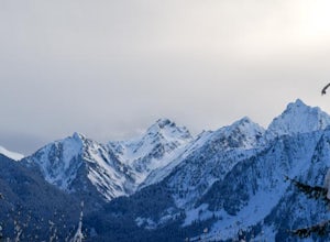
Snowshoe to Coal Lake
13 mi / 1600 ft gainhttps://www.theoutbound.com/wa...Starting out at the Deer Creek gate of Mountain Loop Highway the road is flat and uneventful for the first 2 miles or so, though it does offer some great views of the Big Four as well as a few other peaks and the babbling south fork of the Stillaguamish river. The...Read more -
Granite Falls, Washington
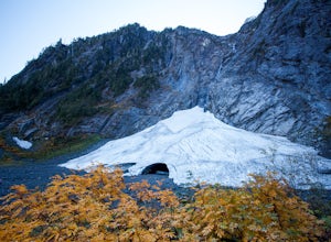
Big Four Ice Caves
4.32.38 mi / 289 ft gainDisclaimer: Hiking into the caves is extremely dangerous as there is potential for the ice to fall. We do not recommend hiking inside of them and if you choose to do so, you're doing it at your own risk. This is a short hike at just 2.3 miles roundtrip with little elevation change. The hike take...Read more -
Granite Falls, Washington
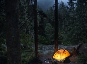
Dispersed Camp near Beaver Creek Group Camp, Mt. Baker Snoqualmie NF
This campsite is located along the Mountain Loop Highway. There are various options for dispersed camping around the area, as well as some you can reserve ahead of time such as the Coal Creek Campground and the Beaver Creek Group Campground. This campsite is located just before Beaver Creek grou...Read more -
Leavenworth, Washington
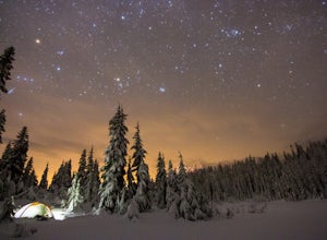
Skyline Lake Trail
4.52.41 mi / 1020 ft gainThis 2.5 mile roundtrip hike with a little over 1,000 feet of elevation gain is a great winter trip for beginners. The trail is typically well-worn, making it easy to stay on target even in some of the most difficult conditions. If you have route finding and off trail skills, you can venture ou...Read more -
Skykomish, Washington
Hike to Josephine Lake
10.4 mi / 2100 ft gainStarting in the parking lot at Steven's Pass Ski Resort (roughly 4,062 feet in elevation; I recommend parking in E lot), start by walking between the two main lodges towards the ski lifts. You'll see a trail on the northwest-facing slope that switches back across the mountain - this is the PCT. O...Read more -
Skykomish, Washington
Snowshoe Lake Valhalla
11.6 mi / 1500 ft gainYou start out at Stevens Pass just across the street from the lodge. The trailhead is slightly hidden but it is located to the left of the substation. Parking is plenty before ski-season. Once you are all geared up, you wanna hit the trail running cause this is a long one to snowshoe. With short...Read more -
Leavenworth, Washington
Evergreen Mountain Lookout
4.52.88 mi / 1522 ft gainThis is a relatively short hike, at only 2.6 miles round trip, that takes you up to the nearly 5600 foot summit. The hike may be short but it is extremely steep, gaining 1300ft in the 1.3 miles to the summit, so be prepared for a good leg workout. On the way to the top you will walk through field...Read more -
Snohomish County, Washington
Hike Johnson Ridge to Scorpion Mountain
9 mi / 2650 ft gainFrom Skykomish, WA drive east on SR 2 roughly 1 mile and turn left on the Beckler River Road, FS RD 65. Drive north on this road approximately 7 miles taking a sharp right at the pavement's end just before crossing the Rapid River. You are now on FS RD 6520. Continue on this road bearing left a...Read more -
Skagit County, Washington
Sauk Mountain Summit 5,541'
4.34 mi / 1200 ft gainEven from the Trailhead, the views overlooking the Skagit River valley, all the way out toward Mount Vernon, are outstanding. The trail follows 20 tight switchbacks as it makes it's way 600 feet up to the southern crest of the summit ridge. This is a steep slope and it's possible to look straight...Read more -
Okanogan County, Washington
Cathedral Lakes and Amphitheater Mountain
5.037.4 mi / 6493 ft gainLocated in the Pasayten Wilderness and surrounded by Amphitheater Mountain and Cathedral Peak, Cathedral Lakes are a great destination for a multi-day backpacking trip. The shortest route to get Cathedral Lakes (not coming from Canada) is roughly 19 miles. This may be a bit of a "slog" but is def...Read more -
Skykomish, Washington
Beckler Peak
7.55 mi / 2139 ft gainLooking for a gradual forest hike up to a peak with 360° views of the Cascades? Beckler Peak trail winds through old growth, past rushing waterfalls, and up to a granite summit. From the top, you can see mountains in the Cascades such as Glacier Peak, Mount Baring, Mount Index, Evergreen Mounta...Read more -
Granite Falls, Washington
Cutthroat Lakes via Walt Bailey Trail
4.06.21 mi / 1978 ft gainAlong the Mountain Loop Highway, past the crowds crawling over Mt. Pilchuck, lies the muddy, unkempt Walt Bailey Trail into a verdant subalpine basin speckled with tiny tarns. The Cutthroat Lakes are a delightful location to spend the night with optional day hikes up to exposed ridgelines and cra...Read more -
Peshastin, Washington
Hike Sauer’s Mountain
4.06 mi / 2000 ft gainSauer’s Mountain is one of those well defined, moderate, and rewarding hikes that give you just the right amount of views for the effort, but the real treat is catching the wildflower bloom in mid-May. The trailhead is located on private property. Start by parking along the private drive and walk...Read more

