Stehekin, Washington
Looking for the best rock climbing in Stehekin? We've got you covered with the top trails, trips, hiking, backpacking, camping and more around Stehekin. The detailed guides, photos, and reviews are all submitted by the Outbound community.
Top Rock Climbing Spots in and near Stehekin
-
Winthrop, Washington
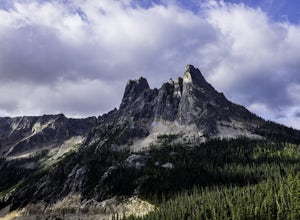
Climb to the Summit of Liberty Bell via the Beckey Route (5.6)
5.0Liberty Bell is one of the most prominent and well defined features of the Washington Pass formation in the North Cascades. This beautiful and stunning rock formation looks equally at home in Washington as it would in the Dolomites or Patagonia.The classic route up Liberty Bell, The Beckey Route,...Read more -
Winthrop, Washington
Climb South Early Winters Spire - South Arete
3 mi / 2600 ft gainFrom the Blue Lake Trailhead, hike approximately 1.5 miles to an obvious clearing with subsidiary trails that depart uphill and right at a stream crossing. These trails will eventually lead up granite slabs and converge into a main trail. Follow the cairns or aim generally for the southern-most s...Read more -
Pacific Crest Trail, Washington
Summit Black Peak
5.010 mi / 4400 ft gainStarting at the Heather-Maple Pass Loop Trailhead, jump onto the trail that will take you counter-clockwise along the loop. After about 1.25 miles, you will come to a split in the trail, take the right path and continue for just under a mile until you reach Heather Pass. Off to the right there ar...Read more -
Rainy Pass, Washington
Black Peak's South Ridge
3.07 mi / 4700 ft gainStarting at Rainy Pass trailhead, you'll proceed to skirt high above Lake Ann on a marvelously maintained trail. Without realizing you're about to arrive at a pass, you'll come to Heather Pass, where you'll need to take a right. Continuing straight is also a popular hike, especially during peak l...Read more -
Skagit County, Washington
Climb Sahale Peak via the South Slope Route
5.012 mi / 4000 ft gainTo get to Sahale Peak, drive to Marblemount, WA and continue on the Cascade River Road (Forest Road 15) for 23.5 miles. The road ends at the Cascade Pass trailhead, where the climb begins.The first part of the climb follows the Cascade Pass trail for 3.5 miles and 1,800 feet. Cascade Pass makes a...Read more -
Okanogan County, Washington
Mult-Pitch Climbing in the Methow Valley
It's 2.7 miles from the store. Park on the left side of the road, cross the street and follow the cairned trail straight up the hillside.Tucked up in the Methow (the h is silent) Valley east of the North Cascades in Washington lies the beautiful and outdoorsy tiny little town of Mazama. Known for...Read more -
Darrington, Washington
Climb Sloan Peak via the Corkscrew Route
5.014 mi / 6035 ft gainYou'll start the approach to this climb at the Sloan Peak trailhead at 1800ft elevation. Moving south along the trail, you'll begin with a traverse through some marshlands and several water crossings along the Sauk River and its tributaries for the first mile and before gaining any elevation. It ...Read more -
Marblemount, Washington
Terror Basin and West McMillan Spire
16.98 mi / 8868 ft gainThe Picket Range is a remote and rugged subrange of Washington's North Cascades. It draws very few visitors per year, and the odds of seeing another human on your adventure are very low. West McMillan Spire is an 8,000' peak located in the Southern Pickets. It is a Class 3 climb involving bot...Read more -
Granite Falls, Washington
Climb Del Campo Peak, WA
5.0Begin by parking at Barlow Pass and following the Gothic Basin Trail to Foggy Lake. Most of the trip's mileage is consumed by just getting to Foggy Lake, from here, the summit sits about 3/4 of a mile distant and over a thousand above you.Face the mountain and identify the obvious leftward trendi...Read more -
Skykomish, Washington
Climb Slippery Slab Tower
13 mi / 4200 ft gainStart out at the Tunnel Creek trailhead. You will follow the trail for about 1.6 miles until you reach Hope Lake and the PCT. From here, you want to travel south along the PCT.For the next 3/4 of a mile, you will hike up switchbacks until you reach the saddle, where it will start to level out a b...Read more

