Snoqualmie Pass, Washington
Top Spots in and near Snoqualmie Pass
-
Packwood, Washington
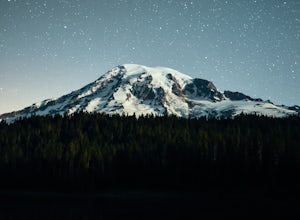
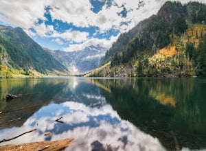
Reflection Lakes is located approximately 1 mile east of Inspiration Point just off Steven Canyons Road in the Paradise section of Mount Rainier National Park. Simply park in one of the pullouts at the lakes and enjoy the scenery. Reflection Lakes can also be accessed via the Wonderland Trail.T...
Read more
-
Packwood, Washington
4.8
2.5 mi
/ 1050 ft gain
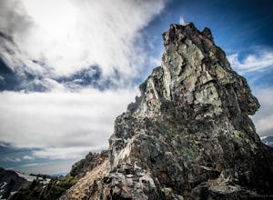
This trailhead is easily accessed at the parking lot at Reflection Lakes in Mount Rainier National Park. A short but sweet hike (1.3 miles one way) that leads to beautiful views of Rainier, Mount Adams, Mount St. Helens, and if clear enough, Mt. Hood (Oregon). Pinnacle itself can be climbed to su...
Read more
-
Ashford, Washington
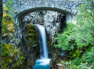
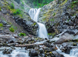
Driving along Paradise Road on the south side of Mount Rainier, provides a couple of opportunities to view gorgeous waterfalls with a short hike. From the West, the first stop is Christine Falls. There is parking on either side side of the bridge, but the east side is closest to the trail. Desce...
Read more
-
Granite Falls, Washington
In general, this is a strenuous hike or snowshoe at approximately 8 miles round trip with nearly 4000 elevation gain. Be aware of current snow conditions and avalanche risk if heading up in the winter. Do not attempt a winter trip without proper knowledge, skill, and gear. Some previous winter tr...
Read more
-
Granite Falls, Washington
Most visitors park at this trailhead to hike Dickerman Mountain. Until this spring, so did I. However, don't overlook this stunning valley hike to Perry Creek, Mount Forgotten Meadows, and the scramble up Mount Forgotten!Begin this hike on the Perry Creek trail, which begins on the far left sid...
Read more
-
Randle, Washington
This is a trail that could easily be done by your older family members but also could be a nice trail run or quick hike for you. The trail starts from Loop B in the Ohanapecosh Campground and after a quick section, you will be walking over the hot springs in the area. They ask that you stay off t...
Read more
-
Darrington, Washington
4.3
10.4 mi
/ 1400 ft gain
If you just loved your day hike to Goat Lake so much that you want to return and spend some more time, you're in luck - the lake offers a camping area that holds at least 15 campsites and even comes with a pit latrine. This is a great overnight option if you aren't looking for a difficult hike in...
Read more
-
Darrington, Washington
4.0
10.4 mi
/ 1400 ft gain
This trail is a perfect winter hike for the average outdoorsmen. Be warned that the most difficult part of this hike is getting to the trailhead in winter. The Mountain-loop highway can be a dangerous drive with black ice, snow, and serious potholes along the way. Take proper precautions like cha...
Read more
-
Darrington, Washington
4.5
10.4 mi
/ 1400 ft gain
The trail starts by lazily winding through beautiful forest. Fairly quickly, you'll reach a fork for the Upper and Lower Elliot Creek Trails. Both will take you to Goat Lake in about the same distance (~3 miles), but each offers a different take on the area. The lower trail winds along as it foll...
Read more
-
Ashford, Washington
Located on Paradise Road along the south side of Mount Rainier, the Comet Falls Trail follows Van Trump Creek up to the magnificent Comet Falls. The hike is 3.8 miles round trip with 1250' of elevation gain.The trail starts off at 3650' and soon crosses over a bridge above Christine Falls. It qui...
Read more
-
Darrington, Washington
Starting at the North Fork Sauk Trailhead (NFD 49) off the Mountain Loop Highway, you will travel 5.3 miles and gain a leisurely 1,100 feet of elevation until you reach Mackinaw Shelter. This is where the real work begins. The trail gains a calf-burning 3,000 feet in the next 2.9 miles until you ...
Read more
-
Seattle, Washington
Although weekend sails are available, this is one of the best ways to get a mid-week fresh air fix in Seattle.Start with a 1.5 hour sunset sail reservation with Emerald City Charters ( approx. $33 per adult). The day of your sail, pack a bag with blankets, drinks and picnic-style dinner. Catch th...
Read more
-
Seattle, Washington
3.3
0.31 mi
/ 217 ft gain
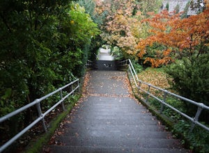
The Howe Street Stairs are Seattle’s longest continuous stairway, and your quads will confirm this fact after you’ve done a few sets of repeats. This is a great place to raise your heart rate and get some exercise outside of the gym. If you’re up for it, throw in some push-ups and sit-ups in betw...
Read more
-
Seattle, Washington
There are 2 ways to get to Blake Island: private boat or via the Argosy Cruises tour boat (or if you're ambitious, I guess you can swim there!). If traveling by private boat, there is a marina with limited dock space as well as buoy moorings around the island for a moorage fee. Blake Island is ...
Read more
-
Granite Falls, Washington
https://www.theoutbound.com/wa...Starting out at the Deer Creek gate of Mountain Loop Highway the road is flat and uneventful for the first 2 miles or so, though it does offer some great views of the Big Four as well as a few other peaks and the babbling south fork of the Stillaguamish river. The...
Read more
-
Granite Falls, Washington
4.3
2.38 mi
/ 289 ft gain
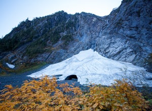
Disclaimer: Hiking into the caves is extremely dangerous as there is potential for the ice to fall. We do not recommend hiking inside of them and if you choose to do so, you're doing it at your own risk.
This is a short hike at just 2.3 miles roundtrip with little elevation change. The hike take...
Read more

