Snohomish County, Washington
Top Spots in and near Snohomish County
-
North Bend, Washington
3.0
4.5 mi
/ 2000 ft gain
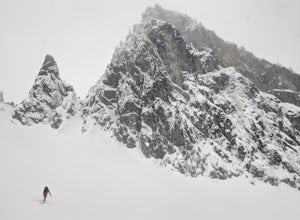
Skiers or snowshoers looking to explore this route should park in the uppermost parking area at the Alpental ski area. This lot is past the main parking lot for the ski area. After getting your gear on, you can proceed down the groomed access run heading northwest out of the parking area. This ru...
Read more
-
North Bend, Washington
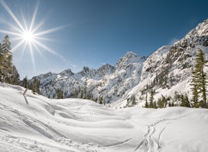
It’s no surprise to outdoor enthusiasts in the PNW just how popular the Alpine Lakes Wilderness can be. With numerous access points, this terrain is unlike any around; offering those who enter a combination of alpine views, crystal blue lakes, lush forest canopies and untouched natural terrain.
...
Read more
-
North Bend, Washington
4.0
6.24 mi
/ 1699 ft gain
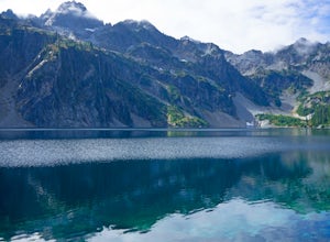
This hike gets crowded fairly quickly so get there early. The parking lot is very large so parking is not really a problem. There are bathrooms at the very beginning of the trail so I highly suggest using them. However at the top there is also a designated restroom area. Starting at 2600 ft, thi...
Read more
-
North Bend, Washington
4.7
10.4 mi
/ 2923 ft gain
This hike shares the trailhead for Snow lake at the Alpental Ski area in Snoqualmie Pass. You'll start out with a great warm up, walking through dense green underbrush and a brief wooded area. Before too long the trail increases in inclination slightly and begins to offer up some small rocky sect...
Read more
-
North Bend, Washington
4.3
2.87 mi
/ 3054 ft gain
For this hike, you park at the same parking lot as the Snow Lake hike. The trailhead to Snoqualmie Mountain is an unmarked trail just 30 feet or so before the Snow Lake trail. This is a tough hike even though its only a ~4 mile out and back trip because you gain 3100 feet to reach the summit.
Th...
Read more
-
North Bend, Washington
Starting near Snoqualmie Pass, hike the historic Pacific Crest Trail (PCT) through old-growth forests and boulder fields to the "Kendall Katwalk," a high ledge of rock carved out of a mountain side many years ago using dynamite.The hike to the Katwalk gradually gains elevation using switchbacks w...
Read more
-
North Bend, Washington
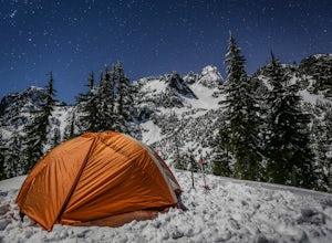
Hike or snowshoe to the ridge below Chair Peak and above Snow Lake and camp among numerous Snoqualmie Pass peaks.Drive to Snoqualmie Pass WA via I-90 and park at the Alpental parking lot (exit 52). Take the Snow Lake trail, which initially climbs 200 feet with wooden steps and eventually evens ou...
Read more
-
North Bend, Washington
4.7
10.62 mi
/ 3107 ft gain
The trail to Gem Lake lies along the same trail that passes by the incredibly popular Snow Lake. While the masses typically stop the first place they can along the shores of Snow Lake, fewer make the short trek from there up to Gem Lake. Park at the giant lots at the end of the road to Alpental (...
Read more
-
North Bend, Washington
The Tooth is a relatively easy multi-pitch trad route within spitting distance of Seattle. It is rated 5.5, although 3 of the 4 pitches are rated 5.2-5.3. It is a great day trip into the Cascades. The rock quality is fantastic.Despite the exposure inherent in any multi-pitch, The Tooth has rappel...
Read more
-
North Bend, Washington
Starting at the Snow Lake Trail Head you climb up the boot pack or ski track of those before you (hopefully) from ~3120 ft. to ~4400 ft. at the ridge line where Snow Lake becomes visible. If there are no tracks, follow the South Fork Snoqualmie River NE and aim just east of the lowest point of t...
Read more
-
North Bend, Washington
1.0
14.43 mi
/ 4370 ft gain
Although this hike is possible if you’re looking for an all-day training hike, it’s much more enjoyable if it’s an overnight backpacking trip.
Head up the trail past Snow Lake toward Gem Lake. En route to Snow Lake will be a little crowded, but should lighten significantly as you continue hiking...
Read more
-
Oak Harbor, Washington
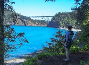
Once you've parked your car, there is a $10 fee which can be paid at the station right next to the bridge unless you have a Discover Pass. From there, you can either go down the stairs to the beach or continue to walk across. Towards the middle, there are some stairs to get down and take some pho...
Read more
-
Goose Rock Perimeter Trail, Washington
Deception Pass State Park is one of Washington state's favorite year-round destinations; Beachside camping, salt-water kayaking, and plenty of short, accessible trails with endless views of the strait. Goose Rock, the tallest point on Whidbey Island, is just southeast of the Deception Pass bridge...
Read more
-
Oak Harbor, Washington
A strait separating Whidbey Island from Fidalgo Island, Deception Pass and the bridges that span it are a fascinating day trip from Seattle. Located 82 miles from Seattle, a 90 minute drive will get you to the Deception Pass State Park. Once here, there are a myriad of activities to do - explore ...
Read more
-
Concrete, Washington
The drive up to the starting point of the trail to Anderson and Watson Lake was easy, but at the end it gets a little tricky - the service road is sharp gravel and runs for about 10 miles to the trailhead. Some spots are steep and there are large potholes, but slow and steady wins the race. There...
Read more
-
Leavenworth, Washington
The Approach
Starting at the Trinity trailhead you'll hike the Buck Creek Trail towards Buck Creek Pass. The trail is fairly obvious once the snows have melted but if you are going early season (June-early July) you will definitely want to bring a GPS. The trail works it's way up the valley alon...
Read more

