Snohomish County, Washington
Top Spots in and near Snohomish County
-
Marblemount, Washington
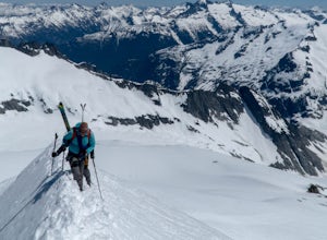
Standing on the knife edge summit, the terrain around you plummets steeply into glacier-filled basins that trickle into turquoise alpine lakes. Serrated snowy peaks give way to forest covered valleys below that craft a rugged landscape. Eldorado Peak delivers you atop this wild and mountainous wo...
Read more
-
Marblemount, Washington
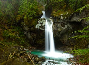
To get to Lazy Bear Falls, take Bacon Creek Road off the North Cascade Highway for 5 miles. At the 3-way fork, take the left road, which will lead you down and over a bridge crossing Bacon Creek. From here, the road will require 4x4 and high clearance.From here, continue up the road for about 0.5...
Read more
-
15671 Rosario Road, Washington
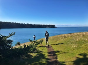
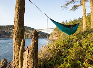
One of the best routes to add to your itinerary when exploring Deception Pass State Park, one of Washington’s most popular year-round camping, hiking, and kayaking destinations; The Lottie Point Loop trail is a great offshoot of a larger trail system that takes you across soaring cliffsides and a...
Read more
-
4399 Bowman Bay Road, Washington
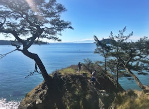
The Lighthouse Point Trail is yet another offshoot of Deception Pass Park’s wonderful trail system, which weaves itself through the northern corners to the southern ends of the park’s expansive walking paths. Perfect for families and for adventurers just getting their hiking legs warmed up for th...
Read more
-
Oak Harbor, Washington
THE TRAIL: On the north side of the bridge, you'll come across Rosario Rd. Take this down to the Bowman Bay parking lot and your trailhead begins here. Take a moment to walk out on the fishing pier or watch what people are catching before you continue south on the trail towards Lottie Bay/Lightho...
Read more
-
North Bend, Washington
3.5
3.79 mi
/ 932 ft gain
As you begin your hike up to Lodge Lake you will pass through a small forest. After about .5 miles you will come out into the open. Simply follow the path under the chairlifts as you cut across the mountain. In the summer when there is no snow on the ground you can see lots of wildflowers. If you...
Read more
-
North Bend, Washington
With a moderate grade on a wide trail, the hike to Talapus Lake is the perfect introduction to the outdoors for hikers and beginning backpackers. Upon arrival at Talapus, break out lunch or pitch camp. Either way, you can cool off in the large lake. If you feel like pressing on, Ollalie Lake is j...
Read more
-
North Bend, Washington
The trail up to Talapus Lake is well graded and relatively short, at only about 2.5 miles in length RT. The trail starts off on a wide old road cut and then veers off into the old growth woods in a slowly winding uphill tack. A few mellow switch backs deliver you to the top, where a short stretch...
Read more
-
North Bend, Washington
Starting at the Snoqualmie Pass PCT trailhead, you start hiking through an old growth forest. This hike has a nice gradual incline with views starting near a talus field. Late June, early July wildflowers are growing like crazy along the trail. This field offers a up close view of Mt. Rainier alo...
Read more
-
North Bend, Washington
The area around Kendall Knob is great for snowshoeing or ski touring. It is particularly nice for ski touring because there are a variety of short tours at varying difficulty and on varying aspects. Skiers or those on snowshoe can begin their trip at the PCT trailhead near the Commonwealth Campgr...
Read more
-
North Bend, Washington
5.0
9.2 mi
/ 2800 ft gain
Kendall Peak is an easily accessible summit hike just off of Exit 52 of I-90 that offers spectacular 360-degree views of the entire Snoqualmie range. You’ll start out in the PCT parking lot where you’ll need a NW Forest Pass to park, or pay the daily fee. A permanent bathroom and backcountry acce...
Read more
-
North Bend, Washington
There are quite a few ways up Guye Peak ranging from a simple walk up to multiple pitches of technical rock climbing. Both of the routes described here start from the PCT parking lot north of exit 52 of I-90 at Snoqualmie Pass. Some of the scrambling described would be treacherous in wet or sno...
Read more
-
North Bend, Washington
The West Ridge of Thomson is rated 5.6 and is 4-5 pitches depending on how you break it up. The East Ridge is some spicy 4th class and although people do scramble it, it is recommend to use a rope on the descent.
The Approach
Starting at the PCT trail-head you have two options. You can take the ...
Read more
-
Leavenworth, Washington
Begin your adventure at the Phelps Creek Trailhead, roughly a 4 hour drive from Seattle. Make sure your car has good clearance and traction because the last section of the forest service road gets a little rough.
Only a few minutes after starting down the trail, you will reach a split that head...
Read more
-
Leavenworth, Washington
Start out on the Phelps Creek Trail and hike in 6.5 miles to reach the head of Spider Meadows. Continue on up the trail to the the base of the Spider Snowfield around 6200 feet for even better views of the entire Phelps Basin. Follow the trail up the snowfield for .5 miles to the top of Spider Ga...
Read more
-
Leavenworth, Washington
Drive USFS Road 62 for 23 miles from Lake Wenatchee (turn left at Cole's Corner off of Highway 2 towards Lake Wenatchee). Turn right on USFS Road 6211 for ~2.5 miles to the end at the Phelps Creek Trailhead.
Begin to hike the Phelps Creek Trail but in 1/4-1/2 a mile, take a right on the Carne Mo...
Read more

