Ravensdale, Washington
Top Spots in and near Ravensdale
-
Ashford, Washington
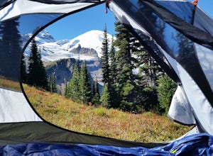
Camp at White River in Mount Rainier NP
Getting There From Seattle: Head East on I90 to 405 South, Take the exit for 169 heading towards Enumclaw. I recommend stopping for a bite at the down home, family restaurant called Kitchen in downtown. The food was great with lots of local flavors! Continue on 169 where you will jump on Highway ...Read more -
Snoqualmie Pass, Washington
Chikamin Peak via Mineral Creek Trailhead
15.34 mi / 5771 ft gainThis is a S5 T4 scramble that involves some routefinding past the alpine lakes. We did this as a day trip and we were out and back in about 12 hours. There are multiple routes to get to Chikamin, one from the PCT, which is 24 miles RT and the other is from the Mineral Creek Trailhead (47.4176, -...Read more -
Ashford, Washington
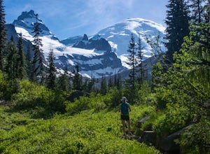
Hike to Upper Palisades Lake
6.6 mi / 1200 ft gainPark at the Sunrise Point parking lot and find the Palisades Trail at the northeast corner of the parking lot. If you bring along a pair of binoculars, you can stop at the first overlook on the left and scan the adjacent mountain slopes for the white dots of mountain goats. Continue down the trai...Read more -
Enumclaw, Washington
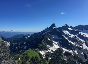
Crystal Peak Trail
7.49 mi / 2966 ft gainMake sure you are going out on a clear day to catch the best views of the mountains, and bring your camera! From the summit, it’s possible to see six volcanoes spanning two states. Baker, Glacier, Adams, Rainier, St. Helens and Hood wait patiently for you to climb the more-than-moderately steep p...Read more -
Ashford, Washington
Summerland Trail
5.08.62 mi / 2359 ft gainThe Summerland trail is by far the easiest trail that I ever experienced. The trail is well maintained and for the first 3 miles you are surrounded by trees and the sound of waterfalls and rivers, and it's green everywhere. The last 1.3 miles, you encounter switchbacks and you can get some view...Read more -
Ashford, Washington
Hike to Mount Rainier's Panhandle Gap
5.012 mi / 3000 ft gainThe trail is 12 mi round trip but don’t let the distance for an out and back turn you off - this hike is fantastic and even better with a beer at the top. The trail winds its way through an old growth forest and shortly joins the Wonderland Trail. After crossing a crick the trail steepens and beg...Read more -
Ashford, Washington
Climb Little Tahoma/East Shoulder
17 mi / 7450 ft gainStart from the Summer Land Trail Head at the Fryingpan Creek parking lot just West of the White River Ranger Station in Mount Rainier National Park. Beginning at an elevation of 3,800 feet, you'll head southeast along the Summer Land Trail for 4.5 miles, tracing the Fryingpan Creek. There are a f...Read more -
Ashford, Washington
Scramble to Tamanos Mountain
10 mi / 3000 ft gainSoon after entering Mt. Rainier National Park via the White River Entrance, pull into the Owyhigh Lakes Trail parking area. From the parking lot, walk across Sunrise Road to the Owyhigh Lakes Trailhead to begin an exceptional hike to the summit of Tamanos Mountain.Start by hiking 3.5 miles on the...Read more -
Gold Bar, Washington
Lake Serene and Bridal Veil Falls
4.87.74 mi / 2569 ft gainConsider this a must-do if you are in Seattle and feel like knocking out two amazing hikes AND getting to see a hidden lake all along US 2. The trail starts out on an old road with the typical amazing forest surrounding you. After roughly 2 miles the road will end and you can go right (signage i...Read more -
Gold Bar, Washington
Sunset Falls
1.0Note: Please be careful when exploring the falls. We recommend not walking on the surfaces directly next to the falls as the water is moving very quickly and can pick you up quickly. The falls are home to several very sad losses. Sunset Falls is the largest and the final of the three major wate...Read more -
Snoqualmie Pass, Washington
Thorp Mountain Lookout via Knox Creek Trail
4.34 mi / 1677 ft gainThis trail features beautiful wildflower meadows during the summer season and is relativity low trafficked. Bring your hammock for breathtaking views from the lookout and catch an incredible sunset. The summit has no established camping spots, so if staying overnight prepare to sleep on uneven gr...Read more -
Skykomish, Washington
Hike to Big Heart Lake
5.014.6 mi / 3300 ft gainThis hike takes you past 5 lakes and a few different waterfalls, so if you don't wish to push on to Big Heart, you won't be disappointed! Start at the West Fork Foss River Trailhead, about 2.6 miles past the Necklace Valley Trailhead. The first mile is relatively flat. Once you reach the bridge t...Read more -
Skykomish, Washington
Hike to Foss River and Lakes
4.04.2 mi / 2400 ft gainChoose from Trout Lake (1.6 miles each way with 500 feet of elevation gain), Copper Lake (4.2 miles each way with 2400 feet of elevation gain), or Big Heart Lake at 7.3 miles each way, with 3300 feet elevation gain). There are plenty of camp sites if you decide to go overnight at any of the lakes...Read more -
Enumclaw, Washington
Norse Peak via Silver Creek
7.77 mi / 2405 ft gainStart out in Crystal parking lot A. There is a small and steep trail that heads up the hill labeled as Silver Creek Trail. The trail follows a horse trail for the majority of the route and gets renamed Bullion Basin Trail shortly after you enter the woods, so when it doubt keep following the hoof...Read more -
Snoqualmie Pass, Washington
Spectacle Lake via Pete Lake Trail
5.018.91 mi / 3058 ft gainDepending on when you arrive at the Pete Lake Trailhead, expect to be traveling with company as it is one of the more popular locations on the eastside of Snoqualmie Pass. At an elevation of 2600 feet, the beginning route is a moderate 400 feet of elevation gain. Start on your way through the va...Read more -
Gold Bar, Washington
Heybrook Lookout
4.72.47 mi / 984 ft gainTo the trailhead, drive east on highway 2 from Everett. Just past milepost 37 you will see a gravel parking area on the left side of the highway. Wander through a mossy forest that reminds me of Olympic National Park and traverse up 1.3 miles of switch backs to ascend heybrook lookout! Dogs ar...Read more

