Mountlake Terrace, Washington
Top Spots in and near Mountlake Terrace
-
Seattle, Washington
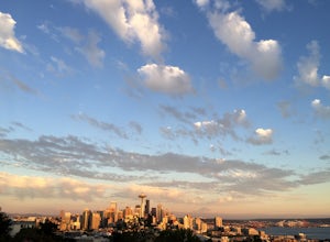
Located at the top of Queen Anne Hill, Kerry Park is a favorite destination for photography. On any given day you'll find tourists and locals relaxing in the park and enjoying the beautiful view.The park is located in the Queen Anne neighborhood so there is free parking along the streets. If yo...
Read more
-
Seattle, Washington
There are 2 ways to get to Blake Island: private boat or via the Argosy Cruises tour boat (or if you're ambitious, I guess you can swim there!). If traveling by private boat, there is a marina with limited dock space as well as buoy moorings around the island for a moorage fee. Blake Island is ...
Read more
-
Seattle, Washington
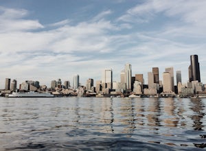
Although weekend sails are available, this is one of the best ways to get a mid-week fresh air fix in Seattle.Start with a 1.5 hour sunset sail reservation with Emerald City Charters ( approx. $33 per adult). The day of your sail, pack a bag with blankets, drinks and picnic-style dinner. Catch th...
Read more
-
Seattle, Washington
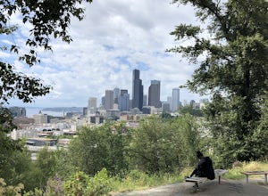
Enjoy a wonderful view of the Seattle skyline from Dr. Jose Rizal park. Parking is easy and accessible, and the park has lots of benches for sitting and taking in the view. Walk around the park for different views of the city or take in the surrounding neighborhood, you'll most likely catch a lot...
Read more
-
Bellevue, Washington
The park is open dawn to dusk. The botanical garden is free to visit and offers excellent photography opportunities.
Additional InfoCopper Kettle Coffee Bar is available at the garden: Weekdays: 10am – 3pm; Saturday & Sunday: 10am – 5pmGarden Map with different attractions featuredBotanica...
Read more
-
Seattle, Washington
There is parking for about a mile along Alki Ave. SW, however it quickly fills up quickly so get there early. The beach is about a mile long and since there is little parking there is a good chance you will need to walk a fair distance.
There are many things to do at this beach. There are kayak,...
Read more
-
Lake Stevens, Washington
Have you ever dreamed of snow skiing and water skiing in the same day? This March, plan your adventure of a lifetime to Stevens Pass and Lake Stevens, Washington. You will need a winter coat, a wet suit, and a heart made of love for the outdoors.Keep an eye on mountain and lake weather conditions...
Read more
-
Bellevue, Washington
4.0
5.55 mi
/ 545 ft gain
This trail takes you through Coal Creek park and follows the creek along the trail with minimal elevation gain. This trail can also be accessed from the northern end of the park if that's a more convenient drive. For the lower parking lot, park at the Red Town lot (exit 13 off I-90) and cross the...
Read more
-
Bellevue, Washington
3.0
2.29 mi
/ 518 ft gain
The popular trailhead is located in the Cougar Mountain Regional Wildlife Park. There is a veritable maze of trails and trailheads here so it is helpful to bring along a map of the area. A trail map for Cougar Mountain can be found on kingcounty.gov.
From the trailhead veer left following the Re...
Read more
-
Bellevue, Washington
4.5
3.53 mi
/ 436 ft gain
Head up the road about .75 miles and take a left onto the Klondike Swamp Trail (well-singed). Stay on Klondike for a mile before taking a left onto Lost Beagle Trail. From here the trail climbs uphill and wraps around the edge of the park, offering views of the surrounding area. Hop on Shangri-La...
Read more
-
Issaquah, Washington
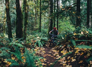
Duthie Hill is a premier and beautifully designed mountain bike park set in lush douglas firs and western hemlock forests . Created and maintained by the Evergreen Mountain Bike Alliance (evergreenmtb.org) with the help of King County and volunteers, Duthie Hill although open to hikers, is 100% s...
Read more
-
Port Orchard, Washington
Did you know that Dungeness Crabs are named after the port of Dungeness, Washington where they were first commercially fished? Big, meaty and delicious these crabs are plentiful in the Puget Sound region as their under appreciated cousins the Red Rock Crab.
The Washington State Department of Fi...
Read more
-
Issaquah, Washington
4.0
7.51 mi
/ 1125 ft gain
The trail system in the 1,300 acre Grand Ridge Park can currently can be accessed from two lots: High Point and Central Park, with a new lot at Duthie Hill still under construction.
To get to the High Point lot take exit 20 off of I-90 (coming from Seattle), take a left and pass under the freewa...
Read more
-
Renton, Washington
4.2
4.25 mi
/ 801 ft gain
From Seattle, take the I-90 E to exit 15. Make a right on 17th Ave. This street will later become Renton/Issaquah Rd. Drive about four miles then turn right on to May Valley Rd. Make a sharp right onto SE 112th St. This street will soon turn into 169th Ave SE as it turns left. The trailhead is ri...
Read more
-
Issaquah, Washington
4.4
6.57 mi
/ 1880 ft gain
The Poo Poo Point trail is a great option for beautiful forest and great views only about 20 minutes outside of Seattle. The longer and less steep of the two routes to Poo Poo Point, this trail leaves from the Issaquah High School (the shorter and steeper Chirico Trail leaves from the paragliding...
Read more
-
Issaquah, Washington
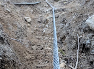
If you're looking for something with low-grade steepness, you're not going to find it here. Gaining over 2,000' in under 2 miles to the summit, this isn't for the faint of heart.
The trail exists because of a buried cable, which has since been exposed and which you can see near the top of the t...
Read more

