Mountlake Terrace, Washington
Top Spots in and near Mountlake Terrace
-
Granite Falls, Washington
4.3
4.33 mi
/ 1165 ft gain
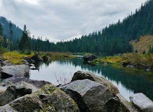
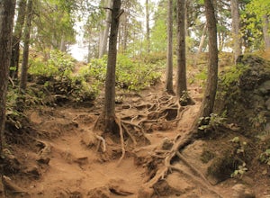
The trail takes you on a gradual climb up to Heather Lake with beautiful second growth to admire along the way. The trail can be very wet and muddy with many tree roots to catch your toes, so make sure to wear a sturdy pair of tennis shoes or hiking shoes. Dogs are permitted on this trail on-leas...
Read more
-
Port Townsend, Washington
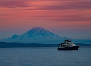
This trail offers amazing views of Mt. Baker, Vancouver Island, the San Juan Islands, and the Cascade Mountains. The Point Wilson trail is located in Fort Worden State Park on the Olympic Peninsula, along the Strait of Juan De Fuca. The trail is 2.5 miles round trip, and is accessible regardless ...
Read more
-
Granite Falls, Washington
4.6
5.98 mi
/ 1434 ft gain
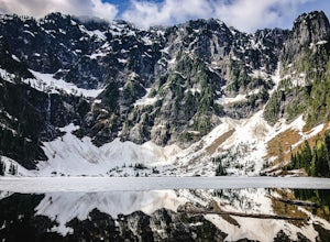
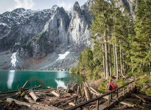
If you're looking for a taste of the Mountain Loop Highway area, but don't have it in you for a longer, steeper journey, look no further than Lake 22. The trail starts out as flat and well-maintained, from the parking lot, before becoming a true mountain rainforest trail. Water and dampness are f...
Read more
-
North Bend, Washington
3.6
4.01 mi
/ 1250 ft gain
Little Si, neighbor to the bigger Mount Si is a decent hike for beginners and families with younger children. It is 4.7 miles round trip (including Boulder Garden Loop - 1.5 miles) gaining 1300ft in elevation - Discover Pass required. This trail is very popular, so if you want seclusion avoid thi...
Read more
-
Coupeville, Washington
Just walk straight past the restroom to find the start of the trail route. The Bluff trail heads up a set of stairs to the top of the hillside on the right. After climbing the stairs, you come right up on farmland (Ebey's Prairie), with a grassy two-track trail leading up toward the top of the bl...
Read more
-
Gig Harbor, Washington
Just over the Tacoma Narrows Bridge is a small, quiet, and tranquil town of Gig Harbor. The best way to experience the town is from the water.Tucked beneath Anthony's restaurant is Gig Harbor Rent-a-Boat, a small rental company that will outfit you for your afternoon on the water. Most days the ...
Read more
-
Quilcene, Washington
There are four trailheads that guide you to the top of Mount Townsend, but the most popular choice is to begin at the Upper Trailhead Trail #839 (snow permitting).
The trail gradually climbs while traversing through forested area. While walking through the fir and hemlock trees, you pass three ...
Read more
-
Quilcene, Washington
5.0
10.5 mi
/ 3481 ft gain
This trail has a nice, steady climb that's perfect for beginner or intermediate backpackers. The first 2.5 miles follow a forest trail along the Big Quilcene River. For the next 3 miles, the trail flows in and out of shaded trees, over a small talus field, and through a meadow before the final ac...
Read more
-
Quilcene, Washington
The climb to Buckhorn Mountain above Marmot Pass is a must see for every PNW adventurer with the endurance to tackle nearly 14 miles and 4,400 feet of gain. Listen to the rushing waters of the Big Quilcene River as the trail gently traverses up 5.5 miles to Marmot Pass. Be sure to filter water ...
Read more
-
Quilcene, Washington
The secret to this trip: Marmot Pass and Boulder Shelter, where you can camp on National Forest Service land. Multiple excellent, large backpacking sites sit just on the edge of the National Park, giving you great access to Mt. Constance and Mt. Deception, two of the tallest peaks in the Olympics...
Read more
-
Gold Bar, Washington
4.8
7.74 mi
/ 2569 ft gain
Consider this a must-do if you are in Seattle and feel like knocking out two amazing hikes AND getting to see a hidden lake all along US 2.
The trail starts out on an old road with the typical amazing forest surrounding you. After roughly 2 miles the road will end and you can go right (signage i...
Read more
-
North Bend, Washington
4.6
7.91 mi
/ 3241 ft gain
Mount Si is probably one of the most well trekked hikes around the Seattle area, but one that any hiker-new to the game or an old pro-should experience as least once. I usually use it as a starter hike to kick start the season and highly recommend you get an early start on this one as the further...
Read more
-
Brinnon, Washington
The Dose Forks Campground is an overlooked campsite deep within the Olympic National Park, making it a perfect weekend camping destination. A mild, 7.5 mile (one-way) trail delivers you to this enchanting area and is a must for those who love photographing forests. There are no reservation requir...
Read more
-
Gig Harbor, Washington
Point Defiance Park is the largest urban park in Pierce County and it provides a variety of amenities. Located at the very northwest tip of Tacoma, the park provides residents with a much needed retreat from the bustle of everyday life. Point Defiance Park is the place to go if you need a quick d...
Read more
-
Gold Bar, Washington
Greider Lakes Trail is an approximately 8+ mile hike out-and-back from the trailhead, which is labeled after a long drive up a gravel road. First 2 miles are flat, next 3 are switchbacks up. Once you reach the first larger lake, keep going! The second one is also gorgeous. This is a beautiful hik...
Read more
-
National Forest Development Road 2530, Washington
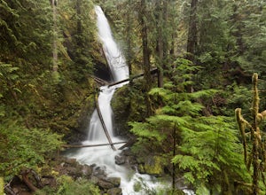
The trailhead to Murhut Falls is located about 7.5 miles off US-101 S but the last couple of miles are on NF-2530 which can be potholed and rutted. I made it up the road in my 2WD sedan but it took quite some time to dodge all of the potholes.
This hike is nice and quick! It starts with a small ...
Read more

