Marblemount, Washington
Top Spots in and near Marblemount
-
Gold Bar, Washington
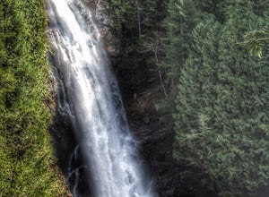
Wallace Falls
4.65.01 mi / 1404 ft gainThe trailhead is located at the far end of the parking lot, next to the info kiosk and bathrooms. It starts out in a wide-open area that shortly leads to stunning views of Mt. Index and Baring Mountain. The trail turns to the left and you're greeted by a beautiful Wordsworth quote carved into a t...Read more -
Gold Bar, Washington
Hike to Wallace Lake via Greg Ball Trail
4.58.2 mi / 1500 ft gainAn alluring State Park for its massive waterfall display, Wallace Falls is a high traffic destination along Highway 2, but don't overlook Wallace Lake as the falls steal the limelight. Head East on Highway 2, once you enter the town of Gold Bar keep on the lookout for the State Park signs and tu...Read more -
Lake Stevens, Washington
Water and Snow Ski Stevens to Stevens
5.0Have you ever dreamed of snow skiing and water skiing in the same day? This March, plan your adventure of a lifetime to Stevens Pass and Lake Stevens, Washington. You will need a winter coat, a wet suit, and a heart made of love for the outdoors.Keep an eye on mountain and lake weather conditions...Read more -
Bellingham, Washington
Hike to Pine & Cedar Lakes
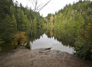
5.05 mi / 1400 ft gainThese two quaint lakes in the Chuckanuts are a must-do for people looking for a day hike, short camping trip or steep trail run in the Bellingham area. Starting at the trailhead off of Old Samish Road, one begins the 2 mile ascent to the two lakes. The first 1,400ft climb has its fair share of up...Read more -
Bellingham, Washington
Whatcom Falls
0.13 mi / 20 ft gainWhatcom Falls is easily accessible within Whatcom Falls Park. It is less than a 2 minute walk from the parking lot to the bridge overlooking Whatcom Falls. This is a nice place to checkout with good company if you don't have a lot of time to enjoy the fresh air.Read more -
Fraser Valley D, British Columbia
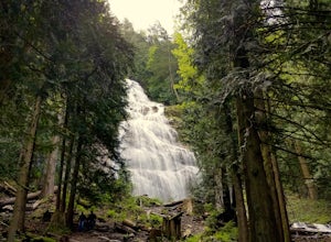
Explore Bridal Veil Falls in Chilliwack
4.00.5 mi / 164 ft gainLocated only a short distance from the Trans-Canada highway is the Bridal Veil Falls Provincial Park. The park is a great area for a picnic lunch, but the highlight of the park is the almost 200 ft. (60 meter) waterfall. The location of the park and the duration of the hike to the waterfall make ...Read more -
Mazama, Washington
Cross Country Ski from the Mazama Trailhead
5.0Many cross country ski trails begin at the Mazama trailhead, located in the town of Mazama, just off of Highway 20. This area offers the perfect jumping off ground for a day on the trails. Follow the interior short and flat Inn Run Loop trail to get your legs warmed up or get some practice on fl...Read more -
Bellingham, Washington
Pixie Falls
2.00.45 mi / 125 ft gainPixie Falls can be accessed during any season; however it’s most enjoyable during the spring and summer months. This waterfall and swimming hole combo is the perfect way to escape the heat and the crowds. On any given day, there will typically be less than 10 people who access the falls. Pixie is...Read more -
Bellingham, Washington
Hike to Fragrance Lake
4.75.5 mi / 950 ft gainTake Chuckanut Drive to the trailhead which is located directly across from the entrance to Larrabee State Park. A small lot in front of the trail has space for 8-10 cars, or you can park at the State Park and walk across the road (carefully!) to reach the trailhead. Either way you will need a Di...Read more -
Okanogan County, Washington
Hike to the Goat Peak Lookout
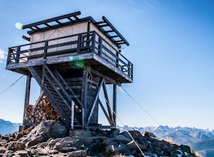
3.55 mi / 1400 ft gainWith fall coming quickly, that means larch fever. Views of the North Cascades, Methow Valley, and fall colors all at 7000 feet, doing the short hike of just over 2 miles up to the Goat Peak Lookout will not disappoint.The hike begins in a beautiful forest you'd expect too see at 5500 feet. The al...Read more -
Bellingham, Washington
Explore Teddy Bear Cove
4.0On Chuckanut Drive (State Route 11) pull off onto a small, unmarked, one-way road that offers parking for Teddy Bear Cove before quickly rejoining the road. There is space to pull over on the road for approximately 15-20 cars. If you are heading North to South, the road is on your right, if headi...Read more -
Leavenworth, Washington
Evergreen Mountain Lookout
4.52.88 mi / 1522 ft gainThis is a relatively short hike, at only 2.6 miles round trip, that takes you up to the nearly 5600 foot summit. The hike may be short but it is extremely steep, gaining 1300ft in the 1.3 miles to the summit, so be prepared for a good leg workout. On the way to the top you will walk through field...Read more -
Winthrop, Washington
Bike the North Cascades Highway
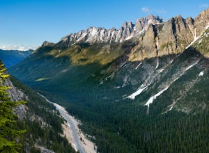
38 mi / 3500 ft gainThe North Cascades Highway is one of the most beautiful roads in the country. A popular, but long bike ride is to ride from Marblemount on the West side of the Cascades to Mazama on the east side. But for those who aren't up for an epic ride, there is an out and back option from Mazama on east si...Read more -
Winthrop, Washington
Hike to the Tawlks Foster Suspension Bridge
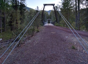
2 mi / 70 ft gainThe pin above is a small gravel parking lot which is clearly marked as "Trail Head" from the road. Once you park you are within eye shot of an information station and the trail is marked as "Suspension Bridge Access." Walk past this sign and continue on the well-groomed trail eastward for just sh...Read more -
Sultan, Washington
Heybrook Ridge
3.71 mi / 856 ft gainAlthough short, this new trail is a great warm-up to the many other trails this area has to offer. Starting immediately across the North Fork Skyhomish River at the new trailhead, you will make your way up this moderately steep hike to the Heybrook Ridge. once you reach the top of the trail, you ...Read more -
Twisp, Washington
Backpack to West Oval Lake
14 mi / 4100 ft gainThe trail to West Oval Lake begins at the Eagle Creek Trailhead, outside of Twisp, Washington. Follow the Eagle Creek trail for 1.9 miles until the trail splits. Take the left fork for Oval Creek and Oval Lakes. The trail continues winding through thick forest for approximately 4 more miles befor...Read more

