Kenmore, Washington
Top Spots in and near Kenmore
-
Gold Bar, Washington
Baring Mountain
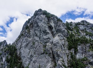
4.62 mi / 3556 ft gainDon't let the low mileage trick you – this is not an easy climb. Give yourself plenty of time to summit this beast of a mountain. Starting at the Barclay Lake Trailhead, be careful not to jump onto the Barclay Lake Trail. The path to Baring Mountain is hidden down a path leading from the bathroo...Read more -
Gold Bar, Washington
Eagle Lake via Barclay Lake Trailhead
8.5 mi / 2000 ft gainStart off on the same trail as Barclay Lake. After 2.25 miles, you will arrive at Barclay Lake. This lake can be quite busy in the summer months as it is relatively easy to access, and you may see many people camping there with their kids. Continue around the lake until you almost reach the east...Read more -
Coupeville, Washington
Hike Ebey's Landing
4.5Just walk straight past the restroom to find the start of the trail route. The Bluff trail heads up a set of stairs to the top of the hillside on the right. After climbing the stairs, you come right up on farmland (Ebey's Prairie), with a grassy two-track trail leading up toward the top of the bl...Read more -
Arlington, Washington
Three Fingers Lookout
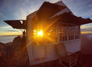
4.514.31 mi / 4357 ft gainApproximately 11 miles east of Granite Falls, WA, on the Mt. Loop Highway, turn onto Forest Service road 41 and follow this road for 18.0 miles to the trailhead. The road is quite rough and it is recommended you have a four-wheel drive vehicle. There is a washout about halfway along the road, an...Read more -
Quilcene, Washington
Marmot Pass via Big Quilcene Trail
5.010.5 mi / 3481 ft gainThis trail has a nice, steady climb that's perfect for beginner or intermediate backpackers. The first 2.5 miles follow a forest trail along the Big Quilcene River. For the next 3 miles, the trail flows in and out of shaded trees, over a small talus field, and through a meadow before the final ac...Read more -
Quilcene, Washington
Buckhorn Mountain
12.26 mi / 4429 ft gainThe climb to Buckhorn Mountain above Marmot Pass is a must see for every PNW adventurer with the endurance to tackle nearly 14 miles and 4,400 feet of gain. Listen to the rushing waters of the Big Quilcene River as the trail gently traverses up 5.5 miles to Marmot Pass. Be sure to filter water ...Read more -
Quilcene, Washington
Backpack to Marmot and Constance Passes
24 mi / 5200 ft gainThe secret to this trip: Marmot Pass and Boulder Shelter, where you can camp on National Forest Service land. Multiple excellent, large backpacking sites sit just on the edge of the National Park, giving you great access to Mt. Constance and Mt. Deception, two of the tallest peaks in the Olympics...Read more -
National Forest Development Road 2530, Washington
Hike to Murhut Falls
1.37 mi / 371 ft gainThe trailhead to Murhut Falls is located about 7.5 miles off US-101 S but the last couple of miles are on NF-2530 which can be potholed and rutted. I made it up the road in my 2WD sedan but it took quite some time to dodge all of the potholes. This hike is nice and quick! It starts with a small ...Read more -
Quilcene, Washington
Mount Townsend
8.59 mi / 2949 ft gainThere are four trailheads that guide you to the top of Mount Townsend, but the most popular choice is to begin at the Upper Trailhead Trail #839 (snow permitting). The trail gradually climbs while traversing through forested area. While walking through the fir and hemlock trees, you pass three ...Read more -
Brinnon, Washington
Camp at the Dose Forks
15 mi / 1200 ft gainThe Dose Forks Campground is an overlooked campsite deep within the Olympic National Park, making it a perfect weekend camping destination. A mild, 7.5 mile (one-way) trail delivers you to this enchanting area and is a must for those who love photographing forests. There are no reservation requir...Read more -
Lilliwaup, Washington
Scuba Dive at Mike's Beach Resort
Located in Washington State on the west shore of the Hood Canal, Mike's Beach Resort is a unique family run establishment offering waterfront cabins and rooms. Perfectly placed between the popular shore dives to the south like Octopus Hole, and Jorsted Creek, and the dynamic boat dives to the nor...Read more -
North Bend, Washington
Summit Mt. Defiance
5.011 mi / 3300 ft gainThis hike offers some of the best views one can see in the area. On a clear day, you'll get amazing views of Mt. Rainier. The best part is that as you start heading uphill in the first half mile, you'll get great views of McClellan Butte. Once you reach the summit of Defiance at 5584 feet, you'll...Read more -
North Bend, Washington
Bandera Mountain
4.47.8 mi / 3176 ft gainThis hike has unreal views of Mount Rainier. On a great clear spring day, the mountain is out. It's right in your face. It's incredible. If you tackle this hike in the spring the bear grass and wildflowers are alive and blooming towards the top and it makes for some fantastic picture-taking. Once...Read more -
North Bend, Washington
Mason Lake via Ira Spring
4.26.88 mi / 2316 ft gainIra Spring trail offers up great views prior to reaching the ridge that you go over to reach Mason Lake. The lake itself is an amazing sight—beautiful water with rocks and trees along the shores, making this 6.5-mile roundtrip hike well worth it. The trail to Mason Lake, the Ira Spring trail, pr...Read more -
North Bend, Washington
Camp and Trail Run from Rainbow Lake
I backpacked to and setup basecamp at Rainbow Lake and then I ran over to Island Lake. After enjoying the peace and quite I ran up to the top of Bandera Mountain and enjoyed the views. Then, I ran back to basecamp and spent the night. The following morning I ran up to the top of Mount Defiance a...Read more -
North Bend, Washington
McClellan Butte
5.010.61 mi / 3629 ft gainStarting at the McClellan's Butte Trailhead, right off of I-90 exit 47, head out on the main (only) trail at the trailhad. The first half mile of the trail is quite easy as it meanders through the forest, but don't be fooled or worried, it will get harder. This first half mile has a crossing of a...Read more

