Greenwater, Washington
Looking for the best backpacking in Greenwater? We've got you covered with the top trails, trips, hiking, backpacking, camping and more around Greenwater. The detailed guides, photos, and reviews are all submitted by the Outbound community.
Top Backpacking Spots in and near Greenwater
-
Ashford, Washington
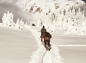
Snowshoe to Panorama Point Mount Rainier National Park
5.03.2 mi / 1700 ft gainArrive at Longmire in Mount Rainier National park about 9a.m. They open the gate during the late season at this time so you will want to get ahead of the crowd, especially if it is a beautiful day! This time of year it is required to carry chains, so don't forget those. Arrive at Paradise parking...Read more -
Ashford, Washington
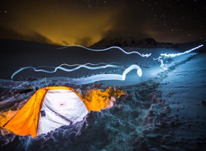
Winter Camp at Glacier Vista
5.03 mi / 1000 ft gainIt's always a good idea to check the weather, but when it comes to getting a peak at Mt. Rainier you might be better off just showing up and hoping for a miracle. To do this from Seattle, you'll have a 2 hour 20 minute drive down I-5 and WA-167. After a couple turns here and there (you can follow...Read more -
Lewis County, Washington
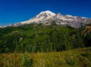
Hike Indian Bar - Cowlitz Divide via Box Canyon
14.64 mi / 4235 ft gainThere are multiple ways to access Indian Bar. This one starts at Box Canyon. From the parking area at Box Canyon walk across the road and follow the signs for Wonderland Trail. Head up the Wonderland trail through the trees to the split with the Cowlitz trail. Continue on the Wonderland Trail...Read more -
Packwood, Washington
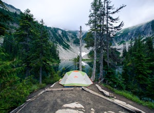
Snow Lake Trail
3.82.12 mi / 427 ft gainSnow Lake is a beautiful lake in Mount Rainier National Park in Washington. You can do the 2.6 mile roundtrip hike to the lake as either a day trip or as a backcountry camp. To camp at one of the two sites on the lake you must secure a permit from the permit office at Longmire. The hike to the s...Read more -
North Bend, Washington
Hike Pratt Balcony
2.2 miThis one can be a bit tricky to find. The trailhead is unmarked and is a bit hidden around a curve of Middle Fork Road so it is easy to miss. At about 9.80 miles from the junction of 468th St. and Middle Fork Road, look for two signs on the right warning of upcoming gravel patches (probably will ...Read more -
Eatonville, Washington
Hike to Gobbler's Knob
4.05 mi / 1500 ft gainEntering the Park from the Southwest Entrance, bear left when you approach the forking Westside Rd. This road has been closed a few miles in due to massive rockfall. When you reach the road closure, just park along the side of the road. In Spring and Summer, you should be able to see plenty of ot...Read more -
Snoqualmie Pass, Washington
Spectacle Lake via Pete Lake Trail
5.018.91 mi / 3058 ft gainDepending on when you arrive at the Pete Lake Trailhead, expect to be traveling with company as it is one of the more popular locations on the eastside of Snoqualmie Pass. At an elevation of 2600 feet, the beginning route is a moderate 400 feet of elevation gain. Start on your way through the va...Read more -
North Bend, Washington
Rainy Lake Trail
4.09 mi / 3205 ft gainThis is an abandoned trail that heads south along Rainy Creek, off of the downstream section of the Middle Fork Snoqualmie Trail, and up to Rainy Lake. The lake is popular among fisherman, since it is home to lots of trout, but be warned -- route-finding skills are a must on this trip. I do my be...Read more -
Packwood, Washington
Hike Tatoosh Ridge from Tatoosh Trail #161
12 mi / 4100 ft gainAt the trailhead kiosk be sure to get one of the provided (and required) self-serve Wilderness Permit. Starting at the trailhead begin your initial accent following the marked trail on the side of the road. In the first two 2.5 miles you will climb 2,745 feet, it's hard but luckily a majority of ...Read more -
Ashford, Washington
Hike Kautz Creek to Indian Henry's Hunting Ground
11 mi / 2520 ft gainNamed after the Native American who lived here prior to Mt. Rainier becoming a national park, So-To-Lick's was dubbed "Indian Henry" by the postman who unfortunately did not learn his name. When heading out on this hike, keep an eye on the weather in Mt. Rainier National Park. If hiking this trai...Read more -
Ronald, Washington
Spade and Venus Lakes
5.026.47 mi / 2300 ft gainNestled in a high rocky cirque near the upper reaches of Mt Daniel, Spade and Venus Lakes are two of the most remote lakes in the Alpine Lake Wilderness. But to experience this level of pure isolation, you'll need to earn it; the shortest hike in to the lakes is 14 miles, the majority of which i...Read more -
Skykomish, Washington
Backpack from Dorothy Lake Trailhead to Snoqualmie Lake
18 mi / 1900 ft gainThe trail was not crowded although when we got to Snoqualmie Lake there were only a couple camping spots left. The trail up from Dorothy is not too hard at all. The weather was perfect. After passing Dorothy you have to ford a creek where the bridge has been washed out. We went through it on foot...Read more -
Skykomish, Washington
Hike to Lake Deer via Lake Dorothy Trailhead
12.6 mi / 1600 ft gainStart off by traveling along Highway 2 and turning towards the Money Creek Campground. Turn off onto Forest Road 6410 and follow that to the Lake Dorothy Trailhead (about 9 miles).This first section of the hike can be pretty crowded on a nice summer day as the trail is very family friendly and it...Read more -
Skykomish, Washington
Hike to Big Heart Lake
5.014.6 mi / 3300 ft gainThis hike takes you past 5 lakes and a few different waterfalls, so if you don't wish to push on to Big Heart, you won't be disappointed! Start at the West Fork Foss River Trailhead, about 2.6 miles past the Necklace Valley Trailhead. The first mile is relatively flat. Once you reach the bridge t...Read more -
Ronald, Washington
Sprite Lake via Paddy-Go-Easy Pass Trail
6.5 mi / 2923 ft gainThe Trail Begin backpacking the Paddy-Go-Easy Pass Trail (#1595) through dense spruce forests with riparian undergrowth. The trail will switchback and climb steadily across dry meadows filled with wildflowers, and you'll have increasing views westward of Mount Daniel, Mount Hinman, and Cathedral...Read more -
Ronald, Washington
Tuck and Robin Lakes
4.313.94 mi / 4199 ft gainRobin Lakes have been coined "The Little Enchantments", and once you visit, you'll realize the nickname is strikingly accurate. But while the hike up is no Aasgard Pass, it's far from a walk in the park. When you leave the car at the end of the pothole-ridden Salmon La Sac forest service road, y...Read more

