Darrington, Washington
Top Spots in and near Darrington
-
Rockport, Washington
Sourdough Mountain Trail
5.09.34 mi / 5046 ft gainGoing east from Newhalem on highway 20, turn off towards the small town of Diablo. There are signs from there on where to park. This hike is very difficult. It is very steep and gains elevation very quickly and right from the start. Once you get above tree line though you are greeted with great ...Read more -
Rockport, Washington
Explore Diablo Lake
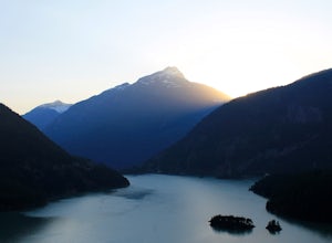
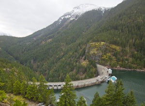
5.0Diablo Lake is a reservoir in the North Cascades created by Diablo Dam. The hue of the lake is created by ground up rocks from local glaciers, which end up drifting down streams into the lake.If you’ve decided to take in the viewpoints driving Hwy 20 through the park, be sure to check out Liberty...Read more -
Woodinville, Washington
Woodland Plateau and Lloyd Trail Loop
5.02.63 mi / 276 ft gainWoodland Plateau and Lloyd Trail Loop is a loop trail where you may see local wildlife located near Woodinville, Washington.Read more -
Mount Vernon, Washington
Explore the Flower Fields of Skagit Valley
4.3Skagit Valley is an important agricultural region of Washington State, but the prettiest time of year to attend is during the spring when flower season takes hold. Daffodils first, then tulips, and then irises bloom and cover fields as far as the eye can see. The Skagit Tulip Festival is held eve...Read more -
Leavenworth, Washington
Day Hike to Lake Valhalla
4.57 mi / 1500 ft gainThe Smith Brook trail starts off with several switchbacks, then continues up to Union Gap where it meets the Pacific Crest Trail. Turn south (left) at Union Gap and continue hiking until you reach the gap between Mount Lichtenberg and McCausland, where you get a first glimpse of Lake Valhalla.Jus...Read more -
Leavenworth, Washington
Hike to Minotaur Lake
5.0This short, steep hike offers rewarding views that is well worth the vertical challenge. Round trip this hike is only 3.5 miles but you will gain 1400 feet elevation in the first mile.The trail starts off with switchbacks that head straight up the hill then about 200 feet from the wilderness boun...Read more -
Skykomish, Washington
Beckler Peak
7.55 mi / 2139 ft gainLooking for a gradual forest hike up to a peak with 360° views of the Cascades? Beckler Peak trail winds through old growth, past rushing waterfalls, and up to a granite summit. From the top, you can see mountains in the Cascades such as Glacier Peak, Mount Baring, Mount Index, Evergreen Mounta...Read more -
Deming, Washington
Hike Helitrope Ridge
4.75.5 mi / 1500 ft gainStarting at the marked Heliotrope Ridge parking lot of FS Road 39, just 8 miles out of the quaint town of Glacier, Washington, you begin your ascent to the glacier viewpoint. The trailhead sign indicates that it is a strenuous 2,000 ft gain over 2.5 miles up to the overlook.This clearly cut trail...Read more -
Rockport, Washington
Hike to Ross Dam
5.02 miThis is a short hike at just under 2 miles round-trip, with little elevation change. The trail begins at a parking area, alongside Washington Route 20. The hike takes you through the forest to an overlook of both Ross Dam and Ross Lake, before making the final descent down to the dam. The trail i...Read more -
Rockport, Washington
Kayak Ross Lake to Cougar Island and Rainbow Point
5.0Start from the Ross Lake Trailhead off Highway 20. Hike down with your vessel 1.5 miles to the hull road. From there you can launch your vessel. Ross Lake is very large with many destinations to paddle to. I went to Cougar Island and Rainbow Point then paddled up to multiple spectacular wate...Read more -
Deming, Washington
Hiking the Kulshan Ridge
This hike starts out at Artist Point, where already you can see jaw-dropping scenery of Mt. Shuksan, Baker, Coleman, and many other peaks of the North Cascades. No matter what time of year you visit, you are bound to get unbelievable views and photos.Artist Point is the furthest destination along...Read more -
Deming, Washington
Hike to Table Mountain via Artist Point
5.03 mi / 560 ft gainThe hike takes off from the Artist Point parking lot at an elevation of 5,220 feett.The trail slowly meanders up for a while until reaching the final steep switchbacks where you'll have a sheer cliff to your side—don't let it distract you, and keep focused on the trail in front of you!Once you've...Read more -
Deming, Washington
Hike Ptarmigan Ridge in the North Cascades
5.09 mi / 1350 ft gainDirections are from Bellingham. Drive Sr 542(Mt Baker Highway) approximately 60 miles to the parking area at Artist Point, elev. 5140 ft. Try to park towards the southwest corner of the lot as this is where our trail begins. Toilets are available.The trail starts from the southwest corner of t...Read more -
Deming, Washington
Explore Artist Point
5.0Note that Artist Point is only accessible by car during the summer - it is closed off from cars as of First Snowfall (end of September) through June.The parking lot of Artist Point is only about an hour and fifteen minute drive from the city of Bellingham, WA. The beautiful and peaceful road that...Read more -
Deming, Washington
Snowshoe to Artist Point
5.05.5 mi / 1200 ft gainFrom the south end of the ski area, snowshoe past an old ski lodge along an old access road parallel to the ski hill. Then, ascend Austin Pass (2 miles) following the broad switchbacks. Once at the top of the ridge, follow the road to the left 1/4 mile and take in the views of Artist Point, Mou...Read more -
Deming, Washington
Stargazing at Artist Point
A couple things must coincide for you to have a great time watching the milky way at Artist Point. The road up to Artist is only open during the summer and early Autumn months but it's always good to check on the Washington State Department of Transportation website to see current road conditions...Read more

