Darrington, Washington
Top Spots in and near Darrington
-
Winthrop, Washington
Climb South Early Winters Spire - South Arete
3 mi / 2600 ft gainFrom the Blue Lake Trailhead, hike approximately 1.5 miles to an obvious clearing with subsidiary trails that depart uphill and right at a stream crossing. These trails will eventually lead up granite slabs and converge into a main trail. Follow the cairns or aim generally for the southern-most s...Read more -
Mountlake Terrace, Washington
Kayak Lake Ballinger
4.0Getting Here: Heading North on I5 from Seattle Center, take exit 178 for 236th Street SW and Lakeveiw Dr. Take a left on Lakeview Dr. and follow along for a half a mile before you see the Lake Ballinger Boat Ramp parking area on the left. There is a community park and rental facility on the noir ...Read more -
Deming, Washington
Hike the Horseshoe Bend Trail
4.06 mi / 210 ft gainLocated just outside the town of Glacier, WA and 40 minutes prior to Mount Baker Ski area, sits the Horseshoe Bend Trail. A simple and straightforward 6 mile out and back route. To get here, take Hwy 542 towards the direction of Mount Baker. About 4 miles after you pass through the town of Glacie...Read more -
Deming, Washington
Summit Church Mountain
8.5 mi / 3750 ft gainStart by driving roughly 2.5 miles up Forest Road 3040, conveniently named E Church Mt Road, to the trailhead. The road is bumpy, but lacking the pot-holes that occupy many of the other forest roads. The only issue comes at 2 miles in where a stream runs over the road and has eroded a small ditch...Read more -
Winthrop, Washington
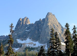
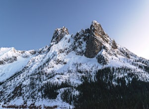
Photograph Liberty Bell
4.0Liberty Bell is just one mile south of Washington Pass. This peak is part of a group of spires, which include North and South Early Winters Spires, Concord Tower, and Lexington Tower. If you’ve decided to take in the viewpoints driving Hwy 20 through the park, be sure to check out Diablo Lake as...Read more -
Winthrop, Washington
Ski Washington Pass
Because the North Cascades highway usually closes from November to May due to heavy snow and huge slides that bury the road, few people expend the energy to get there, meaning it's one of the only places where fresh tracks are almost guaranteed through the winter and early spring.To start, you'll...Read more -
Kirkland, Washington
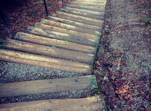
Forbes Creek Stairs
3.00.19 mi / 92 ft gainAll benefits of a stair master paired with fresh air is the perfect recipe for a northwest workout. 210 wooden railroad ties make up a staircase that will test your endurance, build strength and get you sweating in no time. The stairs are open year round, 24 hours a day and offer parking for abo...Read more -
Whatcom County, Washington
Yellow Aster Butte and Tomyhoi Peak
4.713.4 mi / 4902 ft gainThe best way to describe the location is due east of Bellingham. After driving through gorgeous roads to reach Twin Lakes Road (fire service road 3065), you are treated to about a 4-mile drive up to the trailhead for Yellow Aster Butte (8.3 miles RT with 2850' of gain) and Tomyhoi Peak. The drive...Read more -
Whatcom County, Washington
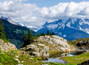
Yellow Aster Butte
9.08 mi / 3258 ft gainYellow Aster Butte has to be one of the most visually rewarding hikes in the Mt. Baker-Snoqualmie National Forest for the effort required to get there. Abundant with lush, rolling mountain meadows, hikers can be treated to an abundance of wildflowers, heather fields, and berry patches with dreamy...Read more -
North Bend, Washington
Rainy Lake Trail
4.09 mi / 3205 ft gainThis is an abandoned trail that heads south along Rainy Creek, off of the downstream section of the Middle Fork Snoqualmie Trail, and up to Rainy Lake. The lake is popular among fisherman, since it is home to lots of trout, but be warned -- route-finding skills are a must on this trip. I do my be...Read more -
Winthrop, Washington
Hike to Cutthroat Pass
11 mi / 2300 ft gainLooking for a distinctive high-country hike just east of the pass? Cutthroat Pass is a hearty day hike perfect for gaining elevation and views with every step. It's even more dynamic as a point-to-point, exiting via the Pacific Crest Trail if you have two vehicles. Also great for a one-night back...Read more -
Whatcom County, Washington
Winchester Mountain Fire Lookout
4.83.28 mi / 1335 ft gainWinchester Mountain is said to have the greatest reward for least amount of effort in all the North Cascades. One of the last fire-lookouts in the region stands on the summit. Views from the summit of Winchester Mountain are beautiful and dramatic to say the least. Being one of the easiest hikes...Read more -
Whatcom County, Washington
Winter Hike to Winchester Mountain
3.5 mi / 1320 ft gainDespite this trip report being titled "to Winchester Mountain", the fun doesn’t stop there. Even though Winchester Mountain is the most popular summer hike departing from Twin Lakes, this whole area turns into a fun-zone during the winter.Upon reaching higher ground above the lakes, this zone off...Read more -
North Bend, Washington
Otter Falls
4.08.37 mi / 853 ft gainThe hike begins at Snoqualmie Lake Trailhead, but you'll actually have to start your hike about a half mile down the road from the trailhead as some cement barricades are up. There is plenty of room to park below the barricades, and the walk up to the trial head is easy and quick. Once at the tr...Read more -
North Bend, Washington
Middle Fork Snoqualmie River Trail
27.57 mi / 3609 ft gainThis beautiful tucked-away trail offers runners, hikers, and backpackers a new view of their favorite neighboring peaks - like Mailbox Peak and Mt. Si - from one of the most scenic river trails in the Seattle area. Often overlooked in favor of more rigorous hikes, the Middle Fork is a gently gra...Read more -
Goose Rock Perimeter Trail, Washington
Hike or Run Goose Rock
2.5 mi / 482 ft gainDeception Pass State Park is one of Washington state's favorite year-round destinations; Beachside camping, salt-water kayaking, and plenty of short, accessible trails with endless views of the strait. Goose Rock, the tallest point on Whidbey Island, is just southeast of the Deception Pass bridge...Read more

