Darrington, Washington
Top Spots in and near Darrington
-
Gold Bar, Washington
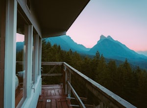
Heybrook Lookout
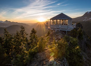
4.72.47 mi / 984 ft gainTo the trailhead, drive east on highway 2 from Everett. Just past milepost 37 you will see a gravel parking area on the left side of the highway. Wander through a mossy forest that reminds me of Olympic National Park and traverse up 1.3 miles of switch backs to ascend heybrook lookout! Dogs ar...Read more -
Gold Bar, Washington
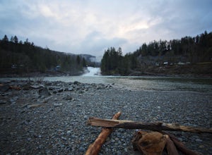
Sunset Falls
1.0Note: Please be careful when exploring the falls. We recommend not walking on the surfaces directly next to the falls as the water is moving very quickly and can pick you up quickly. The falls are home to several very sad losses. Sunset Falls is the largest and the final of the three major wate...Read more -
Gold Bar, Washington
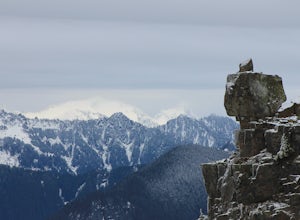
Scramble up Mt. Persis
4 mi / 2658 ft gainThere isn’t a clearly designated trail to start this scramble/hike. Look for the trail that more resembles a boot path. The trail won’t be well marked, but there might be some orange tape or markers to help you find your way.During the first mile of the hike, you’ll see the most elevation gain, s...Read more -
Concrete, Washington
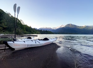
Kayak Baker Lake
5.0Just over 2 hours northeast of Seattle, Baker Lake is an often overlooked gem of the North Cascades. With 8+ miles of turquoise green water to explore, Baker Lake makes for a great day trip or overnight trip, with plenty of backcountry boat-in campsites and sandy beaches along the shore. You can...Read more -
Gold Bar, Washington
Barclay Lake
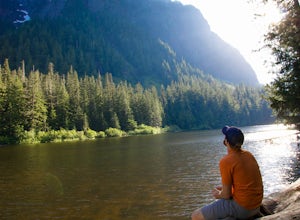
4.44.4 mi / 607 ft gainWith less than 500 feet of total elevation and 4.4 miles of round trip hiking, the Barclay Lake trail is a perfect hike for beginners, families, or those looking for a quick morning or afternoon jaunt. Yet dont let the simplicity of the hike fool you. The end result of the hike is nothing short o...Read more -
Gold Bar, Washington
Baring Mountain
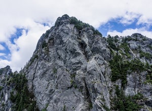
4.62 mi / 3556 ft gainDon't let the low mileage trick you – this is not an easy climb. Give yourself plenty of time to summit this beast of a mountain. Starting at the Barclay Lake Trailhead, be careful not to jump onto the Barclay Lake Trail. The path to Baring Mountain is hidden down a path leading from the bathroo...Read more -
Gold Bar, Washington
Eagle Lake via Barclay Lake Trailhead
8.5 mi / 2000 ft gainStart off on the same trail as Barclay Lake. After 2.25 miles, you will arrive at Barclay Lake. This lake can be quite busy in the summer months as it is relatively easy to access, and you may see many people camping there with their kids. Continue around the lake until you almost reach the east...Read more -
Concrete, Washington
Park Butte Lookout
4.57.64 mi / 2100 ft gainThis place is really the stuff of fairy tales. Where else can you find a tiny cabin with 360-degree views of stunning mountain scenery? To the west, you can see all the way to Bellingham and the Puget Sound. To the south and east lie the jagged North Cascades. And the entire northern horizon is ...Read more -
Concrete, Washington
Backpack the Easton Glacier Railroad Grade
10 mi / 3000 ft gainBegin at the Park Butte trailhead, trail 603. Hike past the first Scott Paul trail sign a few hundred feet from the trailhead. Continue on and cross appropriately name Rocky Creek heading up on the Park Butte Trail. Continue up the Park Butte trail passing the Scott Paul trail again at about 4,50...Read more -
Concrete, Washington
Climb Mt. Baker via the Easton Glacier Route
16 mi / 7600 ft gainThe Easton Glacier route is one of the mountain’s most popular and likewise, most crowded. Check out Mt. Baker’s Squak Glacier route or Coleman Deming Glacier route for an alternative climb with similar difficulty.You’ll start out at Schreibers Meadow Trailhead (3,200 ft.). To get there, exit off...Read more -
Concrete, Washington
Climb Mt. Baker via Squak Glacier
10 mi / 7500 ft gainNOTE: THIS ROUTE REQUIRES GLACIER TRAVEL SKILLSMt Baker, or Kulshan, is a remarkable mountain in northwest Washington. Whether you're in Anacortes, Bellingham, Vancouver or on the San Juan Islands you can see Mt Baker standing as a citadel over the Northwest. Unlike the more popular routes like t...Read more -
Leavenworth, Washington
Evergreen Mountain Lookout
4.52.88 mi / 1522 ft gainThis is a relatively short hike, at only 2.6 miles round trip, that takes you up to the nearly 5600 foot summit. The hike may be short but it is extremely steep, gaining 1300ft in the 1.3 miles to the summit, so be prepared for a good leg workout. On the way to the top you will walk through field...Read more -
Marblemount, Washington
Terror Basin and West McMillan Spire
16.98 mi / 8868 ft gainThe Picket Range is a remote and rugged subrange of Washington's North Cascades. It draws very few visitors per year, and the odds of seeing another human on your adventure are very low. West McMillan Spire is an 8,000' peak located in the Southern Pickets. It is a Class 3 climb involving bot...Read more -
Marblemount, Washington
Photograph Ladder Creek Falls
While not a hike in of itself, this walk to Ladder Creek Falls is still very enjoyable as you bound over a large suspension bridge, wander past smaller falls and overgrown garden steps, and get an up close and personal look at the oldest operating building in Skagit County, the powerhouse. Drive ...Read more -
Concrete, Washington
Mt. Shuksan via The Sulphide Glacier Route
13.62 mi / 6230 ft gainNOTE: This is a very challenging mountaineering adventure. Please do not attempt without the proper skill, knowledge, and equipment. The Sulphide Glacier is the easiest and most popular route to the summit of Mt. Shuksan, and is a great beginner’s glacier + rock climb. More experienced climbers...Read more -
Concrete, Washington
Rainbow Ridge
4.51 mi / 1552 ft gainThe Trail From the parking area proceed back towards the road and hang a right up an abandoned road bed. The trail follows this road bed for a about 0.2 miles before the real trail becomes evident. The first 0.5 - 1.0 miles of this trail can be difficult. Deadfall, wet, steep, and root covere...Read more

