Burlington, Washington
Looking for the best photography in Burlington? We've got you covered with the top trails, trips, hiking, backpacking, camping and more around Burlington. The detailed guides, photos, and reviews are all submitted by the Outbound community.
Top Photography Spots in and near Burlington
-
Friday Harbor, Washington
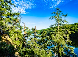
Hike to Lovers Leap on Stuart Island
5 mi / 200 ft gainThis hike is only doable if you are already on Stuart Island! There is no public transportation to Stuart Island, so you must already be there or have a plan to be there in order to complete this hike.I frequent this island during the summer months and it is one of my favorites. I always stay in ...Read more -
Marblemount, Washington
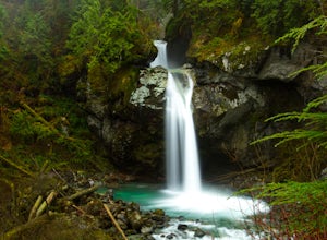
Hike Lazy Bear Falls
3.0To get to Lazy Bear Falls, take Bacon Creek Road off the North Cascade Highway for 5 miles. At the 3-way fork, take the left road, which will lead you down and over a bridge crossing Bacon Creek. From here, the road will require 4x4 and high clearance.From here, continue up the road for about 0.5...Read more -
Edmonds, Washington
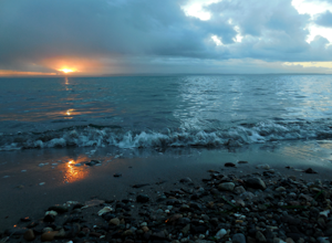
Hike to Meadowdale Beach
5.0If you plan to hike to this beach on the weekend, arrive early because the parking lot fills up fast. From the trailhead, hike down through an old forest along a stream to reach Meadowdale Beach Park. Take in the sounds of birds, wildlife, and the stream adjacent to the trail. At one mile you wil...Read more -
Surrey, British Columbia
Stroll through Redwood Park in Surrey, BC
3.01.2 miRedwood Park is large beautiful forested park in South Surrey. The park is a legacy of one of Surrey's early pioneer's, David Brown, who in 1893 gave the property to his twin sons, David and Peter. The Brown twins spent much of their life traveling the world collecting the seeds and saplings of e...Read more -
Granite Falls, Washington
Cutthroat Lakes via Walt Bailey Trail
4.06.21 mi / 1978 ft gainAlong the Mountain Loop Highway, past the crowds crawling over Mt. Pilchuck, lies the muddy, unkempt Walt Bailey Trail into a verdant subalpine basin speckled with tiny tarns. The Cutthroat Lakes are a delightful location to spend the night with optional day hikes up to exposed ridgelines and cra...Read more -
Whatcom County, Washington
Yellow Aster Butte and Tomyhoi Peak
4.713.4 mi / 4902 ft gainThe best way to describe the location is due east of Bellingham. After driving through gorgeous roads to reach Twin Lakes Road (fire service road 3065), you are treated to about a 4-mile drive up to the trailhead for Yellow Aster Butte (8.3 miles RT with 2850' of gain) and Tomyhoi Peak. The drive...Read more -
Whatcom County, Washington
Yellow Aster Butte
9.08 mi / 3258 ft gainYellow Aster Butte has to be one of the most visually rewarding hikes in the Mt. Baker-Snoqualmie National Forest for the effort required to get there. Abundant with lush, rolling mountain meadows, hikers can be treated to an abundance of wildflowers, heather fields, and berry patches with dreamy...Read more -
Granite Falls, Washington
North Lake via Independence Lake
5.56 mi / 2431 ft gainNorth Lake is everything you could want in a subalpine lake: emerald green hues, cold, clear water, lots of brook trout and far from cell-phone reception. This backpack is perfect when the weather gets hot and sunny, though it does reside in what is known as “the wettest section of the Cascades,...Read more -
Granite Falls, Washington
Dispersed Camp near Beaver Creek Group Camp, Mt. Baker Snoqualmie NF
This campsite is located along the Mountain Loop Highway. There are various options for dispersed camping around the area, as well as some you can reserve ahead of time such as the Coal Creek Campground and the Beaver Creek Group Campground. This campsite is located just before Beaver Creek grou...Read more -
Whatcom County, Washington
Winchester Mountain Fire Lookout
4.83.28 mi / 1335 ft gainWinchester Mountain is said to have the greatest reward for least amount of effort in all the North Cascades. One of the last fire-lookouts in the region stands on the summit. Views from the summit of Winchester Mountain are beautiful and dramatic to say the least. Being one of the easiest hikes...Read more -
Whatcom County, Washington
Winter Hike to Winchester Mountain
3.5 mi / 1320 ft gainDespite this trip report being titled "to Winchester Mountain", the fun doesn’t stop there. Even though Winchester Mountain is the most popular summer hike departing from Twin Lakes, this whole area turns into a fun-zone during the winter.Upon reaching higher ground above the lakes, this zone off...Read more -
Surrey, British Columbia
Walk the 1001 Steps Trail
2.00.3 miOne of Surrey's hidden gems, head down to this short trail down a set of stairs that will take you to an uninhabited beach.The zig zagged steps take you down to the Birlington Rail Lines and you can walk along a trail to an opening under the tracks. Head to the beach from here where you will like...Read more -
Sequim, Washington
Hike Dungeness Spit
3.511 mi / 130 ft gainPark at a the north side of the Dungeness Spit Recreation Area, in the Refuge parking lot. There is a kiosk at the Refuge where you can pay an entrance fee ($3) and check the Tide Table. Only attempt the hike at low tide or the sand spit becomes narrow and you have to climb over logs.Follow the R...Read more -
Granite Falls, Washington
Big Four Ice Caves
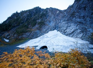
4.32.38 mi / 289 ft gainDisclaimer: Hiking into the caves is extremely dangerous as there is potential for the ice to fall. We do not recommend hiking inside of them and if you choose to do so, you're doing it at your own risk. This is a short hike at just 2.3 miles roundtrip with little elevation change. The hike take...Read more -
Granite Falls, Washington
Snowshoe to Coal Lake
13 mi / 1600 ft gainhttps://www.theoutbound.com/wa...Starting out at the Deer Creek gate of Mountain Loop Highway the road is flat and uneventful for the first 2 miles or so, though it does offer some great views of the Big Four as well as a few other peaks and the babbling south fork of the Stillaguamish river. The...Read more -
Surrey, British Columbia
Hike the Elgin Heritage Park Nature Trail
4.02 miHead over to this magical little park by the water. The forested area between the 2 entrances to the park has many large trees often used by eagles and hawks to survey the surrounding area for prey. The habitat functions of the marsh significantly contribute to the ecological value of the lower N...Read more

