Baring, Washington
Top Spots in and near Baring
-
Snoqualmie Pass, Washington
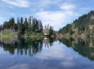
Spectacle Lake via Pete Lake Trail
5.018.91 mi / 3058 ft gainDepending on when you arrive at the Pete Lake Trailhead, expect to be traveling with company as it is one of the more popular locations on the eastside of Snoqualmie Pass. At an elevation of 2600 feet, the beginning route is a moderate 400 feet of elevation gain. Start on your way through the va...Read more -
Snoqualmie Pass, Washington
Hike to Rachel Lake
4.88 mi / 1600 ft gainThis hike is 8 miles roundtrip, with 1600 feet of elevation gain. Once you're on the trail, it starts heading uphill to help get your heart rate up on the hike. As you enter the Alpine Lakes Wilderness, the trail starts to level out. You'll cross a few streams and hike through a fair amount of ve...Read more -
Snoqualmie Pass, Washington
Day Hike to Lila Lakes and Alta Pass
4.312 mi / 3000 ft gainGetting There From Seattle, drive Interstate 90 to Exit 62, Signed Kachess Lake/Stampede Pass. Turn left and head north over the interstate; you'll reach Kachess Lake Campground in five miles. Turn left where the pavements ends and drive four miles on Box Canyon Road (FS Road #4930) to the Rachel...Read more -
Snoqualmie Pass, Washington
Take a Hike Up To Rampart Lakes
5.011 mi / 2200 ft gainGetting There: From I-90 East, take exit 62. Take a left, heading over the highway. After 5.2 miles, the road veers left, passing Lake Kachess Campground. Go another 0.3 miles on the gravel road and take a right at a sign for Rachel Lake/Trail 1313. At this point, the road gets a little rough, bu...Read more -
Snoqualmie Pass, Washington
Hike Alta Mountain
4.012 mi / 3300 ft gainStart off at Trail #1313 to Rachel Lake. The first 2.5 miles is a flat, slow uphill hike till you get to a river crossing. From there, the next 1.3 miles will be a 1,000 foot elevation gain to Rachel Lake. Once you arrive, this is a good spot to rest, eat some snacks, and replenish your water sup...Read more -
Snoqualmie Pass, Washington
Snowshoe to Rachel Lake
8 mi / 2100 ft gainBegin at the Rachel Lake Trailhead and fill out the registry with your individual/group information.As you start the hike heading Northwest towards the lake itself, the trail begins to steadily climb from its initial elevation of 2500 feet. Once you cross the Alpine Lake Wilderness sign, the path...Read more -
Woodinville, Washington
Woodland Plateau and Lloyd Trail Loop
5.02.63 mi / 276 ft gainWoodland Plateau and Lloyd Trail Loop is a loop trail where you may see local wildlife located near Woodinville, Washington.Read more -
Snoqualmie Pass, Washington
Hike Mount Catherine
5.03 mi / 1300 ft gainStart off on the extremely rough Forest Service 9070 road. Follow this for just over 4 miles until you see a sign for trail #1348 on the right. There is only enough room for a couple cars at the trailhead.You start off climbing right away, covering 800 feet of elevation in the first 0.80 miles of...Read more -
Snoqualmie Pass, Washington
Cooper Lake
The Owhi Campground on Cooper Lake is tucked away in the Okanogan-Wenatchee National Forest near Salmon La Sac. It sits at 2,788 feet and has views of Chikamin Peak (6960') and Lemah Mountain (7480'). The lake is quiet, very photogenic, and easily accessible. The campground is on the north si...Read more -
North Bend, Washington
Hike Little Saint Helens via Hansen Creek
7 mi / 1109 ft gainThe road to the hike is rough in some spots but overall any car can make it up. Quite a lot of campsites along the first mile if you choose to camp here. The trail is well maintained and easy to follow. You start out by cutting across the road and starting at the Hansen Creek trailhead. Follow t...Read more -
Issaquah, Washington
West Tiger #3 (Cable Line Trail)
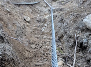
4.76 mi / 2051 ft gainIf you're looking for something with low-grade steepness, you're not going to find it here. Gaining over 2,000' in under 2 miles to the summit, this isn't for the faint of heart. The trail exists because of a buried cable, which has since been exposed and which you can see near the top of the t...Read more -
Snoqualmie Pass, Washington
Hike to Margaret Lake
6 mi / 1800 ft gainStarting at an elevation of 3,300 feet, begin the hike on a steep gravel road for 1/4 of a mile. Take a left onto a dirt road that will lead to an area of clear cuts and windy switchbacks.As daunting as this may seem, don't be discouraged. On a clear day, the surrounding peaks of Snoqualmie Pass ...Read more -
Granite Falls, Washington
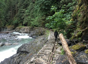
Old Robe Canyon Trail
3.69 mi / 771 ft gainNOTE: The trail is currently closed about 1 mile in due to landslides. This trail starts right off the Mountain Loop Highway outside of Granite Falls. Look out for a brick sign with the trail name, as it's easy to miss otherwise. There's parking next to the highway, but since there is a history...Read more -
Snoqualmie Pass, Washington
Lillian Lake
5.08.36 mi / 2969 ft gainWe backpacked our way to Lillian Lake and set up camp. There is a trail that lead around the lake and a trail that leads up to Rampart Lakes and Rachael Lake as well. We found a few more camps spots on Lillian Lake, then we noticed that only ONE other camp spot was being used. If you want peace ...Read more -
Ronald, Washington
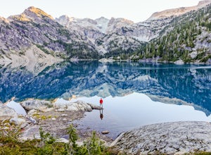
Spade and Venus Lakes
5.026.47 mi / 2300 ft gainNestled in a high rocky cirque near the upper reaches of Mt Daniel, Spade and Venus Lakes are two of the most remote lakes in the Alpine Lake Wilderness. But to experience this level of pure isolation, you'll need to earn it; the shortest hike in to the lakes is 14 miles, the majority of which i...Read more -
Issaquah, Washington
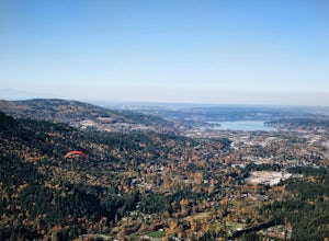
Poo Poo Point
4.46.57 mi / 1880 ft gainThe Poo Poo Point trail is a great option for beautiful forest and great views only about 20 minutes outside of Seattle. The longer and less steep of the two routes to Poo Poo Point, this trail leaves from the Issaquah High School (the shorter and steeper Chirico Trail leaves from the paragliding...Read more

