Baring, Washington
Top Spots in and near Baring
-
North Bend, Washington
Talapus & Olallie Lakes
5.71 mi / 1266 ft gainWith a moderate grade on a wide trail, the hike to Talapus Lake is the perfect introduction to the outdoors for hikers and beginning backpackers. Upon arrival at Talapus, break out lunch or pitch camp. Either way, you can cool off in the large lake. If you feel like pressing on, Ollalie Lake is j...Read more -
Darrington, Washington
Scramble Mount Pugh
5.011 mi / 5300 ft gainNot for the faint of heart - or those with a fear of heights - Mount Pugh offers some of the most rewarding summit views in the Cascades.Located off the northern end of the Mountain Loop Highway, this is an easy day trip from anywhere in the Puget Sound area. Though finding the trailhead can be t...Read more -
North Bend, Washington
Granite Mountain
4.27.92 mi / 3999 ft gainThe trek up Granite Mountain is a strenuous and fairly steep hike located east of Seattle and west of Snoqualmie pass off of I-90. Take exit 47 and turn North to a T intersection, park at the Pratt lake Trailhead at approximately 1860' and right beside I-90. The trail splits just after the first...Read more -
North Bend, Washington
Overnight Hike to Pratt Lake
4.511 mi / 2300 ft gainThis overnight hike is definitely a challenge with 2,300 feet of elevation gain but all that huffing and puffing will be worth it when you reach the beautiful Pratt Lake Basin.The trail can be a bit busy in the first mile but most of the traffic is from day hikers on their way up the popular Gran...Read more -
North Bend, Washington
Camp and Trail Run from Tuscohatchie Lake
5.0This is a beginner to intermediate hike, at the first mile the trail has it first break where you can go up to the Lookout. If you continue going straight, you'll find waterfalls and lakes on the trail. 2.5 Miles in on the trail is another turn to Ollalie and Talapus Lake. Continue onto the 4-m...Read more -
Snoqualmie Pass, Washington
Hike-In and Camp at Alaska Lake
Driving Directions: From Seattle drive east on I-90 to exit 54 (signed "Hyak"). Turn left (north) under the freeway and right on the frontage road marked "Gold Creek." After about 0.5 mile turn left (north) on Gold Creek Road (Forest Road 4832), and in another 0.5 mile reach a junction. To the le...Read more -
North Bend, Washington
Annette Lake
4.57.2 mi / 1923 ft gainFrom Seattle drive east on I-90 to exit 47 (Asahel Curtis/Denny Creek). Turn right from the off-ramp and continue 0.25 mile, then turn left on Forest Road 5590. You'll find the parking area in 0.3 mile. Between the thick second-growth forest stands and the high alpine lake, the trail rolls along...Read more -
North Bend, Washington
Snowshoe Kendall Peak Lakes
9 mi / 2000 ft gainThis hike starts at the Gold Creek sno-park. You need the sno-park and discover pass for this. Park on the side of the road and start hiking up from there. Hike road up and up and up! It's very compact snow (at the moment, that will change fast with new snow coming in). We ended up leaving our sn...Read more -
Issaquah, Washington
Mountain Bike Duthie Hill
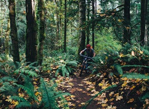
4.76 mi / 130 ft gainDuthie Hill is a premier and beautifully designed mountain bike park set in lush douglas firs and western hemlock forests . Created and maintained by the Evergreen Mountain Bike Alliance (evergreenmtb.org) with the help of King County and volunteers, Duthie Hill although open to hikers, is 100% s...Read more -
Snoqualmie Pass, Washington
Hike Gold Creek Pond
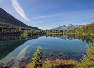
5.01 miThe quintessential family friendly hike, Gold Creek Pond is a simple yet spectacular hike next to Snoqualmie Pass. Easily accessible from the top of the pass (4.5 miles, 12 minute drive), the Gold Creek Pond hike is a simple addition to any itinerary if you're in the area. From Hwy 90, take exit...Read more -
Snoqualmie Pass, Washington
Snowshoe Gold Creek Pond
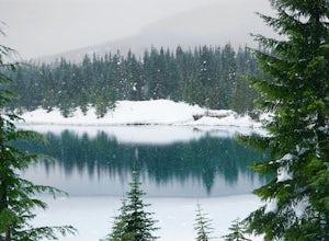
4 mi / 400 ft gainSince the parking lot is not plowed in the winter you have to park along the main road next to the drive way toward the hike. Once to the trial head it is smooth sailing the rest of the hike. When I went the snow was compacted so snowshoes were not necessary but they are very helpful. Once to the...Read more -
North Bend, Washington
Rattlesnake Ledge
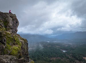
3.95.46 mi / 2096 ft gainRATTLESNAKE LEDGE TRAIL:The hike to Rattlesnake Ledge begins at the trailhead next to the parking lot at Rattlesnake Lake. From here, you can look up and see the Ledge and rock face that you'll be hiking up toward. The trail begins covered under the forest, which can protect from the elements (su...Read more -
North Bend, Washington
Snowy Hike to Rattlesnake Ledge
4.54 mi / 1160 ft gainThe trail to Rattlesnake Ledge is one of the busiest in Washington. Usually, a Saturday or Sunday is a no go for a lot of avid hikers due to the crowds. Adding a little snow and cold diminishes the crowds nicely. While it is no secret, this hike is popular for a reason. The 2 miles it takes t...Read more -
North Bend, Washington
Rattlesnake Lake
5.0Being only a 10 minute drive off the 90, this Lake is often overlooked by the popular Rattlesnake Ledge hike right above. Take exit 32 from the 90E onto 436th SE Ave and continue onto Cedar Falls Rd SE and continue for about 3 miles. At this point, a parking lot will be on your right that is both...Read more -
Issaquah, Washington
Grand Ridge Trail
4.07.51 mi / 1125 ft gainThe trail system in the 1,300 acre Grand Ridge Park can currently can be accessed from two lots: High Point and Central Park, with a new lot at Duthie Hill still under construction. To get to the High Point lot take exit 20 off of I-90 (coming from Seattle), take a left and pass under the freewa...Read more -
Snoqualmie Pass, Washington
Chikamin Peak via Mineral Creek Trailhead
15.34 mi / 5771 ft gainThis is a S5 T4 scramble that involves some routefinding past the alpine lakes. We did this as a day trip and we were out and back in about 12 hours. There are multiple routes to get to Chikamin, one from the PCT, which is 24 miles RT and the other is from the Mineral Creek Trailhead (47.4176, -...Read more

