Woodstock, Virginia
Top Spots in and near Woodstock
-
Madison, Virginia
Fly Fish on the Rapidan River
5.05 miPark at the Graves Mill Parking Area. From here you can easily follow the Rapidan River up the mountain. Fishing reports inform that the lowest concentration of brookies are at the lower boundaries of the park so take some time to enjoy the trail and hike up stream. At the lower boundaries you mi...Read more -
Massanutten, Virginia
Kaylor's Knob Trail
4.03.56 mi / 381 ft gainKaylor's Knob Trail in Massanutten, Virginia is a moderately challenging hiking trail that spans approximately 3.56 miles. The trail is marked by a steady incline, making it a suitable choice for intermediate hikers. The trailhead is easily accessible, located near the Massanutten Resort. The tr...Read more -
Bluemont, Virginia
Hike to Hollow Brook Falls
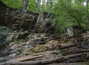
4.32 mi / 300 ft gainThis hike will start on the Appalachian Trail and will take you to a beautiful set of falls. When you arrive at the location you will see numerous spots along the side of the road to park. You'll need to look for the white blaze for the Appalachian Trail (it will head up from the parking area). ...Read more -
Stanardsville, Virginia
Hike South River Falls
4.54.4 miThe trail head for the South River Falls Trail is located at mile marker 63 off of Skyline Drive via the South River Picnic Area. Loop around the picnic area until you reach the Eastern corner where you will find a sign and a map marking the beginning of the 4.2-mile trail. Over the first mile...Read more -
Elkton, Virginia
Hike to Hightop Mountain, Shenandoah NP
4.53.2 mi / 900 ft gainThe parking area for the Hightop Mountain hike is one mile south of the Swift Run Gap entrance on Skyline Drive. If you’re looking to add extra mileage to your hike, you can also park at the entrance and pick up the Appalachian Trail just south of the overpass (doing so will add 1.2 miles each w...Read more -
Cool Spring Path South Parking, Virginia
Hike Cool Spring Path
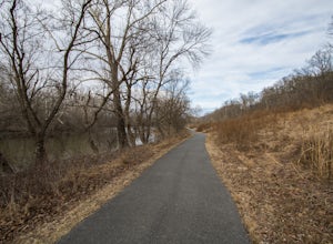
4.02 mi / 70 ft gainThe Cool Spring Path South is an old golf course that has been and still is in the process of being returned to its natural state by Shenandoah University. The paved paths from the golf course make this an easy hike for anyone. For those who may be in a wheelchair, this loop should be fully acces...Read more -
Bluemont, Virginia
Hike to Raven Rock
4.35 mi / 1000 ft gainStarting at a small parking lot right off of Route 7 (wuick right onto Pine Grove Road) this hike takes you North on the Appalachian Trail in a very hilly/rocky part of the trail. Expect to gain and lose 300 feet+ multiple times! It's about 2.5 miles each way so budget at least a few hours to go ...Read more -
Bluemont, Virginia
Hike to Bears Den Overlook
4.41.31 mi / 164 ft gainBears Den is a collection of rocks and boulders that overlooks the Shenandoah Valley in northern Virginia, just off the Appalachian Trail. You have two options to access this overlook: park at the bottom of the mountain and hike up to the overlook via the trail, or drive to the top and access the...Read more -
Cabins, West Virginia
Backpack the North Fork Mountain Trail & Chimney Top
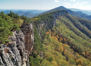
5.024.7 miOne of my favorite hikes in West Virginia, since the whole ridge is full of views. Backpacking the North Fork Mountain Trail is about 24.7 miles in total and a challenging hike but with relentless views. In my opinion, the best West Virginia has to offer. Summertime backpacking the whole the NFM...Read more -
Cabins, West Virginia
Hike to Chimney Rock in the Monongahela National Forest
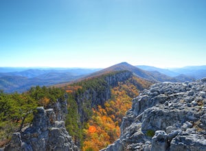
4.74.85 mi / 1319 ft gainChimney Rock (also referred to as Chimney Top) is a hidden gem in the Monongahela National Forest that offers some of the best views in the state of West Virginia. There are several trail options that pass this overlook, including a 24 mile point-to-point backpack of the North Fork Mountain Trai...Read more -
Hinton, Virginia
Fly Fish at Switzer Lake
Switzer Lake is a great spot outside of Harrisonburg, Virginia for fly fishing during the spring, summer, and fall. The lake is pretty decently sized, so you shouldn't have any problems finding a place along the shores to wade out and cast. Small boats are also allowed on the lake as well. Make s...Read more -
Hinton, Virginia
Camp at Switzer Lake
3.92 miDirectly off of Interstate 81, headed toward West Virginia on Rt 33 is a beautiful lake only known by the locals. Switzer Lake, named because Switzer Dam was placed on the Dry River years ago to aid Harrisonburg and the surrounding area with its increased need for drinking water. The lake is seld...Read more -
Elkton, Virginia
Rocky Mount Trail Loop
3.29.58 mi / 2200 ft gainThe trail begin 0.1 miles north of Two Mile Run Overlook at milepost 76.2 on Skyline Drive. You can park at this overlook for the night, just make sure you fill out a (free) wilderness permit and walk the short way on Skyline Drive to the trailhead. Immediately climb a wooded knoll before headin...Read more -
Brandywine, West Virginia
High Knob Tower Trail
4.52.46 mi / 630 ft gainHigh Knob Tower Trail is an out-and-back trail that takes you through a nice forest located near Brandywine, West Virginia.Read more -
Free Union, Virginia
Photograph Brown Mountain Overlook
At mile post 77 off of Skyline Drive, Brown Mountain Overlook offers photographers a western view of the Blue Ridge Mountains, Shenandoah National Park, and the Shenandoah Valley. At 2,840 feet, Brown Mountain Overlook is one of 72 beautiful overlooks that are on Skyline Drive located in the nort...Read more -
Free Union, Virginia
Hike Frazier Discovery Trail
5.01.3 mi / 950 ft gainThere are two ways to the summit: the first is a 1.3 mile loop that starts at the Loft Mountain Wayside parking lot at mile marker 79.5 off of Skyline Drive in the southern district of Shenandoah National Park. The second way is a 3.7 mile hike out and back from the Loft Mountain Campground, but...Read more


