Tyro, Virginia
Top Spots in and near Tyro
-
Elkton, Virginia
Rocky Mount Trail Loop
3.29.58 mi / 2200 ft gainThe trail begin 0.1 miles north of Two Mile Run Overlook at milepost 76.2 on Skyline Drive. You can park at this overlook for the night, just make sure you fill out a (free) wilderness permit and walk the short way on Skyline Drive to the trailhead. Immediately climb a wooded knoll before headin...Read more -
Buchanan, Virginia
Hike to Fallingwater Cascades
4.5The trailhead for this hike is at the same parking area for the Flat Top Trail. From the Peaks of Otter Visitor Center, travel north up the Blue Ridge Parkway for about 3 miles, where you will come to small parking area. It is quite tiny, and probably holds around 10 vehicles, but there was only ...Read more -
Buchanan, Virginia
Hike Flat Top Mountain
4.5From the Peaks of Otter Visitor Center, travel north up the Blue Ridge Parkway for about 3 miles, where you will come to small parking area for the Flat Top Trailhead. The parking area is quite tiny, and probably holds around 10 vehicles, but there was only one other car there when I went. It's p...Read more -
Wildwood, Virginia
Pleasant Grove Park: Heritage Trail and Beach Grove Loop
4.64 mi / 361 ft gainPleasant Grove Park has miles and miles of trails and you could easily hike a ten-mile loop if you linked everything together. This particular trail, Heritage Trail and Beach Grove Loop, is a 4.6 mile loop in the southern part of Pleasant Grove, which takes a little under two hours to complete de...Read more -
Bedford, Virginia
Hike the Harkening Hill Loop
3.33.3 mi / 850 ft gainTo get to the trailhead, pull into the Peaks of Otter Visitor Center off of the Blue Ridge Parkway and park there. Proceed to the outdoor amphitheater behind the center. At the rear of the amphitheater there is a large sign showing Harkening Hill and other nearby trails, here the trail begins. Th...Read more -
Bedford, Virginia
Sharp Top Trail
4.72.91 mi / 1296 ft gainOnce thought to be the highest peak in Virginia, this 2.5 hour hike is one that will leave you speechless at the top. Park at the Peaks of Otter Nature Center (which is now closed). The trailhead is located to the right of the building. You will cross over a paved bus road soon after beginning th...Read more -
Charlottesville, Virginia
Preddy Creek & Creekside Trail Loop
4.33.75 mi / 266 ft gainMy husband is a runner and I am not. I hate to run and the entire time I am running I am exhausting myself thinking how much I hate running. However, I love hiking. I can hike all day and I can kick my runner husband's butt with a pack on going up a mountain trail. The problem with this though is...Read more -
Eagle Rock, Virginia
Canoe or Kayak the Upper James River
4.3Put in at the Horseshoe Bend Boat Ramp near Buchanan, VA. The pin on the map will take you right there. Takeout will be at the boat ramp in downtown Buchanan, approximately 9 miles down river. This ramp is located just above the Rt. 11 bridge.Twin River Outfitters uses this ramp also, so there's ...Read more -
Elkton, Virginia
Hike to Hightop Mountain, Shenandoah NP
4.53.2 mi / 900 ft gainThe parking area for the Hightop Mountain hike is one mile south of the Swift Run Gap entrance on Skyline Drive. If you’re looking to add extra mileage to your hike, you can also park at the entrance and pick up the Appalachian Trail just south of the overpass (doing so will add 1.2 miles each w...Read more -
Dayton, Virginia
Climb Hidden Rocks
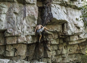
5.0Amazing rock climbing can be found just outside Harrisonburg, VA at a series of crags hiding in the beautiful landscape of GW National Forest. Hidden Rocks offers amazing climbing and bouldering for intermediate level or well-guided beginners.Near the end of Hone Quarry Road is a small, self-pay ...Read more -
Massanutten, Virginia
Kaylor's Knob Trail
4.03.56 mi / 381 ft gainKaylor's Knob Trail in Massanutten, Virginia is a moderately challenging hiking trail that spans approximately 3.56 miles. The trail is marked by a steady incline, making it a suitable choice for intermediate hikers. The trailhead is easily accessible, located near the Massanutten Resort. The tr...Read more -
Millboro, Virginia
Hike Blue Suck Falls and the Tuscarora Overlook
3.47.2 mi / 2200 ft gainIn Douthat State Park, park at the Discovery Center/Amphitheater parking lot near the children's fishing area. The Blue Suck Falls trail head will be towards the dam on the left side and is well-marked.Note: A trail map is highly recommended for this trail! It is fairly well-marked with blue blaz...Read more -
Stanardsville, Virginia
Hike South River Falls
4.54.4 miThe trail head for the South River Falls Trail is located at mile marker 63 off of Skyline Drive via the South River Picnic Area. Loop around the picnic area until you reach the Eastern corner where you will find a sign and a map marking the beginning of the 4.2-mile trail. Over the first mile...Read more -
Eagle Rock, Virginia
Hike Roaring Run Falls
4.72.4 miFrom 615 (Craig Creek rd) you turn on to 621 (Roaring Run rd) and about mile down is a little gravel road on the left that you turn down. Go down this gravel road a little ways to reach the parking area, you'll know you're there when you see a big gate held up by two stone pillars. Once you are r...Read more

